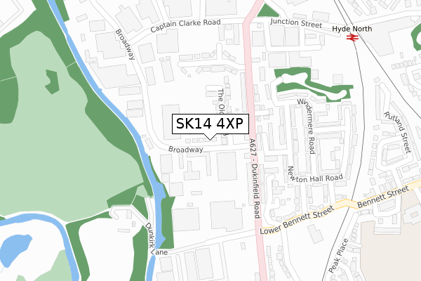
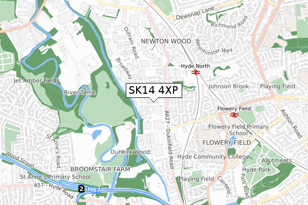
SK14 4XP is located in the Hyde Newton electoral ward, within the metropolitan district of Tameside and the English Parliamentary constituency of Stalybridge and Hyde. The Sub Integrated Care Board (ICB) Location is NHS Greater Manchester ICB - 01Y and the police force is Greater Manchester. This postcode has been in use since July 2019.


GetTheData
Source: OS Open Zoomstack (Ordnance Survey)
Licence: Open Government Licence (requires attribution)
Attribution: Contains OS data © Crown copyright and database right 2024
Source: Open Postcode Geo
Licence: Open Government Licence (requires attribution)
Attribution: Contains OS data © Crown copyright and database right 2024; Contains Royal Mail data © Royal Mail copyright and database right 2024; Source: Office for National Statistics licensed under the Open Government Licence v.3.0
| Easting | 394094 |
| Northing | 396258 |
| Latitude | 53.463049 |
| Longitude | -2.090423 |
GetTheData
Source: Open Postcode Geo
Licence: Open Government Licence
| Country | England |
| Postcode District | SK14 |
| ➜ SK14 open data dashboard ➜ See where SK14 is on a map ➜ Where is Hyde? | |
GetTheData
Source: Land Registry Price Paid Data
Licence: Open Government Licence
| Ward | Hyde Newton |
| Constituency | Stalybridge And Hyde |
GetTheData
Source: ONS Postcode Database
Licence: Open Government Licence
2023 31 MAY £300,000 |
99, THE OLD DAIRY, HYDE, SK14 4XP 2021 28 JUN £339,995 |
61, THE OLD DAIRY, HYDE, SK14 4XP 2021 30 APR £239,496 |
63, THE OLD DAIRY, HYDE, SK14 4XP 2021 26 MAR £242,496 |
51, THE OLD DAIRY, HYDE, SK14 4XP 2021 26 MAR £309,995 |
49, THE OLD DAIRY, HYDE, SK14 4XP 2021 26 MAR £309,995 |
39, THE OLD DAIRY, HYDE, SK14 4XP 2021 5 FEB £294,995 |
37, THE OLD DAIRY, HYDE, SK14 4XP 2021 22 JAN £294,995 |
12, THE OLD DAIRY, HYDE, SK14 4XP 2020 18 DEC £299,995 |
27, THE OLD DAIRY, HYDE, SK14 4XP 2020 27 NOV £289,995 |
GetTheData
Source: HM Land Registry Price Paid Data
Licence: Contains HM Land Registry data © Crown copyright and database right 2024. This data is licensed under the Open Government Licence v3.0.
| Dukinfield Rd/Broadway (Dukinfield Rd) | Flowery Field | 103m |
| Dukinfield Rd/Broadway (Dukinfield Rd) | Flowery Field | 160m |
| Dukinfield Rd/Dunkirk Ln (Dukinfield Rd) | Flowery Field | 257m |
| Dukinfield Rd/Junction St (Dukinfield Rd) | Newton Wood | 279m |
| Victoria Rd/Junction St (Victoria Rd) | Newton Wood | 345m |
| Hyde North Station | 0.4km |
| Flowery Field Station | 0.6km |
| Hyde Central Station | 1.3km |
GetTheData
Source: NaPTAN
Licence: Open Government Licence
| Percentage of properties with Next Generation Access | 0.0% |
| Percentage of properties with Superfast Broadband | 0.0% |
| Percentage of properties with Ultrafast Broadband | 0.0% |
| Percentage of properties with Full Fibre Broadband | 0.0% |
Superfast Broadband is between 30Mbps and 300Mbps
Ultrafast Broadband is > 300Mbps
| Percentage of properties unable to receive 2Mbps | 0.0% |
| Percentage of properties unable to receive 5Mbps | 0.0% |
| Percentage of properties unable to receive 10Mbps | 0.0% |
| Percentage of properties unable to receive 30Mbps | 0.0% |
GetTheData
Source: Ofcom
Licence: Ofcom Terms of Use (requires attribution)
GetTheData
Source: ONS Postcode Database
Licence: Open Government Licence


➜ Get more ratings from the Food Standards Agency
GetTheData
Source: Food Standards Agency
Licence: FSA terms & conditions
| Last Collection | |||
|---|---|---|---|
| Location | Mon-Fri | Sat | Distance |
| Victoria Road | 17:45 | 12:00 | 509m |
| Inverness Road | 17:45 | 11:30 | 878m |
| Cheshire Cheese Pub | 17:45 | 11:30 | 949m |
GetTheData
Source: Dracos
Licence: Creative Commons Attribution-ShareAlike
| Facility | Distance |
|---|---|
| Village Gym (Hyde) Captain Clarke Road, Hyde Swimming Pool, Health and Fitness Gym, Studio, Squash Courts | 241m |
| Thomas Ashton School Bennett Street, Hyde Health and Fitness Gym, Sports Hall | 464m |
| Hyde Technology School (Closed) Old Road, Hyde Sports Hall, Studio | 555m |
GetTheData
Source: Active Places
Licence: Open Government Licence
| School | Phase of Education | Distance |
|---|---|---|
| Thomas Ashton School Bennett Street, Hyde, SK14 4SS | Not applicable | 521m |
| Hyde High School Old Road, Hyde, SK14 4SP | Secondary | 555m |
| Tameside Pupil Referral Service Globe Lane, Dukinfield, SK16 4UJ | Not applicable | 649m |
GetTheData
Source: Edubase
Licence: Open Government Licence
The below table lists the International Territorial Level (ITL) codes (formerly Nomenclature of Territorial Units for Statistics (NUTS) codes) and Local Administrative Units (LAU) codes for SK14 4XP:
| ITL 1 Code | Name |
|---|---|
| TLD | North West (England) |
| ITL 2 Code | Name |
| TLD3 | Greater Manchester |
| ITL 3 Code | Name |
| TLD35 | Greater Manchester South East |
| LAU 1 Code | Name |
| E08000008 | Tameside |
GetTheData
Source: ONS Postcode Directory
Licence: Open Government Licence
The below table lists the Census Output Area (OA), Lower Layer Super Output Area (LSOA), and Middle Layer Super Output Area (MSOA) for SK14 4XP:
| Code | Name | |
|---|---|---|
| OA | E00030582 | |
| LSOA | E01006031 | Tameside 020A |
| MSOA | E02001248 | Tameside 020 |
GetTheData
Source: ONS Postcode Directory
Licence: Open Government Licence
| SK14 4QE | Dukinfield Road | 95m |
| SK14 4QH | Nicholson Road | 111m |
| SK14 4QX | Old Dairy Mews | 147m |
| SK14 4PY | Lindale | 162m |
| SK14 4QD | Dukinfield Road | 192m |
| SK14 4QL | Plain Pitt Street | 208m |
| SK14 4PZ | Newton Hall Road | 225m |
| SK14 4PU | Windermere Road | 238m |
| SK14 4PX | Whitehaven Place | 290m |
| SK14 4PT | Kirkstone Road | 301m |
GetTheData
Source: Open Postcode Geo; Land Registry Price Paid Data
Licence: Open Government Licence