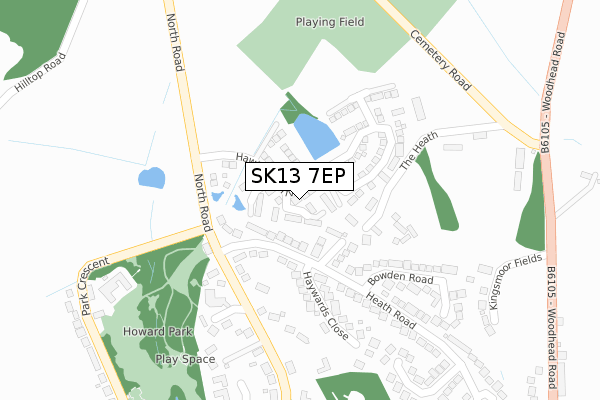
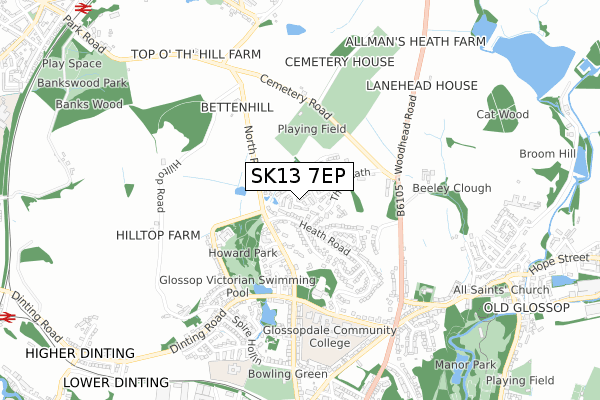
SK13 7EP is located in the Dinting electoral ward, within the local authority district of High Peak and the English Parliamentary constituency of High Peak. The Sub Integrated Care Board (ICB) Location is NHS Derby and Derbyshire ICB - 15M and the police force is Derbyshire. This postcode has been in use since April 2018.


GetTheData
Source: OS Open Zoomstack (Ordnance Survey)
Licence: Open Government Licence (requires attribution)
Attribution: Contains OS data © Crown copyright and database right 2024
Source: Open Postcode Geo
Licence: Open Government Licence (requires attribution)
Attribution: Contains OS data © Crown copyright and database right 2024; Contains Royal Mail data © Royal Mail copyright and database right 2024; Source: Office for National Statistics licensed under the Open Government Licence v.3.0
| Easting | 403297 |
| Northing | 395208 |
| Latitude | 53.453636 |
| Longitude | -1.951816 |
GetTheData
Source: Open Postcode Geo
Licence: Open Government Licence
| Country | England |
| Postcode District | SK13 |
| ➜ SK13 open data dashboard ➜ See where SK13 is on a map ➜ Where is Glossop? | |
GetTheData
Source: Land Registry Price Paid Data
Licence: Open Government Licence
| Ward | Dinting |
| Constituency | High Peak |
GetTheData
Source: ONS Postcode Database
Licence: Open Government Licence
| June 2022 | Public order | On or near Bexley Close | 104m |
| June 2022 | Violence and sexual offences | On or near Bexley Close | 104m |
| June 2022 | Violence and sexual offences | On or near Bexley Close | 104m |
| ➜ Get more crime data in our Crime section | |||
GetTheData
Source: data.police.uk
Licence: Open Government Licence
| Heath Road | Glossop | 216m |
| Heath Road | Glossop | 219m |
| North Road | Glossop | 242m |
| North Road | Glossop | 250m |
| Howard Park (Dinting Road) | Glossop | 425m |
| Glossop Station | 1km |
| Hadfield Station | 1.2km |
| Dinting Station | 1.3km |
GetTheData
Source: NaPTAN
Licence: Open Government Licence
| Percentage of properties with Next Generation Access | 100.0% |
| Percentage of properties with Superfast Broadband | 100.0% |
| Percentage of properties with Ultrafast Broadband | 100.0% |
| Percentage of properties with Full Fibre Broadband | 100.0% |
Superfast Broadband is between 30Mbps and 300Mbps
Ultrafast Broadband is > 300Mbps
| Percentage of properties unable to receive 2Mbps | 0.0% |
| Percentage of properties unable to receive 5Mbps | 0.0% |
| Percentage of properties unable to receive 10Mbps | 0.0% |
| Percentage of properties unable to receive 30Mbps | 0.0% |
GetTheData
Source: Ofcom
Licence: Ofcom Terms of Use (requires attribution)
GetTheData
Source: ONS Postcode Database
Licence: Open Government Licence


➜ Get more ratings from the Food Standards Agency
GetTheData
Source: Food Standards Agency
Licence: FSA terms & conditions
| Last Collection | |||
|---|---|---|---|
| Location | Mon-Fri | Sat | Distance |
| Bexley Close | 17:45 | 11:45 | 98m |
| Talbot Road | 17:45 | 11:45 | 431m |
| Hall Meadow Road | 17:45 | 11:45 | 661m |
GetTheData
Source: Dracos
Licence: Creative Commons Attribution-ShareAlike
| Facility | Distance |
|---|---|
| Cemetery Road Playing Fields Cemetery Road, Glossop Grass Pitches | 359m |
| Glossop Pool Dinting Road, Glossop Swimming Pool | 442m |
| Glossopdale School (Glossop Site) (Closed) Talbot Road, Glossop Sports Hall, Health and Fitness Gym, Studio | 546m |
GetTheData
Source: Active Places
Licence: Open Government Licence
| School | Phase of Education | Distance |
|---|---|---|
| St Luke's CofE Primary School Spire Hollin, Glossop, SK13 7BS | Primary | 744m |
| All Saints Catholic Voluntary Academy Church Street, Old Glossop, All Saints Cva, Glossop, SK13 7RJ | Primary | 748m |
| Duke of Norfolk CofE Primary School Royle Avenue, Glossop, SK13 7RD | Primary | 1km |
GetTheData
Source: Edubase
Licence: Open Government Licence
The below table lists the International Territorial Level (ITL) codes (formerly Nomenclature of Territorial Units for Statistics (NUTS) codes) and Local Administrative Units (LAU) codes for SK13 7EP:
| ITL 1 Code | Name |
|---|---|
| TLF | East Midlands (England) |
| ITL 2 Code | Name |
| TLF1 | Derbyshire and Nottinghamshire |
| ITL 3 Code | Name |
| TLF13 | South and West Derbyshire |
| LAU 1 Code | Name |
| E07000037 | High Peak |
GetTheData
Source: ONS Postcode Directory
Licence: Open Government Licence
The below table lists the Census Output Area (OA), Lower Layer Super Output Area (LSOA), and Middle Layer Super Output Area (MSOA) for SK13 7EP:
| Code | Name | |
|---|---|---|
| OA | E00099814 | |
| LSOA | E01019727 | High Peak 004A |
| MSOA | E02004096 | High Peak 004 |
GetTheData
Source: ONS Postcode Directory
Licence: Open Government Licence
| SK13 7AY | Heath Road | 110m |
| SK13 7BG | Bexley Close | 119m |
| SK13 7QF | The Heath | 135m |
| SK13 7AX | North Road | 197m |
| SK13 7AZ | Haywards Close | 198m |
| SK13 7BZ | Partington Villas | 222m |
| SK13 7BD | Bowden Road | 222m |
| SK13 7AD | Partington Park | 262m |
| SK13 7BE | Fernhill Close | 316m |
| SK13 7BA | Heath Road | 342m |
GetTheData
Source: Open Postcode Geo; Land Registry Price Paid Data
Licence: Open Government Licence