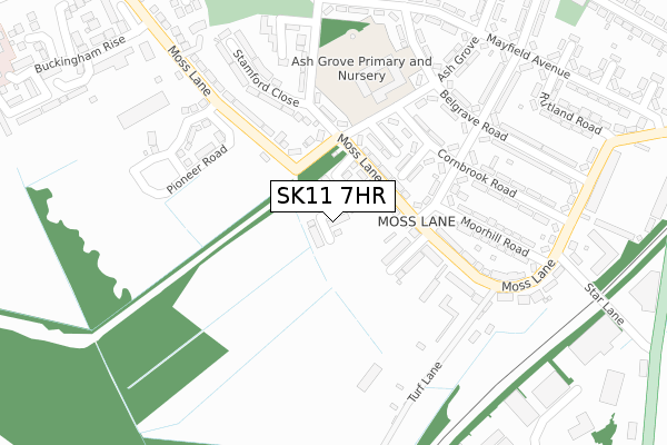
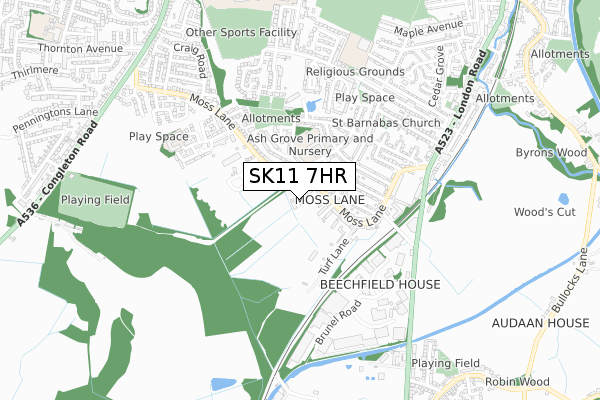
SK11 7HR is located in the Macclesfield South electoral ward, within the unitary authority of Cheshire East and the English Parliamentary constituency of Macclesfield. The Sub Integrated Care Board (ICB) Location is NHS Cheshire and Merseyside ICB - 27D and the police force is Cheshire. This postcode has been in use since July 2019.


GetTheData
Source: OS Open Zoomstack (Ordnance Survey)
Licence: Open Government Licence (requires attribution)
Attribution: Contains OS data © Crown copyright and database right 2024
Source: Open Postcode Geo
Licence: Open Government Licence (requires attribution)
Attribution: Contains OS data © Crown copyright and database right 2024; Contains Royal Mail data © Royal Mail copyright and database right 2024; Source: Office for National Statistics licensed under the Open Government Licence v.3.0
| Easting | 391162 |
| Northing | 371714 |
| Latitude | 53.242392 |
| Longitude | -2.133888 |
GetTheData
Source: Open Postcode Geo
Licence: Open Government Licence
| Country | England |
| Postcode District | SK11 |
| ➜ SK11 open data dashboard ➜ See where SK11 is on a map ➜ Where is Macclesfield? | |
GetTheData
Source: Land Registry Price Paid Data
Licence: Open Government Licence
| Ward | Macclesfield South |
| Constituency | Macclesfield |
GetTheData
Source: ONS Postcode Database
Licence: Open Government Licence
2022 12 JUL £313,000 |
17, SILK ROSE DRIVE, MACCLESFIELD, SK11 7HR 2021 28 MAY £289,995 |
16, SILK ROSE DRIVE, MACCLESFIELD, SK11 7HR 2021 28 MAY £325,495 |
15, SILK ROSE DRIVE, MACCLESFIELD, SK11 7HR 2021 21 MAY £389,495 |
23, SILK ROSE DRIVE, MACCLESFIELD, SK11 7HR 2021 9 APR £397,995 |
24, SILK ROSE DRIVE, MACCLESFIELD, SK11 7HR 2021 9 APR £315,995 |
11, SILK ROSE DRIVE, MACCLESFIELD, SK11 7HR 2021 26 FEB £387,495 |
12, SILK ROSE DRIVE, MACCLESFIELD, SK11 7HR 2021 29 JAN £322,495 |
10, SILK ROSE DRIVE, MACCLESFIELD, SK11 7HR 2020 18 DEC £384,995 |
13, SILK ROSE DRIVE, MACCLESFIELD, SK11 7HR 2020 18 DEC £315,495 |
GetTheData
Source: HM Land Registry Price Paid Data
Licence: Contains HM Land Registry data © Crown copyright and database right 2024. This data is licensed under the Open Government Licence v3.0.
| January 2024 | Violence and sexual offences | On or near Belgrave Road | 272m |
| September 2023 | Violence and sexual offences | On or near Belgrave Road | 272m |
| September 2023 | Violence and sexual offences | On or near Belgrave Road | 272m |
| ➜ Get more crime data in our Crime section | |||
GetTheData
Source: data.police.uk
Licence: Open Government Licence
| Moorhill Road (Parkgate Road) | Macclesfield | 167m |
| Moorhill Road (Parkgate Road) | Macclesfield | 183m |
| Turf Lane (Moss Lane) | Macclesfield | 297m |
| Cornbrook Road (Moss Lane) | Macclesfield | 365m |
| Mayfield Avenue (Moss Lane) | Macclesfield | 519m |
| Macclesfield Station | 2km |
GetTheData
Source: NaPTAN
Licence: Open Government Licence
GetTheData
Source: ONS Postcode Database
Licence: Open Government Licence


➜ Get more ratings from the Food Standards Agency
GetTheData
Source: Food Standards Agency
Licence: FSA terms & conditions
| Last Collection | |||
|---|---|---|---|
| Location | Mon-Fri | Sat | Distance |
| Cornbrook Road | 17:45 | 11:45 | 187m |
| London Road | 17:45 | 11:45 | 589m |
| Coppice Rise | 18:00 | 11:45 | 648m |
GetTheData
Source: Dracos
Licence: Creative Commons Attribution-ShareAlike
| Facility | Distance |
|---|---|
| Ash Grove Academy Belgrave Road, Macclesfield Grass Pitches | 262m |
| Rise Fitness (Macclesfield) London Road, Macclesfield Health and Fitness Gym | 505m |
| Macclesfield Football Club London Road, Macclesfield Grass Pitches, Artificial Grass Pitch | 505m |
GetTheData
Source: Active Places
Licence: Open Government Licence
| School | Phase of Education | Distance |
|---|---|---|
| Ash Grove Academy Belgrave Road, Macclesfield, SK11 7TF | Primary | 311m |
| Christ The King Catholic and Church of England Primary School Fir Grove, Macclesfield, SK11 7SF | Primary | 696m |
| The Macclesfield Academy Park Lane, Macclesfield, SK11 8JR | Secondary | 880m |
GetTheData
Source: Edubase
Licence: Open Government Licence
The below table lists the International Territorial Level (ITL) codes (formerly Nomenclature of Territorial Units for Statistics (NUTS) codes) and Local Administrative Units (LAU) codes for SK11 7HR:
| ITL 1 Code | Name |
|---|---|
| TLD | North West (England) |
| ITL 2 Code | Name |
| TLD6 | Cheshire |
| ITL 3 Code | Name |
| TLD62 | Cheshire East |
| LAU 1 Code | Name |
| E06000049 | Cheshire East |
GetTheData
Source: ONS Postcode Directory
Licence: Open Government Licence
The below table lists the Census Output Area (OA), Lower Layer Super Output Area (LSOA), and Middle Layer Super Output Area (MSOA) for SK11 7HR:
| Code | Name | |
|---|---|---|
| OA | E00094064 | |
| LSOA | E01018637 | Cheshire East 021A |
| MSOA | E02003873 | Cheshire East 021 |
GetTheData
Source: ONS Postcode Directory
Licence: Open Government Licence
| SK11 7WJ | Moss Chase | 47m |
| SK11 7XH | Moss Lane | 118m |
| SK11 7XJ | Moss Bower Road | 135m |
| SK11 7TT | Moss Lane | 231m |
| SK11 7TS | Moorhill Road | 236m |
| SK11 7TQ | Stamford Road | 238m |
| SK11 7TA | Parkgate Road | 247m |
| SK11 7TZ | Stamford Close | 261m |
| SK11 7TN | Belgrave Road | 276m |
| SK11 7TD | Ash Grove | 290m |
GetTheData
Source: Open Postcode Geo; Land Registry Price Paid Data
Licence: Open Government Licence