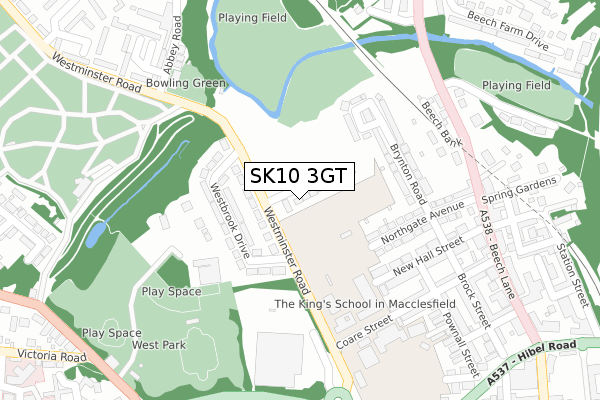
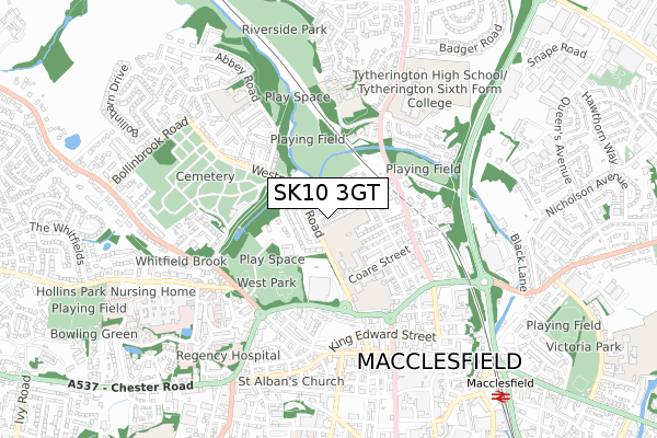
SK10 3GT is located in the Macclesfield Tytherington electoral ward, within the unitary authority of Cheshire East and the English Parliamentary constituency of Macclesfield. The Sub Integrated Care Board (ICB) Location is NHS Cheshire and Merseyside ICB - 27D and the police force is Cheshire. This postcode has been in use since January 2020.


GetTheData
Source: OS Open Zoomstack (Ordnance Survey)
Licence: Open Government Licence (requires attribution)
Attribution: Contains OS data © Crown copyright and database right 2024
Source: Open Postcode Geo
Licence: Open Government Licence (requires attribution)
Attribution: Contains OS data © Crown copyright and database right 2024; Contains Royal Mail data © Royal Mail copyright and database right 2024; Source: Office for National Statistics licensed under the Open Government Licence v.3.0
| Easting | 391349 |
| Northing | 374276 |
| Latitude | 53.265424 |
| Longitude | -2.131157 |
GetTheData
Source: Open Postcode Geo
Licence: Open Government Licence
| Country | England |
| Postcode District | SK10 |
| ➜ SK10 open data dashboard ➜ See where SK10 is on a map ➜ Where is Macclesfield? | |
GetTheData
Source: Land Registry Price Paid Data
Licence: Open Government Licence
| Ward | Macclesfield Tytherington |
| Constituency | Macclesfield |
GetTheData
Source: ONS Postcode Database
Licence: Open Government Licence
37, WIGHTMAN AVENUE, MACCLESFIELD, SK10 3GT 2021 21 DEC £494,995 |
39, WIGHTMAN AVENUE, MACCLESFIELD, SK10 3GT 2021 17 DEC £424,995 |
41, WIGHTMAN AVENUE, MACCLESFIELD, SK10 3GT 2021 29 NOV £347,995 |
47, WIGHTMAN AVENUE, MACCLESFIELD, SK10 3GT 2020 30 SEP £442,995 |
45, WIGHTMAN AVENUE, MACCLESFIELD, SK10 3GT 2020 30 SEP £444,995 |
43, WIGHTMAN AVENUE, MACCLESFIELD, SK10 3GT 2020 30 SEP £324,995 |
53, WIGHTMAN AVENUE, MACCLESFIELD, SK10 3GT 2020 1 SEP £442,995 |
49, WIGHTMAN AVENUE, MACCLESFIELD, SK10 3GT 2020 28 AUG £379,995 |
55, WIGHTMAN AVENUE, MACCLESFIELD, SK10 3GT 2020 14 AUG £442,995 |
51, WIGHTMAN AVENUE, MACCLESFIELD, SK10 3GT 2020 14 AUG £374,995 |
GetTheData
Source: HM Land Registry Price Paid Data
Licence: Contains HM Land Registry data © Crown copyright and database right 2024. This data is licensed under the Open Government Licence v3.0.
| January 2024 | Anti-social behaviour | On or near Parking Area | 434m |
| October 2023 | Public order | On or near Parking Area | 434m |
| July 2023 | Violence and sexual offences | On or near Sports/Recreation Area | 369m |
| ➜ Get more crime data in our Crime section | |||
GetTheData
Source: data.police.uk
Licence: Open Government Licence
| The King's School (Westminster Road) | Macclesfield | 134m |
| The King's School (Westminster Road) | Macclesfield | 136m |
| Sainsbury's (Westminster Road) | Macclesfield | 254m |
| Sainsbury's (Westminster Road) | Macclesfield | 254m |
| Beechwood Mews (Beech Lane) | Macclesfield | 281m |
| Macclesfield Station | 0.9km |
| Prestbury Station | 3.3km |
GetTheData
Source: NaPTAN
Licence: Open Government Licence
GetTheData
Source: ONS Postcode Database
Licence: Open Government Licence


➜ Get more ratings from the Food Standards Agency
GetTheData
Source: Food Standards Agency
Licence: FSA terms & conditions
| Last Collection | |||
|---|---|---|---|
| Location | Mon-Fri | Sat | Distance |
| Westminster Road | 18:00 | 11:00 | 238m |
| Beech Lane | 17:30 | 11:30 | 260m |
| Jordangate | 18:30 | 12:45 | 529m |
GetTheData
Source: Dracos
Licence: Creative Commons Attribution-ShareAlike
| Facility | Distance |
|---|---|
| The Kings School (Cumberland Street Site) (Closed) Cumberland Street, Macclesfield Grass Pitches, Sports Hall, Artificial Grass Pitch | 19m |
| Packhorse Bowling & Social Club Abbey Road, Macclesfield Sports Hall | 328m |
| Beech Hall School Beech Hall Drive, Macclesfield Grass Pitches, Sports Hall, Swimming Pool, Artificial Grass Pitch | 488m |
GetTheData
Source: Active Places
Licence: Open Government Licence
| School | Phase of Education | Distance |
|---|---|---|
| Beech Hall School Beech Hall Drive, Tytherington, Macclesfield, SK10 2EG | Not applicable | 488m |
| Tytherington School Manchester Road, Macclesfield, SK10 2EE | Secondary | 539m |
| Bollinbrook CofE (A) Primary School Bollinbrook Ce (A) Primary School, Abbey Road, Macclesfield, SK10 3AT | Primary | 604m |
GetTheData
Source: Edubase
Licence: Open Government Licence
The below table lists the International Territorial Level (ITL) codes (formerly Nomenclature of Territorial Units for Statistics (NUTS) codes) and Local Administrative Units (LAU) codes for SK10 3GT:
| ITL 1 Code | Name |
|---|---|
| TLD | North West (England) |
| ITL 2 Code | Name |
| TLD6 | Cheshire |
| ITL 3 Code | Name |
| TLD62 | Cheshire East |
| LAU 1 Code | Name |
| E06000049 | Cheshire East |
GetTheData
Source: ONS Postcode Directory
Licence: Open Government Licence
The below table lists the Census Output Area (OA), Lower Layer Super Output Area (LSOA), and Middle Layer Super Output Area (MSOA) for SK10 3GT:
| Code | Name | |
|---|---|---|
| OA | E00093951 | |
| LSOA | E01018615 | Cheshire East 017A |
| MSOA | E02003869 | Cheshire East 017 |
GetTheData
Source: ONS Postcode Directory
Licence: Open Government Licence
| SK10 3AH | Westminster Road | 126m |
| SK10 3AG | Brynton Close | 144m |
| SK10 3AQ | Westbrook Drive | 152m |
| SK10 3AF | Brynton Road | 155m |
| SK10 3AE | Northgate Avenue | 157m |
| SK10 3AB | New Hall Street | 171m |
| SK10 3AA | New Hall Street | 192m |
| SK10 2EB | Beech Bank | 205m |
| SK10 1DW | Coare Street | 211m |
| SK10 1DG | Pownall Street | 245m |
GetTheData
Source: Open Postcode Geo; Land Registry Price Paid Data
Licence: Open Government Licence