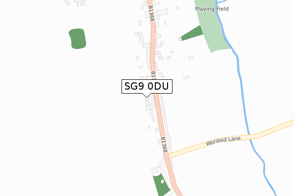
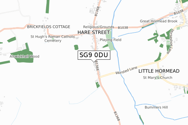
SG9 0DU is located in the Buntingford electoral ward, within the local authority district of East Hertfordshire and the English Parliamentary constituency of North East Hertfordshire. The Sub Integrated Care Board (ICB) Location is NHS Hertfordshire and West Essex ICB - 06K and the police force is Hertfordshire. This postcode has been in use since August 2019.


GetTheData
Source: OS Open Zoomstack (Ordnance Survey)
Licence: Open Government Licence (requires attribution)
Attribution: Contains OS data © Crown copyright and database right 2024
Source: Open Postcode Geo
Licence: Open Government Licence (requires attribution)
Attribution: Contains OS data © Crown copyright and database right 2024; Contains Royal Mail data © Royal Mail copyright and database right 2024; Source: Office for National Statistics licensed under the Open Government Licence v.3.0
| Easting | 539000 |
| Northing | 229305 |
| Latitude | 51.944894 |
| Longitude | 0.020926 |
GetTheData
Source: Open Postcode Geo
Licence: Open Government Licence
| Country | England |
| Postcode District | SG9 |
| ➜ SG9 open data dashboard ➜ See where SG9 is on a map ➜ Where is Hare Street? | |
GetTheData
Source: Land Registry Price Paid Data
Licence: Open Government Licence
| Ward | Buntingford |
| Constituency | North East Hertfordshire |
GetTheData
Source: ONS Postcode Database
Licence: Open Government Licence
| June 2022 | Violence and sexual offences | On or near B1368 | 37m |
| June 2022 | Anti-social behaviour | On or near Petrol Station | 330m |
| November 2021 | Other theft | On or near B1368 | 37m |
| ➜ Get more crime data in our Crime section | |||
GetTheData
Source: data.police.uk
Licence: Open Government Licence
| Swan Lane (B1368) | Hare Street | 148m |
| Swan Lane (B1368) | Hare Street | 173m |
| Chapel (B1038) | Hare Street | 448m |
| Chapel (B1368) | Hare Street | 462m |
| Horseshoe Lane | Little Hormead | 850m |
GetTheData
Source: NaPTAN
Licence: Open Government Licence
GetTheData
Source: ONS Postcode Database
Licence: Open Government Licence


➜ Get more ratings from the Food Standards Agency
GetTheData
Source: Food Standards Agency
Licence: FSA terms & conditions
| Last Collection | |||
|---|---|---|---|
| Location | Mon-Fri | Sat | Distance |
| Hare Street | 16:30 | 11:30 | 265m |
| Great Hormead | 16:00 | 11:30 | 1,327m |
| Dassells | 16:30 | 10:15 | 2,006m |
GetTheData
Source: Dracos
Licence: Creative Commons Attribution-ShareAlike
| Facility | Distance |
|---|---|
| The Meads (Lower Field) Hare Street, Buntingford Grass Pitches | 273m |
| The Meads (Upper Field) Hare Street, Buntingford Grass Pitches | 486m |
| The Bury London Road, Buntingford Grass Pitches | 2.3km |
GetTheData
Source: Active Places
Licence: Open Government Licence
| School | Phase of Education | Distance |
|---|---|---|
| Hormead Church of England (VA) First School Great Hormead, Buntingford, SG9 0NR | Primary | 962m |
| Layston Church of England First School The Causeway, Buntingford, SG9 9EU | Primary | 2.5km |
| Millfield First and Nursery School Monks Walk, Buntingford, SG9 9DT | Primary | 2.9km |
GetTheData
Source: Edubase
Licence: Open Government Licence
The below table lists the International Territorial Level (ITL) codes (formerly Nomenclature of Territorial Units for Statistics (NUTS) codes) and Local Administrative Units (LAU) codes for SG9 0DU:
| ITL 1 Code | Name |
|---|---|
| TLH | East |
| ITL 2 Code | Name |
| TLH2 | Bedfordshire and Hertfordshire |
| ITL 3 Code | Name |
| TLH23 | Hertfordshire CC |
| LAU 1 Code | Name |
| E07000242 | East Hertfordshire |
GetTheData
Source: ONS Postcode Directory
Licence: Open Government Licence
The below table lists the Census Output Area (OA), Lower Layer Super Output Area (LSOA), and Middle Layer Super Output Area (MSOA) for SG9 0DU:
| Code | Name | |
|---|---|---|
| OA | E00119173 | |
| LSOA | E01023462 | East Hertfordshire 001A |
| MSOA | E02004878 | East Hertfordshire 001 |
GetTheData
Source: ONS Postcode Directory
Licence: Open Government Licence
| SG9 0EQ | 58m | |
| SG9 0EE | Fayland Cottages | 108m |
| SG9 0EG | Vine Cottage | 135m |
| SG9 0EF | New Cottages | 235m |
| SG9 0EA | 275m | |
| SG9 0DZ | Hare Street | 304m |
| SG9 0EB | Moorfield | 353m |
| SG9 0AD | 423m | |
| SG9 0AE | 442m | |
| SG9 0DY | 519m |
GetTheData
Source: Open Postcode Geo; Land Registry Price Paid Data
Licence: Open Government Licence