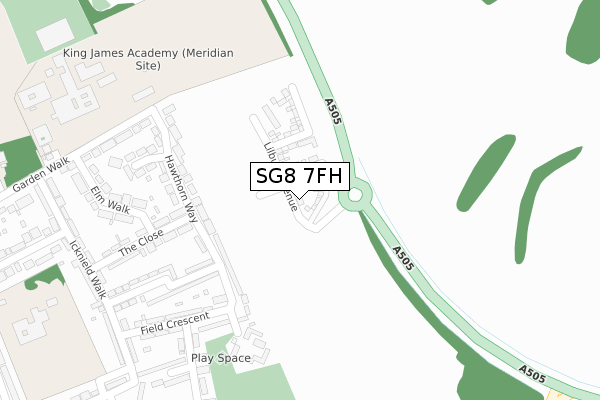
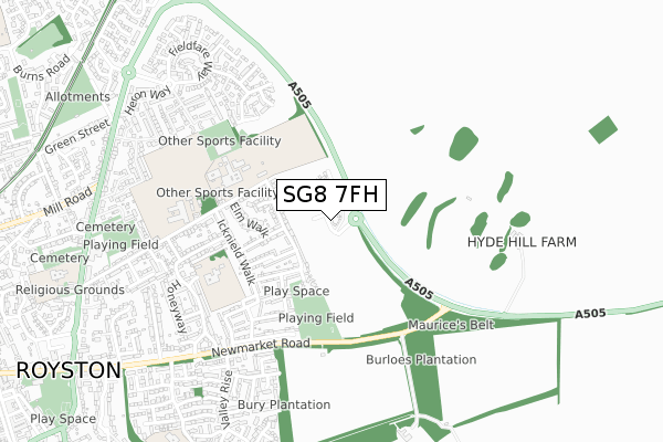
SG8 7FH is located in the Royston Meridian electoral ward, within the local authority district of North Hertfordshire and the English Parliamentary constituency of North East Hertfordshire. The Sub Integrated Care Board (ICB) Location is NHS Cambridgeshire and Peterborough ICB - 06H and the police force is Hertfordshire. This postcode has been in use since June 2019.


GetTheData
Source: OS Open Zoomstack (Ordnance Survey)
Licence: Open Government Licence (requires attribution)
Attribution: Contains OS data © Crown copyright and database right 2024
Source: Open Postcode Geo
Licence: Open Government Licence (requires attribution)
Attribution: Contains OS data © Crown copyright and database right 2024; Contains Royal Mail data © Royal Mail copyright and database right 2024; Source: Office for National Statistics licensed under the Open Government Licence v.3.0
| Easting | 536811 |
| Northing | 241358 |
| Latitude | 52.053737 |
| Longitude | -0.006094 |
GetTheData
Source: Open Postcode Geo
Licence: Open Government Licence
| Country | England |
| Postcode District | SG8 |
| ➜ SG8 open data dashboard ➜ See where SG8 is on a map ➜ Where is Royston? | |
GetTheData
Source: Land Registry Price Paid Data
Licence: Open Government Licence
| Ward | Royston Meridian |
| Constituency | North East Hertfordshire |
GetTheData
Source: ONS Postcode Database
Licence: Open Government Licence
55, LILBURN AVENUE, ROYSTON, SG8 7FH 2022 5 JAN £510,000 |
51, LILBURN AVENUE, ROYSTON, SG8 7FH 2021 23 DEC £599,995 |
6, LILBURN AVENUE, ROYSTON, SG8 7FH 2021 17 DEC £475,996 |
53, LILBURN AVENUE, ROYSTON, SG8 7FH 2021 30 SEP £524,995 |
52, LILBURN AVENUE, ROYSTON, SG8 7FH 2021 24 SEP £685,000 |
49, LILBURN AVENUE, ROYSTON, SG8 7FH 2021 20 AUG £595,995 |
43, LILBURN AVENUE, ROYSTON, SG8 7FH 2021 14 JUL £514,995 |
56, LILBURN AVENUE, ROYSTON, SG8 7FH 2021 24 JUN £562,995 |
54, LILBURN AVENUE, ROYSTON, SG8 7FH 2021 28 MAY £575,000 |
50, LILBURN AVENUE, ROYSTON, SG8 7FH 2021 24 MAY £578,495 |
GetTheData
Source: HM Land Registry Price Paid Data
Licence: Contains HM Land Registry data © Crown copyright and database right 2024. This data is licensed under the Open Government Licence v3.0.
| October 2023 | Criminal damage and arson | On or near Field Crescent | 267m |
| October 2023 | Burglary | On or near Newman Avenue | 395m |
| October 2023 | Burglary | On or near Newman Avenue | 395m |
| ➜ Get more crime data in our Crime section | |||
GetTheData
Source: data.police.uk
Licence: Open Government Licence
| Meridian And Greneway Schools (Garden Walk) | Royston | 326m |
| The Close (Icknield Walk) | Royston | 361m |
| Dacre Green (Icknield Walk) | Royston | 472m |
| Greneway School (Garden Walk) | Royston | 473m |
| Greneway School (Garden Walk) | Royston | 485m |
| Royston Station | 1.4km |
| Meldreth Station | 4.2km |
GetTheData
Source: NaPTAN
Licence: Open Government Licence
| Percentage of properties with Next Generation Access | 100.0% |
| Percentage of properties with Superfast Broadband | 100.0% |
| Percentage of properties with Ultrafast Broadband | 100.0% |
| Percentage of properties with Full Fibre Broadband | 100.0% |
Superfast Broadband is between 30Mbps and 300Mbps
Ultrafast Broadband is > 300Mbps
| Percentage of properties unable to receive 2Mbps | 0.0% |
| Percentage of properties unable to receive 5Mbps | 0.0% |
| Percentage of properties unable to receive 10Mbps | 0.0% |
| Percentage of properties unable to receive 30Mbps | 0.0% |
GetTheData
Source: Ofcom
Licence: Ofcom Terms of Use (requires attribution)
GetTheData
Source: ONS Postcode Database
Licence: Open Government Licence


➜ Get more ratings from the Food Standards Agency
GetTheData
Source: Food Standards Agency
Licence: FSA terms & conditions
| Last Collection | |||
|---|---|---|---|
| Location | Mon-Fri | Sat | Distance |
| Garden Walk | 18:00 | 11:45 | 354m |
| Icknield Walk | 18:00 | 11:45 | 366m |
| Valley Rise | 18:00 | 11:45 | 693m |
GetTheData
Source: Dracos
Licence: Creative Commons Attribution-ShareAlike
| Facility | Distance |
|---|---|
| King James Academy Royston (Upper School) Garden Walk, Royston Grass Pitches, Artificial Grass Pitch, Sports Hall, Swimming Pool | 340m |
| Royston Leisure Centre Woodcock Road, Royston Sports Hall, Swimming Pool, Health and Fitness Gym, Studio | 401m |
| Newmarket Road Playing Fields Newman Avenue, Royston Grass Pitches | 437m |
GetTheData
Source: Active Places
Licence: Open Government Licence
| School | Phase of Education | Distance |
|---|---|---|
| King James Academy Royston Garden Walk, Royston, SG8 7JH | All-through | 339m |
| Icknield Walk First School Poplar Drive, Royston, SG8 7EZ | Primary | 487m |
| St Mary Roman Catholic Primary School Melbourn Road, Royston, SG8 7DB | Primary | 979m |
GetTheData
Source: Edubase
Licence: Open Government Licence
The below table lists the International Territorial Level (ITL) codes (formerly Nomenclature of Territorial Units for Statistics (NUTS) codes) and Local Administrative Units (LAU) codes for SG8 7FH:
| ITL 1 Code | Name |
|---|---|
| TLH | East |
| ITL 2 Code | Name |
| TLH2 | Bedfordshire and Hertfordshire |
| ITL 3 Code | Name |
| TLH23 | Hertfordshire CC |
| LAU 1 Code | Name |
| E07000099 | North Hertfordshire |
GetTheData
Source: ONS Postcode Directory
Licence: Open Government Licence
The below table lists the Census Output Area (OA), Lower Layer Super Output Area (LSOA), and Middle Layer Super Output Area (MSOA) for SG8 7FH:
| Code | Name | |
|---|---|---|
| OA | E00120145 | |
| LSOA | E01023658 | North Hertfordshire 002E |
| MSOA | E02004910 | North Hertfordshire 002 |
GetTheData
Source: ONS Postcode Directory
Licence: Open Government Licence
| SG8 7JS | Hawthorn Way | 139m |
| SG8 7JP | Hawthorn Way | 155m |
| SG8 7JR | Hawthorn Close | 222m |
| SG8 7JT | The Close | 233m |
| SG8 7JN | Garden Walk | 247m |
| SG8 7LA | Field Crescent | 247m |
| SG8 7JL | Elm Walk | 267m |
| SG8 7JZ | Field Crescent | 293m |
| SG8 7LB | Field Crescent | 323m |
| SG8 7JJ | Garden Walk | 339m |
GetTheData
Source: Open Postcode Geo; Land Registry Price Paid Data
Licence: Open Government Licence