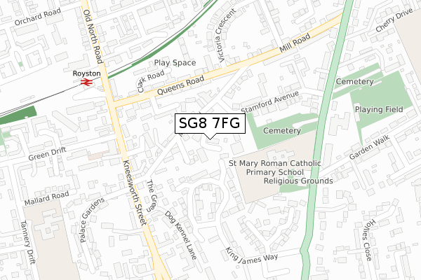
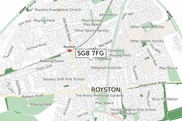
SG8 7FG is located in the Royston Palace electoral ward, within the local authority district of North Hertfordshire and the English Parliamentary constituency of North East Hertfordshire. The Sub Integrated Care Board (ICB) Location is NHS Cambridgeshire and Peterborough ICB - 06H and the police force is Hertfordshire. This postcode has been in use since October 2019.


GetTheData
Source: OS Open Zoomstack (Ordnance Survey)
Licence: Open Government Licence (requires attribution)
Attribution: Contains OS data © Crown copyright and database right 2024
Source: Open Postcode Geo
Licence: Open Government Licence (requires attribution)
Attribution: Contains OS data © Crown copyright and database right 2024; Contains Royal Mail data © Royal Mail copyright and database right 2024; Source: Office for National Statistics licensed under the Open Government Licence v.3.0
| Easting | 535673 |
| Northing | 241123 |
| Latitude | 52.051905 |
| Longitude | -0.022773 |
GetTheData
Source: Open Postcode Geo
Licence: Open Government Licence
| Country | England |
| Postcode District | SG8 |
| ➜ SG8 open data dashboard ➜ See where SG8 is on a map ➜ Where is Royston? | |
GetTheData
Source: Land Registry Price Paid Data
Licence: Open Government Licence
| Ward | Royston Palace |
| Constituency | North East Hertfordshire |
GetTheData
Source: ONS Postcode Database
Licence: Open Government Licence
| January 2024 | Violence and sexual offences | On or near Parking Area | 367m |
| January 2024 | Anti-social behaviour | On or near Jepps Lane | 481m |
| December 2023 | Bicycle theft | On or near Parking Area | 367m |
| ➜ Get more crime data in our Crime section | |||
GetTheData
Source: data.police.uk
Licence: Open Government Licence
| Royston Railway Station (Queens Road) | Royston | 193m |
| Royston Railway Station (Kneesworth Street) | Royston | 217m |
| Royston Railway Station (Kneesworth Street) | Royston | 230m |
| The Green (Kneesworth Street) | Royston | 250m |
| St Mary's Rc School (Melbourn Road) | Royston | 255m |
| Royston Station | 0.3km |
| Meldreth Station | 4.8km |
GetTheData
Source: NaPTAN
Licence: Open Government Licence
GetTheData
Source: ONS Postcode Database
Licence: Open Government Licence


➜ Get more ratings from the Food Standards Agency
GetTheData
Source: Food Standards Agency
Licence: FSA terms & conditions
| Last Collection | |||
|---|---|---|---|
| Location | Mon-Fri | Sat | Distance |
| Queens Road | 18:30 | 11:45 | 204m |
| King James Way | 18:00 | 11:45 | 213m |
| Melbourn Road | 18:00 | 11:45 | 319m |
GetTheData
Source: Dracos
Licence: Creative Commons Attribution-ShareAlike
| Facility | Distance |
|---|---|
| St Marys Roman Catholic School Melbourn Road, Royston Grass Pitches | 160m |
| Royston Town Football Club Garden Walk, Royston Grass Pitches | 428m |
| Tannery Drift First School Tannery Drift, Royston Grass Pitches, Outdoor Tennis Courts | 437m |
GetTheData
Source: Active Places
Licence: Open Government Licence
| School | Phase of Education | Distance |
|---|---|---|
| St Mary Roman Catholic Primary School Melbourn Road, Royston, SG8 7DB | Primary | 227m |
| Tannery Drift School Tannery Drift, Royston, SG8 5DE | Primary | 433m |
| Icknield Walk First School Poplar Drive, Royston, SG8 7EZ | Primary | 749m |
GetTheData
Source: Edubase
Licence: Open Government Licence
The below table lists the International Territorial Level (ITL) codes (formerly Nomenclature of Territorial Units for Statistics (NUTS) codes) and Local Administrative Units (LAU) codes for SG8 7FG:
| ITL 1 Code | Name |
|---|---|
| TLH | East |
| ITL 2 Code | Name |
| TLH2 | Bedfordshire and Hertfordshire |
| ITL 3 Code | Name |
| TLH23 | Hertfordshire CC |
| LAU 1 Code | Name |
| E07000099 | North Hertfordshire |
GetTheData
Source: ONS Postcode Directory
Licence: Open Government Licence
The below table lists the Census Output Area (OA), Lower Layer Super Output Area (LSOA), and Middle Layer Super Output Area (MSOA) for SG8 7FG:
| Code | Name | |
|---|---|---|
| OA | E00120169 | |
| LSOA | E01023660 | North Hertfordshire 001A |
| MSOA | E02004909 | North Hertfordshire 001 |
GetTheData
Source: ONS Postcode Directory
Licence: Open Government Licence
| SG8 7AG | Lumen Road | 36m |
| SG8 7AE | Mill Road | 78m |
| SG8 7BQ | Mill Road | 112m |
| SG8 7AN | Queens Road | 137m |
| SG8 5AZ | Pightle Close | 147m |
| SG8 7AQ | Mill Road | 159m |
| SG8 7DD | Stamford Avenue | 160m |
| SG8 7AU | Queens Road | 175m |
| SG8 7AD | The Green | 176m |
| SG8 7EF | King James Way | 181m |
GetTheData
Source: Open Postcode Geo; Land Registry Price Paid Data
Licence: Open Government Licence