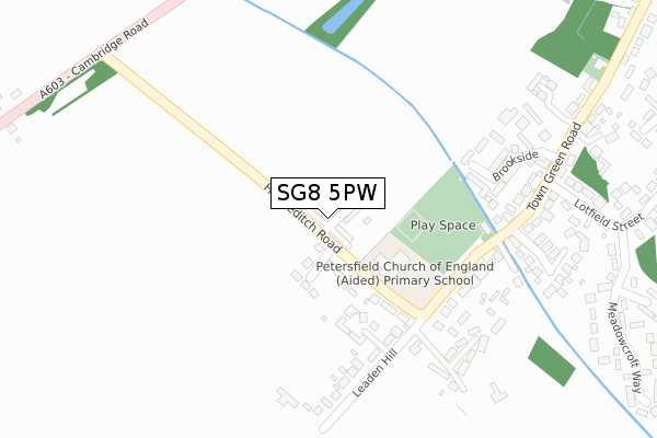
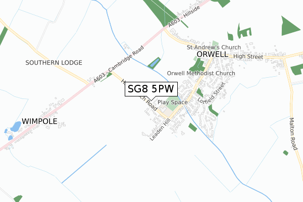
SG8 5PW is located in the Barrington electoral ward, within the local authority district of South Cambridgeshire and the English Parliamentary constituency of South Cambridgeshire. The Sub Integrated Care Board (ICB) Location is NHS Cambridgeshire and Peterborough ICB - 06H and the police force is Cambridgeshire. This postcode has been in use since April 2020.


GetTheData
Source: OS Open Zoomstack (Ordnance Survey)
Licence: Open Government Licence (requires attribution)
Attribution: Contains OS data © Crown copyright and database right 2024
Source: Open Postcode Geo
Licence: Open Government Licence (requires attribution)
Attribution: Contains OS data © Crown copyright and database right 2024; Contains Royal Mail data © Royal Mail copyright and database right 2024; Source: Office for National Statistics licensed under the Open Government Licence v.3.0
| Easting | 535779 |
| Northing | 250110 |
| Latitude | 52.132630 |
| Longitude | -0.017653 |
GetTheData
Source: Open Postcode Geo
Licence: Open Government Licence
| Country | England |
| Postcode District | SG8 |
| ➜ SG8 open data dashboard ➜ See where SG8 is on a map ➜ Where is Orwell? | |
GetTheData
Source: Land Registry Price Paid Data
Licence: Open Government Licence
| Ward | Barrington |
| Constituency | South Cambridgeshire |
GetTheData
Source: ONS Postcode Database
Licence: Open Government Licence
44, WEST CROFT, ORWELL, ROYSTON, SG8 5PW 2021 30 SEP £745,000 |
48, WEST CROFT, ORWELL, ROYSTON, SG8 5PW 2021 30 SEP £770,000 |
42, WEST CROFT, ORWELL, ROYSTON, SG8 5PW 2021 27 AUG £650,000 |
35, WEST CROFT, ORWELL, ROYSTON, SG8 5PW 2021 30 JUL £760,000 |
21, WEST CROFT, ORWELL, ROYSTON, SG8 5PW 2021 25 JUN £580,000 |
2021 11 JUN £380,000 |
37, WEST CROFT, ORWELL, ROYSTON, SG8 5PW 2021 8 JUN £695,000 |
33, WEST CROFT, ORWELL, ROYSTON, SG8 5PW 2021 1 JUN £420,000 |
19, WEST CROFT, ORWELL, ROYSTON, SG8 5PW 2021 19 MAY £755,000 |
17, WEST CROFT, ORWELL, ROYSTON, SG8 5PW 2021 14 MAY £752,000 |
GetTheData
Source: HM Land Registry Price Paid Data
Licence: Contains HM Land Registry data © Crown copyright and database right 2024. This data is licensed under the Open Government Licence v3.0.
| June 2022 | Public order | On or near Meadowcroft Way | 431m |
| June 2022 | Violence and sexual offences | On or near Meadowcroft Way | 431m |
| June 2022 | Public order | On or near Meadowcroft Way | 431m |
| ➜ Get more crime data in our Crime section | |||
GetTheData
Source: data.police.uk
Licence: Open Government Licence
| Chequers Close (Town Green Road) | Orwell | 329m |
| Chequers Close (Town Green Road) | Orwell | 340m |
| Cambridge Road (Fishers Lane) | Orwell | 469m |
| Lordship Close (Town Green Road) | Orwell | 545m |
| Lordship Close (Town Green Road) | Orwell | 550m |
| Shepreth Station | 3.9km |
| Meldreth Station | 5km |
GetTheData
Source: NaPTAN
Licence: Open Government Licence
GetTheData
Source: ONS Postcode Database
Licence: Open Government Licence


➜ Get more ratings from the Food Standards Agency
GetTheData
Source: Food Standards Agency
Licence: FSA terms & conditions
| Last Collection | |||
|---|---|---|---|
| Location | Mon-Fri | Sat | Distance |
| Orwell | 16:30 | 10:15 | 356m |
| Meadowcroft Way | 16:15 | 10:00 | 417m |
| Hillside | 16:00 | 10:00 | 863m |
GetTheData
Source: Dracos
Licence: Creative Commons Attribution-ShareAlike
| Facility | Distance |
|---|---|
| The Petersfield Ce Primary School Hurdleditch Road, Orwell, Royston Grass Pitches, Swimming Pool | 135m |
| Orwell Recreation Ground Town Green Road, Orwell, Royston Grass Pitches, Outdoor Tennis Courts | 196m |
| New Malton Golf Club (Closed) Malton Lane, Meldreth, Royston Golf | 2.1km |
GetTheData
Source: Active Places
Licence: Open Government Licence
| School | Phase of Education | Distance |
|---|---|---|
| Petersfield CofE Aided Primary School Hurdleditch Road, Orwell, Royston, SG8 5QG | Primary | 135m |
| Barrington CofE VC Primary School Haslingfield Road, Barrington, Cambridge, CB22 7RG | Primary | 3.9km |
| Aurora Meldreth Manor School Fenny Lane, Meldreth, Royston, SG8 6LG | Not applicable | 4.1km |
GetTheData
Source: Edubase
Licence: Open Government Licence
The below table lists the International Territorial Level (ITL) codes (formerly Nomenclature of Territorial Units for Statistics (NUTS) codes) and Local Administrative Units (LAU) codes for SG8 5PW:
| ITL 1 Code | Name |
|---|---|
| TLH | East |
| ITL 2 Code | Name |
| TLH1 | East Anglia |
| ITL 3 Code | Name |
| TLH12 | Cambridgeshire CC |
| LAU 1 Code | Name |
| E07000012 | South Cambridgeshire |
GetTheData
Source: ONS Postcode Directory
Licence: Open Government Licence
The below table lists the Census Output Area (OA), Lower Layer Super Output Area (LSOA), and Middle Layer Super Output Area (MSOA) for SG8 5PW:
| Code | Name | |
|---|---|---|
| OA | E00092178 | |
| LSOA | E01018275 | South Cambridgeshire 013D |
| MSOA | E02003787 | South Cambridgeshire 013 |
GetTheData
Source: ONS Postcode Directory
Licence: Open Government Licence
| SG8 5QG | Hurdleditch Road | 169m |
| SG8 5TQ | Brookside | 201m |
| SG8 5QJ | Town Green Road | 227m |
| SG8 5QH | Leaden Hill | 278m |
| SG8 5RH | The Grove | 294m |
| SG8 5UN | Chequers Close | 298m |
| SG8 5QA | Greenford Close | 309m |
| SG8 5QL | Town Green Road | 375m |
| SG8 5QT | Lotfield Street | 439m |
| SG8 5QW | Cross Lane Close | 462m |
GetTheData
Source: Open Postcode Geo; Land Registry Price Paid Data
Licence: Open Government Licence