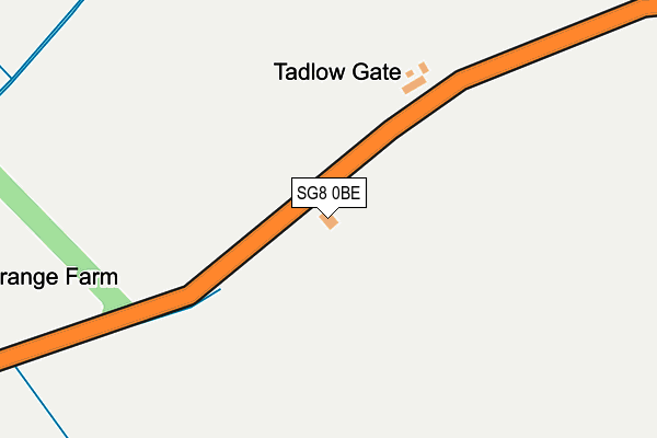
SG8 0BE is located in the The Mordens electoral ward, within the local authority district of South Cambridgeshire and the English Parliamentary constituency of South Cambridgeshire. The Sub Integrated Care Board (ICB) Location is NHS Cambridgeshire and Peterborough ICB - 06H and the police force is Cambridgeshire. This postcode has been in use since June 2017.


GetTheData
Source: OS OpenMap – Local (Ordnance Survey)
Source: OS VectorMap District (Ordnance Survey)
Licence: Open Government Licence (requires attribution)
| Easting | 527017 |
| Northing | 247476 |
| Latitude | 52.111042 |
| Longitude | -0.146575 |
GetTheData
Source: Open Postcode Geo
Licence: Open Government Licence
| Country | England |
| Postcode District | SG8 |
| ➜ SG8 open data dashboard ➜ See where SG8 is on a map | |
GetTheData
Source: Land Registry Price Paid Data
Licence: Open Government Licence
| Ward | The Mordens |
| Constituency | South Cambridgeshire |
GetTheData
Source: ONS Postcode Database
Licence: Open Government Licence
| Grange Farm (Tadlow Road) | Wrestlingworth | 291m |
| Grange Farm (Tadlow Road) | Wrestlingworth | 292m |
| High Street (Lower Road) | Tadlow | 1,017m |
| High Street (Cambridge Road) | Tadlow | 1,052m |
| Chapel Close (High Street) | Wrestlingworth | 1,122m |
GetTheData
Source: NaPTAN
Licence: Open Government Licence
GetTheData
Source: ONS Postcode Database
Licence: Open Government Licence

➜ Get more ratings from the Food Standards Agency
GetTheData
Source: Food Standards Agency
Licence: FSA terms & conditions
| Last Collection | |||
|---|---|---|---|
| Location | Mon-Fri | Sat | Distance |
| Tadlow | 16:00 | 08:30 | 1,124m |
| Wrestlingworth | 16:15 | 09:30 | 1,218m |
| Cross Roads | 16:15 | 09:30 | 1,219m |
GetTheData
Source: Dracos
Licence: Creative Commons Attribution-ShareAlike
| Facility | Distance |
|---|---|
| Guilden Morden Recreation Ground Fox Hill Road, Guilden Morden, Royston Grass Pitches | 3.5km |
| Hatley Playing Field Main Street, Hatley St. George, Sandy Grass Pitches | 3.7km |
| Dunton Recreation Ground Horseshoe Close, Dunton Grass Pitches | 4.6km |
GetTheData
Source: Active Places
Licence: Open Government Licence
| School | Phase of Education | Distance |
|---|---|---|
| Wrestlingworth CofE VC Lower School Church Lane, Wrestlingworth, Sandy, SG19 2EU | Primary | 1.2km |
| Guilden Morden CofE Primary Academy Pound Green, Guilden Morden, Nr Royston, SG8 0JZ | Primary | 3.4km |
| Dunton CofE VC Lower School High Street, Dunton, Biggleswade, SG18 8RN | Primary | 4.7km |
GetTheData
Source: Edubase
Licence: Open Government Licence
The below table lists the International Territorial Level (ITL) codes (formerly Nomenclature of Territorial Units for Statistics (NUTS) codes) and Local Administrative Units (LAU) codes for SG8 0BE:
| ITL 1 Code | Name |
|---|---|
| TLH | East |
| ITL 2 Code | Name |
| TLH1 | East Anglia |
| ITL 3 Code | Name |
| TLH12 | Cambridgeshire CC |
| LAU 1 Code | Name |
| E07000012 | South Cambridgeshire |
GetTheData
Source: ONS Postcode Directory
Licence: Open Government Licence
The below table lists the Census Output Area (OA), Lower Layer Super Output Area (LSOA), and Middle Layer Super Output Area (MSOA) for SG8 0BE:
| Code | Name | |
|---|---|---|
| OA | E00092254 | |
| LSOA | E01018290 | South Cambridgeshire 019D |
| MSOA | E02003793 | South Cambridgeshire 019 |
GetTheData
Source: ONS Postcode Directory
Licence: Open Government Licence
| SG8 0ER | Tadlow Gate | 147m |
| SG8 0EP | 609m | |
| SG19 2ER | Braggs Lane | 994m |
| SG8 0TP | Swanns Close | 996m |
| SG8 0ES | High Street | 1079m |
| SG19 2ET | Chapel Close | 1102m |
| SG19 2EN | High Street | 1140m |
| SG19 2EU | Church Lane | 1146m |
| SG8 0EN | 1150m | |
| SG19 2BU | Walnut Tree Close | 1171m |
GetTheData
Source: Open Postcode Geo; Land Registry Price Paid Data
Licence: Open Government Licence