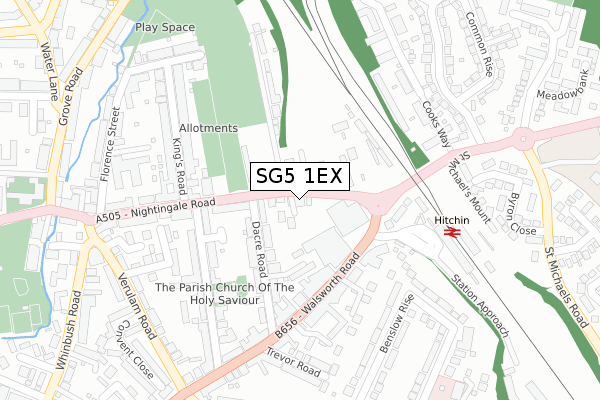
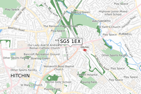
SG5 1EX is located in the Hitchin Bearton electoral ward, within the local authority district of North Hertfordshire and the English Parliamentary constituency of Hitchin and Harpenden. The Sub Integrated Care Board (ICB) Location is NHS Hertfordshire and West Essex ICB - 06K and the police force is Hertfordshire. This postcode has been in use since March 2019.


GetTheData
Source: OS Open Zoomstack (Ordnance Survey)
Licence: Open Government Licence (requires attribution)
Attribution: Contains OS data © Crown copyright and database right 2024
Source: Open Postcode Geo
Licence: Open Government Licence (requires attribution)
Attribution: Contains OS data © Crown copyright and database right 2024; Contains Royal Mail data © Royal Mail copyright and database right 2024; Source: Office for National Statistics licensed under the Open Government Licence v.3.0
| Easting | 519197 |
| Northing | 229794 |
| Latitude | 51.953878 |
| Longitude | -0.266868 |
GetTheData
Source: Open Postcode Geo
Licence: Open Government Licence
| Country | England |
| Postcode District | SG5 |
| ➜ SG5 open data dashboard ➜ See where SG5 is on a map ➜ Where is Hitchin? | |
GetTheData
Source: Land Registry Price Paid Data
Licence: Open Government Licence
| Ward | Hitchin Bearton |
| Constituency | Hitchin And Harpenden |
GetTheData
Source: ONS Postcode Database
Licence: Open Government Licence
| January 2024 | Criminal damage and arson | On or near Parking Area | 133m |
| December 2023 | Burglary | On or near Parking Area | 133m |
| November 2023 | Burglary | On or near Parking Area | 133m |
| ➜ Get more crime data in our Crime section | |||
GetTheData
Source: data.police.uk
Licence: Open Government Licence
| Hitchin Station (Nightingale Road) | Hitchin | 51m |
| Hitchin Station (Nightingale Road) | Hitchin | 78m |
| Hitchin Railway Station (Walsworth Road) | Hitchin | 126m |
| Hitchin Railway Station (Walsworth Road) | Hitchin | 140m |
| Hitchin Railway Station (Station Approach) | Hitchin | 171m |
| Hitchin Station | 0.2km |
| Letchworth Station | 3.9km |
GetTheData
Source: NaPTAN
Licence: Open Government Licence
| Percentage of properties with Next Generation Access | 100.0% |
| Percentage of properties with Superfast Broadband | 100.0% |
| Percentage of properties with Ultrafast Broadband | 100.0% |
| Percentage of properties with Full Fibre Broadband | 0.0% |
Superfast Broadband is between 30Mbps and 300Mbps
Ultrafast Broadband is > 300Mbps
| Percentage of properties unable to receive 2Mbps | 0.0% |
| Percentage of properties unable to receive 5Mbps | 0.0% |
| Percentage of properties unable to receive 10Mbps | 0.0% |
| Percentage of properties unable to receive 30Mbps | 0.0% |
GetTheData
Source: Ofcom
Licence: Ofcom Terms of Use (requires attribution)
GetTheData
Source: ONS Postcode Database
Licence: Open Government Licence


➜ Get more ratings from the Food Standards Agency
GetTheData
Source: Food Standards Agency
Licence: FSA terms & conditions
| Last Collection | |||
|---|---|---|---|
| Location | Mon-Fri | Sat | Distance |
| Nightingale Road | 18:30 | 12:00 | 130m |
| Railway Station | 18:30 | 12:00 | 155m |
| Meadowbank | 17:30 | 12:00 | 390m |
GetTheData
Source: Dracos
Licence: Creative Commons Attribution-ShareAlike
| Facility | Distance |
|---|---|
| Zone Fitness (Closed) Station Approach, Hitchin Health and Fitness Gym | 179m |
| Ransoms Recreation Ground Grove Road, Hitchin Grass Pitches | 295m |
| North Hertfordshire College (Hitchin Campus) Cambridge Road, Hitchin Sports Hall, Health and Fitness Gym, Grass Pitches, Squash Courts, Artificial Grass Pitch | 533m |
GetTheData
Source: Active Places
Licence: Open Government Licence
| School | Phase of Education | Distance |
|---|---|---|
| St Andrew's Church of England Voluntary Aided Primary School, Hitchin Benslow Lane, Hitchin, SG4 9RD | Primary | 385m |
| Hitchin Girls' School Highbury Road, Hitchin, SG4 9RS | Secondary | 683m |
| York Road Nursery School York Road, Hitchin, SG5 1XA | Nursery | 788m |
GetTheData
Source: Edubase
Licence: Open Government Licence
The below table lists the International Territorial Level (ITL) codes (formerly Nomenclature of Territorial Units for Statistics (NUTS) codes) and Local Administrative Units (LAU) codes for SG5 1EX:
| ITL 1 Code | Name |
|---|---|
| TLH | East |
| ITL 2 Code | Name |
| TLH2 | Bedfordshire and Hertfordshire |
| ITL 3 Code | Name |
| TLH23 | Hertfordshire CC |
| LAU 1 Code | Name |
| E07000099 | North Hertfordshire |
GetTheData
Source: ONS Postcode Directory
Licence: Open Government Licence
The below table lists the Census Output Area (OA), Lower Layer Super Output Area (LSOA), and Middle Layer Super Output Area (MSOA) for SG5 1EX:
| Code | Name | |
|---|---|---|
| OA | E00119865 | |
| LSOA | E01023601 | North Hertfordshire 010A |
| MSOA | E02004918 | North Hertfordshire 010 |
GetTheData
Source: ONS Postcode Directory
Licence: Open Government Licence
| SG5 1RL | Nightingale Road | 16m |
| SG5 1RN | Nightingale Road | 41m |
| SG4 9FJ | Walsworth Road | 75m |
| SG5 1QL | Dacre Road | 100m |
| SG5 1RH | Nightingale Road | 116m |
| SG4 9FH | Walsworth Road | 133m |
| SG5 1QJ | Dacre Road | 143m |
| SG4 9UJ | Walsworth Road | 155m |
| SG5 1RQ | Nightingale Road | 156m |
| SG4 9SX | Walsworth Road | 158m |
GetTheData
Source: Open Postcode Geo; Land Registry Price Paid Data
Licence: Open Government Licence