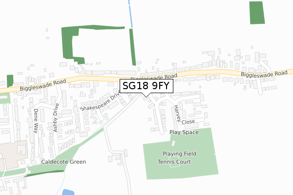
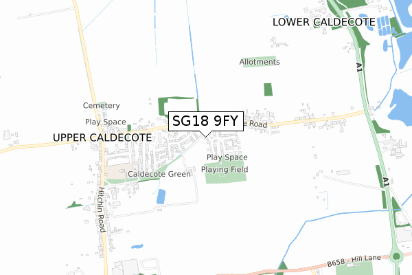
SG18 9FY is located in the Northill electoral ward, within the unitary authority of Central Bedfordshire and the English Parliamentary constituency of North East Bedfordshire. The Sub Integrated Care Board (ICB) Location is NHS Bedfordshire, Luton and Milton Keynes ICB - M1J4Y and the police force is Bedfordshire. This postcode has been in use since April 2020.


GetTheData
Source: OS Open Zoomstack (Ordnance Survey)
Licence: Open Government Licence (requires attribution)
Attribution: Contains OS data © Crown copyright and database right 2024
Source: Open Postcode Geo
Licence: Open Government Licence (requires attribution)
Attribution: Contains OS data © Crown copyright and database right 2024; Contains Royal Mail data © Royal Mail copyright and database right 2024; Source: Office for National Statistics licensed under the Open Government Licence v.3.0
| Easting | 517192 |
| Northing | 245862 |
| Latitude | 52.098705 |
| Longitude | -0.290534 |
GetTheData
Source: Open Postcode Geo
Licence: Open Government Licence
| Country | England |
| Postcode District | SG18 |
| ➜ SG18 open data dashboard ➜ See where SG18 is on a map ➜ Where is Upper Caldecote? | |
GetTheData
Source: Land Registry Price Paid Data
Licence: Open Government Licence
| Ward | Northill |
| Constituency | North East Bedfordshire |
GetTheData
Source: ONS Postcode Database
Licence: Open Government Licence
2022 12 DEC £455,000 |
15, SUNFLOWER CROFT, UPPER CALDECOTE, BIGGLESWADE, SG18 9FY 2021 21 APR £545,000 |
11, SUNFLOWER CROFT, UPPER CALDECOTE, BIGGLESWADE, SG18 9FY 2021 23 MAR £460,000 |
9, SUNFLOWER CROFT, UPPER CALDECOTE, BIGGLESWADE, SG18 9FY 2021 10 MAR £449,000 |
2020 9 DEC £369,950 |
16, SUNFLOWER CROFT, UPPER CALDECOTE, BIGGLESWADE, SG18 9FY 2020 13 NOV £349,950 |
12, SUNFLOWER CROFT, UPPER CALDECOTE, BIGGLESWADE, SG18 9FY 2020 31 JUL £434,950 |
14, SUNFLOWER CROFT, UPPER CALDECOTE, BIGGLESWADE, SG18 9FY 2020 31 JUL £429,950 |
➜ Upper Caldecote house prices
GetTheData
Source: HM Land Registry Price Paid Data
Licence: Contains HM Land Registry data © Crown copyright and database right 2024. This data is licensed under the Open Government Licence v3.0.
| May 2022 | Criminal damage and arson | On or near Wordsworth Close | 103m |
| May 2022 | Vehicle crime | On or near Swallowfield | 413m |
| May 2022 | Vehicle crime | On or near Swallowfield | 413m |
| ➜ Get more crime data in our Crime section | |||
GetTheData
Source: data.police.uk
Licence: Open Government Licence
| The Pastures (Biggleswade Road) | Upper Caldecote | 90m |
| The Pastures (Biggleswade Road) | Upper Caldecote | 98m |
| Swallofield (Biggleswade Road) | Upper Caldecote | 367m |
| Swallofield (Biggleswade Road) | Upper Caldecote | 402m |
| All Saints Church (Biggleswade Road) | Upper Caldecote | 547m |
| Biggleswade Station | 2.5km |
| Sandy Station | 3km |
GetTheData
Source: NaPTAN
Licence: Open Government Licence
GetTheData
Source: ONS Postcode Database
Licence: Open Government Licence


➜ Get more ratings from the Food Standards Agency
GetTheData
Source: Food Standards Agency
Licence: FSA terms & conditions
| Last Collection | |||
|---|---|---|---|
| Location | Mon-Fri | Sat | Distance |
| Biggleswade Road | 16:00 | 09:15 | 87m |
| Woodlands | 16:00 | 07:15 | 636m |
| Upper Caldecote Post Office | 16:00 | 09:00 | 658m |
GetTheData
Source: Dracos
Licence: Creative Commons Attribution-ShareAlike
| Facility | Distance |
|---|---|
| Upper Caldecote Playing Field Harvey Close, Upper Caldecote Grass Pitches | 214m |
| Biggleswade Golf Centre Hill Lane, Biggleswade Golf | 1.2km |
| Biggleswade United Fc Fairfield Road, Biggleswade Grass Pitches | 1.6km |
GetTheData
Source: Active Places
Licence: Open Government Licence
| School | Phase of Education | Distance |
|---|---|---|
| Caldecote Church of England Academy Manor Place, Upper Caldecote, Biggleswade, SG18 9DA | Primary | 467m |
| St Andrew's CofE VC Lower School Brunts Lane, Biggleswade, SG18 0LY | Primary | 1.9km |
| Northill CofE Academy Bedford Road, Northill, Biggleswade, SG18 9AH | Primary | 2.4km |
GetTheData
Source: Edubase
Licence: Open Government Licence
The below table lists the International Territorial Level (ITL) codes (formerly Nomenclature of Territorial Units for Statistics (NUTS) codes) and Local Administrative Units (LAU) codes for SG18 9FY:
| ITL 1 Code | Name |
|---|---|
| TLH | East |
| ITL 2 Code | Name |
| TLH2 | Bedfordshire and Hertfordshire |
| ITL 3 Code | Name |
| TLH25 | Central Bedfordshire |
| LAU 1 Code | Name |
| E06000056 | Central Bedfordshire |
GetTheData
Source: ONS Postcode Directory
Licence: Open Government Licence
The below table lists the Census Output Area (OA), Lower Layer Super Output Area (LSOA), and Middle Layer Super Output Area (MSOA) for SG18 9FY:
| Code | Name | |
|---|---|---|
| OA | E00087991 | |
| LSOA | E01017422 | Central Bedfordshire 004B |
| MSOA | E02003602 | Central Bedfordshire 004 |
GetTheData
Source: ONS Postcode Directory
Licence: Open Government Licence
| SG18 9BN | Biggleswade Road | 98m |
| SG18 9DE | Wordsworth Close | 106m |
| SG18 9BG | The Pastures | 118m |
| SG18 9BQ | Harvey Close | 134m |
| SG18 9BP | Biggleswade Road | 207m |
| SG18 9DD | Shakespeare Drive | 209m |
| SG18 9BH | Biggleswade Road | 246m |
| SG18 9BD | Biggleswade Road | 263m |
| SG18 9DN | Taddy Close | 303m |
| SG18 9DW | Brook Close | 307m |
GetTheData
Source: Open Postcode Geo; Land Registry Price Paid Data
Licence: Open Government Licence