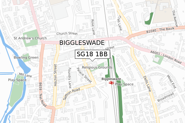
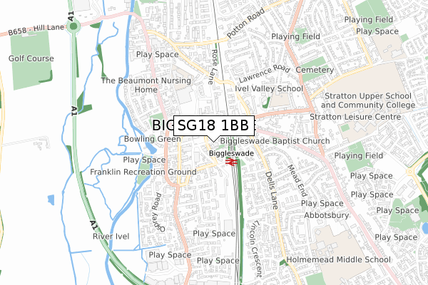
SG18 1BB is located in the Biggleswade West electoral ward, within the unitary authority of Central Bedfordshire and the English Parliamentary constituency of North East Bedfordshire. The Sub Integrated Care Board (ICB) Location is NHS Bedfordshire, Luton and Milton Keynes ICB - M1J4Y and the police force is Bedfordshire. This postcode has been in use since July 2018.


GetTheData
Source: OS Open Zoomstack (Ordnance Survey)
Licence: Open Government Licence (requires attribution)
Attribution: Contains OS data © Crown copyright and database right 2024
Source: Open Postcode Geo
Licence: Open Government Licence (requires attribution)
Attribution: Contains OS data © Crown copyright and database right 2024; Contains Royal Mail data © Royal Mail copyright and database right 2024; Source: Office for National Statistics licensed under the Open Government Licence v.3.0
| Easting | 519151 |
| Northing | 244487 |
| Latitude | 52.085931 |
| Longitude | -0.262428 |
GetTheData
Source: Open Postcode Geo
Licence: Open Government Licence
| Country | England |
| Postcode District | SG18 |
| ➜ SG18 open data dashboard ➜ See where SG18 is on a map ➜ Where is Biggleswade? | |
GetTheData
Source: Land Registry Price Paid Data
Licence: Open Government Licence
| Ward | Biggleswade West |
| Constituency | North East Bedfordshire |
GetTheData
Source: ONS Postcode Database
Licence: Open Government Licence
| January 2024 | Public order | On or near Parking Area | 259m |
| January 2024 | Anti-social behaviour | On or near Parking Area | 259m |
| January 2024 | Other theft | On or near Parking Area | 259m |
| ➜ Get more crime data in our Crime section | |||
GetTheData
Source: data.police.uk
Licence: Open Government Licence
| Station Road | Biggleswade | 91m |
| Bus Station (Biggleswade Centre) | Biggleswade | 184m |
| Bus Station (Biggleswade Centre) | Biggleswade | 184m |
| Bus Station (Biggleswade Centre) | Biggleswade | 191m |
| Bus Station (Market Square) | Biggleswade | 193m |
| Biggleswade Station | 0.2km |
| Sandy Station | 4.5km |
GetTheData
Source: NaPTAN
Licence: Open Government Licence
GetTheData
Source: ONS Postcode Database
Licence: Open Government Licence


➜ Get more ratings from the Food Standards Agency
GetTheData
Source: Food Standards Agency
Licence: FSA terms & conditions
| Last Collection | |||
|---|---|---|---|
| Location | Mon-Fri | Sat | Distance |
| Biggleswade | 17:45 | 12:00 | 34m |
| Budgens | 18:45 | 11:00 | 132m |
| Crown Archway | 17:30 | 11:00 | 196m |
GetTheData
Source: Dracos
Licence: Creative Commons Attribution-ShareAlike
| Facility | Distance |
|---|---|
| Keytone Leisure Ltd (Closed) High Street, Biggleswade Health and Fitness Gym | 244m |
| Biggleswade Conservative Tennis Club St. Andrews Street, Biggleswade Outdoor Tennis Courts | 338m |
| Drove Road Recreation Ground Drove Road, Drove Road, Biggleswade Outdoor Tennis Courts | 805m |
GetTheData
Source: Active Places
Licence: Open Government Licence
| School | Phase of Education | Distance |
|---|---|---|
| Lawnside Academy Lawnside, Biggleswade, SG18 0LX | Primary | 498m |
| St Andrew's CofE VC Lower School Brunts Lane, Biggleswade, SG18 0LY | Primary | 530m |
| Stratton Upper School Eagle Farm Road, Biggleswade, SG18 8JB | Secondary | 844m |
GetTheData
Source: Edubase
Licence: Open Government Licence
The below table lists the International Territorial Level (ITL) codes (formerly Nomenclature of Territorial Units for Statistics (NUTS) codes) and Local Administrative Units (LAU) codes for SG18 1BB:
| ITL 1 Code | Name |
|---|---|
| TLH | East |
| ITL 2 Code | Name |
| TLH2 | Bedfordshire and Hertfordshire |
| ITL 3 Code | Name |
| TLH25 | Central Bedfordshire |
| LAU 1 Code | Name |
| E06000056 | Central Bedfordshire |
GetTheData
Source: ONS Postcode Directory
Licence: Open Government Licence
The below table lists the Census Output Area (OA), Lower Layer Super Output Area (LSOA), and Middle Layer Super Output Area (MSOA) for SG18 1BB:
| Code | Name | |
|---|---|---|
| OA | E00087804 | |
| LSOA | E01017385 | Central Bedfordshire 005C |
| MSOA | E02003603 | Central Bedfordshire 005 |
GetTheData
Source: ONS Postcode Directory
Licence: Open Government Licence
| SG18 8LG | Back Street | 41m |
| SG18 8AW | Station Road | 74m |
| SG18 8DP | Palace Street | 102m |
| SG18 8AL | Station Road | 104m |
| SG18 8AS | Market Square | 122m |
| SG18 8JA | Back Street | 125m |
| SG18 0JH | High Street | 128m |
| SG18 0LJ | High Street | 131m |
| SG18 0JF | High Street | 152m |
| SG18 8AQ | Market Square | 159m |
GetTheData
Source: Open Postcode Geo; Land Registry Price Paid Data
Licence: Open Government Licence