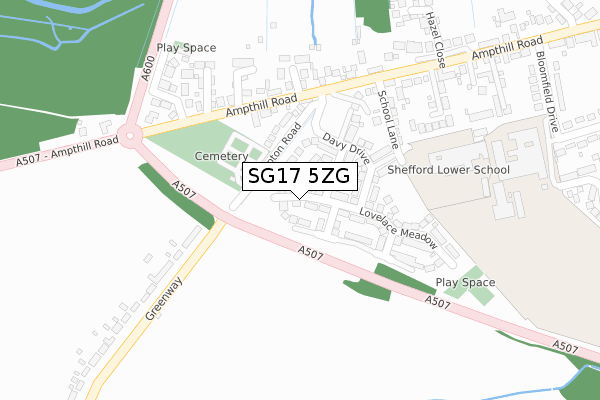
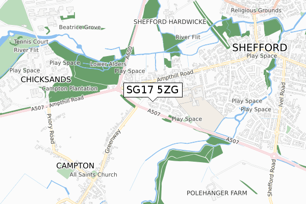
SG17 5ZG is located in the Shefford electoral ward, within the unitary authority of Central Bedfordshire and the English Parliamentary constituency of Mid Bedfordshire. The Sub Integrated Care Board (ICB) Location is NHS Bedfordshire, Luton and Milton Keynes ICB - M1J4Y and the police force is Bedfordshire. This postcode has been in use since July 2019.


GetTheData
Source: OS Open Zoomstack (Ordnance Survey)
Licence: Open Government Licence (requires attribution)
Attribution: Contains OS data © Crown copyright and database right 2024
Source: Open Postcode Geo
Licence: Open Government Licence (requires attribution)
Attribution: Contains OS data © Crown copyright and database right 2024; Contains Royal Mail data © Royal Mail copyright and database right 2024; Source: Office for National Statistics licensed under the Open Government Licence v.3.0
| Easting | 513492 |
| Northing | 238669 |
| Latitude | 52.034832 |
| Longitude | -0.346912 |
GetTheData
Source: Open Postcode Geo
Licence: Open Government Licence
| Country | England |
| Postcode District | SG17 |
| ➜ SG17 open data dashboard ➜ See where SG17 is on a map ➜ Where is Shefford? | |
GetTheData
Source: Land Registry Price Paid Data
Licence: Open Government Licence
| Ward | Shefford |
| Constituency | Mid Bedfordshire |
GetTheData
Source: ONS Postcode Database
Licence: Open Government Licence
1, FARADAY CORNER, SHEFFORD, SG17 5ZG 2023 20 SEP £495,000 |
2023 2 AUG £500,000 |
2022 6 DEC £815,000 |
1, FARADAY CORNER, SHEFFORD, SG17 5ZG 2020 3 JUL £424,995 |
11, FARADAY CORNER, SHEFFORD, SG17 5ZG 2020 26 JUN £624,995 |
16, FARADAY CORNER, SHEFFORD, SG17 5ZG 2020 3 APR £674,995 |
5, FARADAY CORNER, SHEFFORD, SG17 5ZG 2020 7 JAN £624,995 |
2019 13 DEC £469,995 |
3, FARADAY CORNER, SHEFFORD, SG17 5ZG 2019 6 DEC £579,995 |
7, FARADAY CORNER, SHEFFORD, SG17 5ZG 2019 27 SEP £699,995 |
GetTheData
Source: HM Land Registry Price Paid Data
Licence: Contains HM Land Registry data © Crown copyright and database right 2024. This data is licensed under the Open Government Licence v3.0.
| May 2022 | Other crime | On or near School Lane | 202m |
| May 2022 | Violence and sexual offences | On or near School Lane | 202m |
| May 2022 | Violence and sexual offences | On or near School Lane | 202m |
| ➜ Get more crime data in our Crime section | |||
GetTheData
Source: data.police.uk
Licence: Open Government Licence
| School Lane (Ampthill Road) | Shefford | 218m |
| Priory Gate (Ampthill Road) | Shefford | 226m |
| Priory Gate (Ampthill Road) | Shefford | 232m |
| School Lane (Ampthill Road) | Shefford | 239m |
| J R Ford (Ampthill Road) | Shefford | 556m |
GetTheData
Source: NaPTAN
Licence: Open Government Licence
GetTheData
Source: ONS Postcode Database
Licence: Open Government Licence


➜ Get more ratings from the Food Standards Agency
GetTheData
Source: Food Standards Agency
Licence: FSA terms & conditions
| Last Collection | |||
|---|---|---|---|
| Location | Mon-Fri | Sat | Distance |
| Ampthill Road | 16:45 | 10:00 | 550m |
| Shefford Post Office | 17:15 | 12:15 | 1,006m |
| Ivel Road | 16:15 | 10:45 | 1,084m |
GetTheData
Source: Dracos
Licence: Creative Commons Attribution-ShareAlike
| Facility | Distance |
|---|---|
| Robert Bloomfield Academy Bloomfield Drive, Shefford Sports Hall, Grass Pitches, Artificial Grass Pitch | 379m |
| Campton Recreation Ground Rectory Road, Campton Grass Pitches | 909m |
| Little Aqua Shefford St. Francis Way, Shefford Swimming Pool | 919m |
GetTheData
Source: Active Places
Licence: Open Government Licence
| School | Phase of Education | Distance |
|---|---|---|
| Shefford Lower School School Lane, Shefford, SG17 5XA | Primary | 284m |
| Robert Bloomfield Academy Bloomfield Drive, Shefford, SG17 5BU | Middle deemed secondary | 375m |
| Campton Academy Rectory Road, Campton, Shefford, SG17 5PF | Primary | 842m |
GetTheData
Source: Edubase
Licence: Open Government Licence
The below table lists the International Territorial Level (ITL) codes (formerly Nomenclature of Territorial Units for Statistics (NUTS) codes) and Local Administrative Units (LAU) codes for SG17 5ZG:
| ITL 1 Code | Name |
|---|---|
| TLH | East |
| ITL 2 Code | Name |
| TLH2 | Bedfordshire and Hertfordshire |
| ITL 3 Code | Name |
| TLH25 | Central Bedfordshire |
| LAU 1 Code | Name |
| E06000056 | Central Bedfordshire |
GetTheData
Source: ONS Postcode Directory
Licence: Open Government Licence
The below table lists the Census Output Area (OA), Lower Layer Super Output Area (LSOA), and Middle Layer Super Output Area (MSOA) for SG17 5ZG:
| Code | Name | |
|---|---|---|
| OA | E00088061 | |
| LSOA | E01017439 | Central Bedfordshire 011C |
| MSOA | E02003609 | Central Bedfordshire 011 |
GetTheData
Source: ONS Postcode Directory
Licence: Open Government Licence
| SG17 5BJ | Campton Road | 146m |
| SG17 5XA | School Lane | 200m |
| SG17 5BH | Ampthill Road | 207m |
| SG17 5DF | Penfold Close | 216m |
| SG17 5FE | The Pyghtle | 253m |
| SG17 5FY | Lambs Close | 254m |
| SG17 5BL | Greenway | 257m |
| SG17 5BZ | Bramley Close | 262m |
| SG17 5TX | Priory Gate | 285m |
| SG17 5AZ | Ampthill Road | 329m |
GetTheData
Source: Open Postcode Geo; Land Registry Price Paid Data
Licence: Open Government Licence