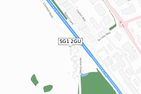
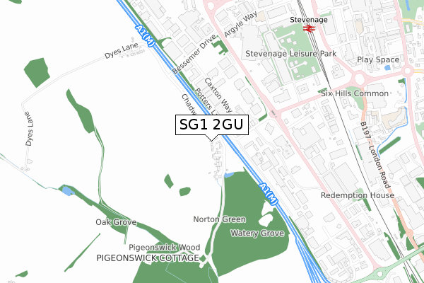
SG1 2GU is located in the Symonds Green electoral ward, within the local authority district of Stevenage and the English Parliamentary constituency of Stevenage. The Sub Integrated Care Board (ICB) Location is NHS Hertfordshire and West Essex ICB - 06K and the police force is Hertfordshire. This postcode has been in use since August 2018.


GetTheData
Source: OS Open Zoomstack (Ordnance Survey)
Licence: Open Government Licence (requires attribution)
Attribution: Contains OS data © Crown copyright and database right 2024
Source: Open Postcode Geo
Licence: Open Government Licence (requires attribution)
Attribution: Contains OS data © Crown copyright and database right 2024; Contains Royal Mail data © Royal Mail copyright and database right 2024; Source: Office for National Statistics licensed under the Open Government Licence v.3.0
| Easting | 522878 |
| Northing | 223424 |
| Latitude | 51.895833 |
| Longitude | -0.215604 |
GetTheData
Source: Open Postcode Geo
Licence: Open Government Licence
| Country | England |
| Postcode District | SG1 |
| ➜ SG1 open data dashboard ➜ See where SG1 is on a map ➜ Where is Stevenage? | |
GetTheData
Source: Land Registry Price Paid Data
Licence: Open Government Licence
| Ward | Symonds Green |
| Constituency | Stevenage |
GetTheData
Source: ONS Postcode Database
Licence: Open Government Licence
10, PIGEONSWICK CLOSE, STEVENAGE, SG1 2GU 2020 15 JAN £527,500 |
7, PIGEONSWICK CLOSE, STEVENAGE, SG1 2GU 2019 18 OCT £449,950 |
9, PIGEONSWICK CLOSE, STEVENAGE, SG1 2GU 2019 11 OCT £438,000 |
8, PIGEONSWICK CLOSE, STEVENAGE, SG1 2GU 2019 2 AUG £397,950 |
GetTheData
Source: HM Land Registry Price Paid Data
Licence: Contains HM Land Registry data © Crown copyright and database right 2024. This data is licensed under the Open Government Licence v3.0.
| June 2022 | Burglary | On or near Pedestrian Subway | 395m |
| June 2022 | Vehicle crime | On or near Pedestrian Subway | 395m |
| June 2022 | Anti-social behaviour | On or near Pedestrian Subway | 395m |
| ➜ Get more crime data in our Crime section | |||
GetTheData
Source: data.police.uk
Licence: Open Government Licence
| Robertson House (Gunnels Wood Road) | Stevenage | 442m |
| Robertson House (Gunnels Wood Road) | Stevenage | 468m |
| Norton Green Road (Gunnels Wood Road) | Stevenage | 475m |
| Norton Green Road (Gunnels Wood Road) | Stevenage | 519m |
| Gunnels Wood Park (Gunnels Wood Road) | Stevenage | 631m |
| Stevenage Station | 0.9km |
| Knebworth Station | 3.8km |
GetTheData
Source: NaPTAN
Licence: Open Government Licence
| Percentage of properties with Next Generation Access | 100.0% |
| Percentage of properties with Superfast Broadband | 100.0% |
| Percentage of properties with Ultrafast Broadband | 0.0% |
| Percentage of properties with Full Fibre Broadband | 0.0% |
Superfast Broadband is between 30Mbps and 300Mbps
Ultrafast Broadband is > 300Mbps
| Percentage of properties unable to receive 2Mbps | 0.0% |
| Percentage of properties unable to receive 5Mbps | 0.0% |
| Percentage of properties unable to receive 10Mbps | 0.0% |
| Percentage of properties unable to receive 30Mbps | 0.0% |
GetTheData
Source: Ofcom
Licence: Ofcom Terms of Use (requires attribution)
GetTheData
Source: ONS Postcode Database
Licence: Open Government Licence


➜ Get more ratings from the Food Standards Agency
GetTheData
Source: Food Standards Agency
Licence: FSA terms & conditions
| Last Collection | |||
|---|---|---|---|
| Location | Mon-Fri | Sat | Distance |
| Potters Lane | 17:30 | 08:45 | 138m |
| Gunnelswood Road | 18:30 | 10:45 | 633m |
| Stevenage Mail Centre | 19:30 | 13:30 | 868m |
GetTheData
Source: Dracos
Licence: Creative Commons Attribution-ShareAlike
| Facility | Distance |
|---|---|
| David Lloyd (Stevenage) Stevenage Leisure Park, Kings Way, Stevenage Swimming Pool, Health and Fitness Gym, Studio | 591m |
| Glaxo Smithkline Stevenage Health and Fitness Gym, Sports Hall, Squash Courts | 869m |
| Stevenage Arts & Leisure Centre Lytton Way, Stevenage Sports Hall, Indoor Bowls, Health and Fitness Gym, Studio, Squash Courts | 976m |
GetTheData
Source: Active Places
Licence: Open Government Licence
| School | Phase of Education | Distance |
|---|---|---|
| North Hertfordshire College Monkswood Way, Stevenage, SG1 1LA | 16 plus | 1.1km |
| Woolenwick Junior School Bridge Road West, Stevenage, SG1 2NU | Primary | 1.5km |
| Woolenwick Infant and Nursery School Bridge Road West, Stevenage, SG1 2NU | Primary | 1.5km |
GetTheData
Source: Edubase
Licence: Open Government Licence
The below table lists the International Territorial Level (ITL) codes (formerly Nomenclature of Territorial Units for Statistics (NUTS) codes) and Local Administrative Units (LAU) codes for SG1 2GU:
| ITL 1 Code | Name |
|---|---|
| TLH | East |
| ITL 2 Code | Name |
| TLH2 | Bedfordshire and Hertfordshire |
| ITL 3 Code | Name |
| TLH23 | Hertfordshire CC |
| LAU 1 Code | Name |
| E07000243 | Stevenage |
GetTheData
Source: ONS Postcode Directory
Licence: Open Government Licence
The below table lists the Census Output Area (OA), Lower Layer Super Output Area (LSOA), and Middle Layer Super Output Area (MSOA) for SG1 2GU:
| Code | Name | |
|---|---|---|
| OA | E00120837 | |
| LSOA | E01023798 | Stevenage 005D |
| MSOA | E02004948 | Stevenage 005 |
GetTheData
Source: ONS Postcode Directory
Licence: Open Government Licence
| SG1 2DS | Chadwell Road | 57m |
| SG1 2DP | Norton Green | 135m |
| SG1 2DF | Caxton Way | 196m |
| SG1 2DG | Aspect One | 419m |
| SG1 2BA | Norton Green Road | 587m |
| SG1 2DL | Bessemer Drive | 602m |
| SG1 2UA | Stevenage Leisure Park | 681m |
| SG1 2DY | Babbage Road | 878m |
| SG1 2EP | Maxwell Road | 913m |
| SG1 1XW | London Road | 941m |
GetTheData
Source: Open Postcode Geo; Land Registry Price Paid Data
Licence: Open Government Licence