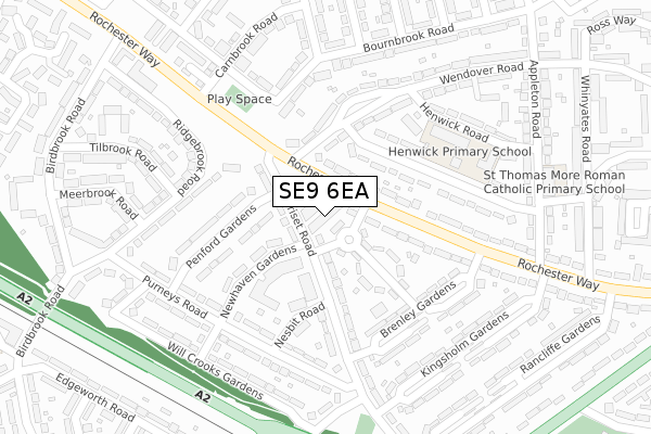
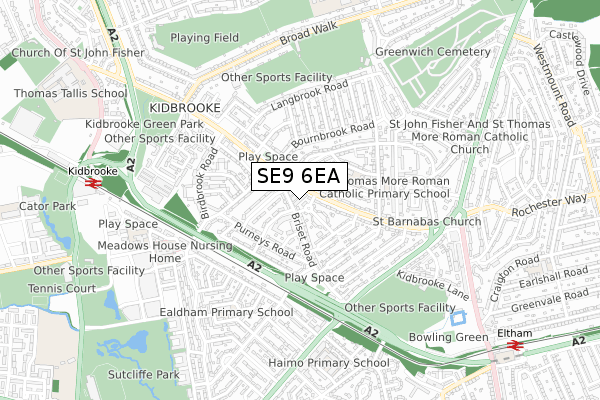
SE9 6EA is located in the Eltham Page electoral ward, within the London borough of Greenwich and the English Parliamentary constituency of Eltham. The Sub Integrated Care Board (ICB) Location is NHS South East London ICB - 72Q and the police force is Metropolitan Police. This postcode has been in use since May 2019.


GetTheData
Source: OS Open Zoomstack (Ordnance Survey)
Licence: Open Government Licence (requires attribution)
Attribution: Contains OS data © Crown copyright and database right 2024
Source: Open Postcode Geo
Licence: Open Government Licence (requires attribution)
Attribution: Contains OS data © Crown copyright and database right 2024; Contains Royal Mail data © Royal Mail copyright and database right 2024; Source: Office for National Statistics licensed under the Open Government Licence v.3.0
| Easting | 541811 |
| Northing | 175569 |
| Latitude | 51.461338 |
| Longitude | 0.039956 |
GetTheData
Source: Open Postcode Geo
Licence: Open Government Licence
| Country | England |
| Postcode District | SE9 |
| ➜ SE9 open data dashboard ➜ See where SE9 is on a map ➜ Where is London? | |
GetTheData
Source: Land Registry Price Paid Data
Licence: Open Government Licence
| Ward | Eltham Page |
| Constituency | Eltham |
GetTheData
Source: ONS Postcode Database
Licence: Open Government Licence
| January 2024 | Violence and sexual offences | On or near Ridgebrook Road | 256m |
| January 2024 | Violence and sexual offences | On or near Ridgebrook Road | 256m |
| December 2023 | Burglary | On or near Brenley Gardens | 199m |
| ➜ Get more crime data in our Crime section | |||
GetTheData
Source: data.police.uk
Licence: Open Government Licence
| Rochester Way Wendover Road (Rochester Way) | Kidbrooke | 68m |
| Rochester Way Wendover Road (Rochester Way) | Kidbrooke | 103m |
| Appleton Road (Rochester Way) | Eltham Park | 305m |
| Appleton Road (Rochester Way) | Eltham Park | 376m |
| Westhorne Avenue Briset Road | Eltham | 461m |
| Kidbrooke Station | 0.9km |
| Eltham Station | 1.1km |
| Blackheath Station | 2.2km |
GetTheData
Source: NaPTAN
Licence: Open Government Licence
| Percentage of properties with Next Generation Access | 100.0% |
| Percentage of properties with Superfast Broadband | 100.0% |
| Percentage of properties with Ultrafast Broadband | 100.0% |
| Percentage of properties with Full Fibre Broadband | 0.0% |
Superfast Broadband is between 30Mbps and 300Mbps
Ultrafast Broadband is > 300Mbps
| Percentage of properties unable to receive 2Mbps | 0.0% |
| Percentage of properties unable to receive 5Mbps | 0.0% |
| Percentage of properties unable to receive 10Mbps | 0.0% |
| Percentage of properties unable to receive 30Mbps | 0.0% |
GetTheData
Source: Ofcom
Licence: Ofcom Terms of Use (requires attribution)
GetTheData
Source: ONS Postcode Database
Licence: Open Government Licence


➜ Get more ratings from the Food Standards Agency
GetTheData
Source: Food Standards Agency
Licence: FSA terms & conditions
| Last Collection | |||
|---|---|---|---|
| Location | Mon-Fri | Sat | Distance |
| Purneys Road | 17:30 | 12:00 | 236m |
| Bournebrook Road | 17:30 | 12:00 | 244m |
| 442 Rochester Way | 17:30 | 12:00 | 342m |
GetTheData
Source: Dracos
Licence: Creative Commons Attribution-ShareAlike
| Facility | Distance |
|---|---|
| Charlton Park Rugby Club Broad Walk, London Grass Pitches, Squash Courts | 556m |
| Blackheath Rfc (Well Hall) Kidbrooke Lane, London Grass Pitches, Artificial Grass Pitch | 632m |
| Shooters Hill Sports Club Mayday Gardens, Kidbrooke, London Grass Pitches | 641m |
GetTheData
Source: Active Places
Licence: Open Government Licence
| School | Phase of Education | Distance |
|---|---|---|
| Newhaven Pupil Referral Unit Newhaven Gardens, Eltham, Greenwich, London, SE9 6HR | Not applicable | 126m |
| Henwick Primary School Henwick Road, Eltham, London, SE9 6NZ | Primary | 233m |
| St Thomas More Catholic Primary School Appleton Road, Eltham, London, SE9 6NS | Primary | 350m |
GetTheData
Source: Edubase
Licence: Open Government Licence
The below table lists the International Territorial Level (ITL) codes (formerly Nomenclature of Territorial Units for Statistics (NUTS) codes) and Local Administrative Units (LAU) codes for SE9 6EA:
| ITL 1 Code | Name |
|---|---|
| TLI | London |
| ITL 2 Code | Name |
| TLI5 | Outer London - East and North East |
| ITL 3 Code | Name |
| TLI51 | Bexley and Greenwich |
| LAU 1 Code | Name |
| E09000011 | Greenwich |
GetTheData
Source: ONS Postcode Directory
Licence: Open Government Licence
The below table lists the Census Output Area (OA), Lower Layer Super Output Area (LSOA), and Middle Layer Super Output Area (MSOA) for SE9 6EA:
| Code | Name | |
|---|---|---|
| OA | E00008064 | |
| LSOA | E01001625 | Greenwich 025E |
| MSOA | E02000337 | Greenwich 025 |
GetTheData
Source: ONS Postcode Directory
Licence: Open Government Licence
| SE9 6HN | Briset Road | 75m |
| SE9 6PG | Rochester Way | 82m |
| SE9 6LG | Lynsted Gardens | 83m |
| SE9 6LQ | Briset Road | 102m |
| SE9 6HR | Newhaven Gardens | 125m |
| SE9 6LH | Rochester Way | 126m |
| SE9 6HP | Penford Gardens | 155m |
| SE9 6NU | Winchcomb Gardens | 160m |
| SE9 6HS | Nesbit Road | 175m |
| SE9 6NX | Winchcomb Gardens | 178m |
GetTheData
Source: Open Postcode Geo; Land Registry Price Paid Data
Licence: Open Government Licence