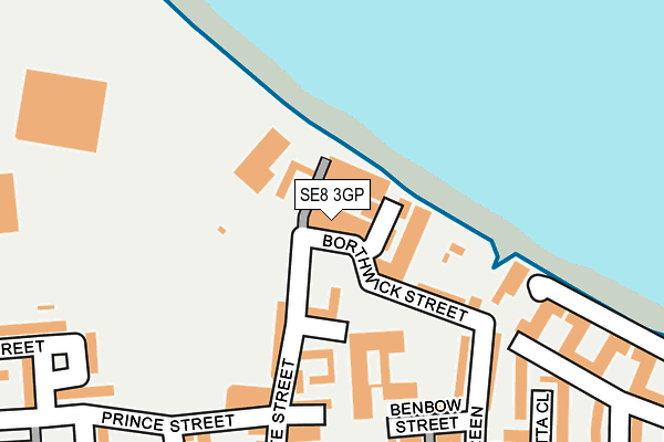
SE8 3GP is located in the Deptford electoral ward, within the London borough of Lewisham and the English Parliamentary constituency of Lewisham, Deptford. The Sub Integrated Care Board (ICB) Location is NHS South East London ICB - 72Q and the police force is Metropolitan Police. This postcode has been in use since July 2017.


GetTheData
Source: OS OpenMap – Local (Ordnance Survey)
Source: OS VectorMap District (Ordnance Survey)
Licence: Open Government Licence (requires attribution)
| Easting | 537576 |
| Northing | 177466 |
| Latitude | 51.479429 |
| Longitude | -0.020228 |
GetTheData
Source: Open Postcode Geo
Licence: Open Government Licence
| Country | England |
| Postcode District | SE8 |
➜ See where SE8 is on a map ➜ Where is Deptford? | |
GetTheData
Source: Land Registry Price Paid Data
Licence: Open Government Licence
| Ward | Deptford |
| Constituency | Lewisham, Deptford |
GetTheData
Source: ONS Postcode Database
Licence: Open Government Licence
| Macmillan Students Village (Creek Road) | Deptford | 193m |
| Macmillan Students Village (Creek Road) | Deptford | 197m |
| Deptford Church Street Creek Road (Deptford Church Street) | Deptford | 200m |
| Wavelengths (Deptford Church Street) | Deptford | 214m |
| Creek Road (Deptford Church Street) | Deptford | 215m |
| Greenwich Dlr Station (Greenwich High Road) | Greenwich | 481m |
| Deptford Bridge Dlr Station (Deptford Bridge) | Deptford Bridge | 600m |
| Cutty Sark (For Maritime Greenwich) Dlr Station (Creek Road) | Greenwich | 702m |
| Island Gardens Dlr Station (Manchester Road) | Island Gardens | 1,167m |
| Elverson Road Dlr Station (Elverson Road) | Elverson Road | 1,178m |
| Deptford Station | 0.4km |
| Greenwich Station | 0.5km |
| New Cross ELL Station | 0.9km |
GetTheData
Source: NaPTAN
Licence: Open Government Licence
| Percentage of properties with Next Generation Access | 100.0% |
| Percentage of properties with Superfast Broadband | 100.0% |
| Percentage of properties with Ultrafast Broadband | 100.0% |
| Percentage of properties with Full Fibre Broadband | 100.0% |
Superfast Broadband is between 30Mbps and 300Mbps
Ultrafast Broadband is > 300Mbps
| Median download speed | 11.6Mbps |
| Average download speed | 11.9Mbps |
| Maximum download speed | 12.92Mbps |
| Median upload speed | 1.1Mbps |
| Average upload speed | 1.0Mbps |
| Maximum upload speed | 1.23Mbps |
| Percentage of properties unable to receive 2Mbps | 0.0% |
| Percentage of properties unable to receive 5Mbps | 0.0% |
| Percentage of properties unable to receive 10Mbps | 0.0% |
| Percentage of properties unable to receive 30Mbps | 0.0% |
GetTheData
Source: Ofcom
Licence: Ofcom Terms of Use (requires attribution)
GetTheData
Source: ONS Postcode Database
Licence: Open Government Licence


➜ Get more ratings from the Food Standards Agency
GetTheData
Source: Food Standards Agency
Licence: FSA terms & conditions
| Last Collection | |||
|---|---|---|---|
| Location | Mon-Fri | Sat | Distance |
| Creekside | 17:30 | 12:00 | 232m |
| Glaisher Street | 17:30 | 12:00 | 249m |
| Banning Street | 17:30 | 12:00 | 374m |
GetTheData
Source: Dracos
Licence: Creative Commons Attribution-ShareAlike
| Risk of SE8 3GP flooding from rivers and sea | Very Low |
| ➜ SE8 3GP flood map | |
GetTheData
Source: Open Flood Risk by Postcode
Licence: Open Government Licence
The below table lists the International Territorial Level (ITL) codes (formerly Nomenclature of Territorial Units for Statistics (NUTS) codes) and Local Administrative Units (LAU) codes for SE8 3GP:
| ITL 1 Code | Name |
|---|---|
| TLI | London |
| ITL 2 Code | Name |
| TLI4 | Inner London - East |
| ITL 3 Code | Name |
| TLI44 | Lewisham and Southwark |
| LAU 1 Code | Name |
| E09000023 | Lewisham |
GetTheData
Source: ONS Postcode Directory
Licence: Open Government Licence
The below table lists the Census Output Area (OA), Lower Layer Super Output Area (LSOA), and Middle Layer Super Output Area (MSOA) for SE8 3GP:
| Code | Name | |
|---|---|---|
| OA | E00165804 | |
| LSOA | E01032579 | Lewisham 039E |
| MSOA | E02006798 | Lewisham 039 |
GetTheData
Source: ONS Postcode Directory
Licence: Open Government Licence
| SE8 3DZ | Creekside | 43m |
| SE8 3DU | Bronze Street | 87m |
| SE8 3FB | Little Thames Walk | 127m |
| SE8 3EB | Berthon Street | 139m |
| SE8 3DT | Bronze Street | 150m |
| SE8 3FE | Harmony Place | 161m |
| SE8 3DY | Deptford Church Street | 162m |
| SE8 3BP | Bruford Court | 165m |
| SE8 3BN | Creek Road | 169m |
| SE8 3FG | Dancers Way | 179m |
GetTheData
Source: Open Postcode Geo; Land Registry Price Paid Data
Licence: Open Government Licence