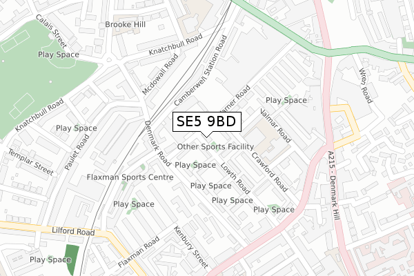
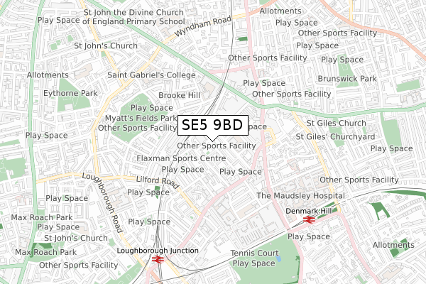
SE5 9BD is located in the Camberwell Green electoral ward, within the London borough of Southwark and the English Parliamentary constituency of Camberwell and Peckham. The Sub Integrated Care Board (ICB) Location is NHS South East London ICB - 72Q and the police force is Metropolitan Police. This postcode has been in use since May 2018.


GetTheData
Source: OS Open Zoomstack (Ordnance Survey)
Licence: Open Government Licence (requires attribution)
Attribution: Contains OS data © Crown copyright and database right 2024
Source: Open Postcode Geo
Licence: Open Government Licence (requires attribution)
Attribution: Contains OS data © Crown copyright and database right 2024; Contains Royal Mail data © Royal Mail copyright and database right 2024; Source: Office for National Statistics licensed under the Open Government Licence v.3.0
| Easting | 532243 |
| Northing | 176532 |
| Latitude | 51.472307 |
| Longitude | -0.097328 |
GetTheData
Source: Open Postcode Geo
Licence: Open Government Licence
| Country | England |
| Postcode District | SE5 |
| ➜ SE5 open data dashboard ➜ See where SE5 is on a map ➜ Where is Camberwell? | |
GetTheData
Source: Land Registry Price Paid Data
Licence: Open Government Licence
| Ward | Camberwell Green |
| Constituency | Camberwell And Peckham |
GetTheData
Source: ONS Postcode Database
Licence: Open Government Licence
| January 2024 | Anti-social behaviour | On or near Welby Street | 326m |
| January 2024 | Anti-social behaviour | On or near Wren Road | 407m |
| January 2024 | Anti-social behaviour | On or near Wren Road | 407m |
| ➜ Get more crime data in our Crime section | |||
GetTheData
Source: data.police.uk
Licence: Open Government Licence
| Valmar Road | Camberwell | 261m |
| Valmar Road | Camberwell | 271m |
| Caldecot Road (Coldharbour Lane) | Camberwell | 275m |
| Caldecot Road (Coldharbour Lane) | Camberwell | 287m |
| Denmark Hill Camberwell Green (Denmark Hill) | Camberwell | 295m |
| Oval Underground Station | Oval | 1,492m |
| Brixton Underground Station | Brixton | 1,627m |
| Denmark Hill Station | 0.7km |
| Loughborough Junction Station | 0.7km |
| Brixton Station | 1.5km |
GetTheData
Source: NaPTAN
Licence: Open Government Licence
| Percentage of properties with Next Generation Access | 100.0% |
| Percentage of properties with Superfast Broadband | 100.0% |
| Percentage of properties with Ultrafast Broadband | 0.0% |
| Percentage of properties with Full Fibre Broadband | 0.0% |
Superfast Broadband is between 30Mbps and 300Mbps
Ultrafast Broadband is > 300Mbps
| Percentage of properties unable to receive 2Mbps | 0.0% |
| Percentage of properties unable to receive 5Mbps | 0.0% |
| Percentage of properties unable to receive 10Mbps | 0.0% |
| Percentage of properties unable to receive 30Mbps | 0.0% |
GetTheData
Source: Ofcom
Licence: Ofcom Terms of Use (requires attribution)
GetTheData
Source: ONS Postcode Database
Licence: Open Government Licence


➜ Get more ratings from the Food Standards Agency
GetTheData
Source: Food Standards Agency
Licence: FSA terms & conditions
| Last Collection | |||
|---|---|---|---|
| Location | Mon-Fri | Sat | Distance |
| Crawford Road | 17:30 | 12:00 | 81m |
| Post Office S E 5 9 J H | 17:30 | 12:00 | 188m |
| 8a Coldharbour Lane | 17:30 | 12:00 | 253m |
GetTheData
Source: Dracos
Licence: Creative Commons Attribution-ShareAlike
| Facility | Distance |
|---|---|
| Flaxman Sports Centre Carew Street, London Sports Hall, Health and Fitness Gym, Squash Courts | 180m |
| Easygym (Camberwell) Denmark Hill, Denmark Hill, London Health and Fitness Gym | 269m |
| Harry Caddick Community Hall Lilford Road, London Sports Hall | 309m |
GetTheData
Source: Active Places
Licence: Open Government Licence
| School | Phase of Education | Distance |
|---|---|---|
| Crawford Primary School Crawford Road, London, SE5 9NF | Primary | 119m |
| Sacred Heart Catholic School Camberwell New Road, London, SE5 0RP | Secondary | 315m |
| Maudsley and Bethlem Hospital School 1st Floor, Mapother House, Maudsley Hospital, De Crespigny Park, Camberwell, London, SE5 8AZ | Not applicable | 510m |
GetTheData
Source: Edubase
Licence: Open Government Licence
The below table lists the International Territorial Level (ITL) codes (formerly Nomenclature of Territorial Units for Statistics (NUTS) codes) and Local Administrative Units (LAU) codes for SE5 9BD:
| ITL 1 Code | Name |
|---|---|
| TLI | London |
| ITL 2 Code | Name |
| TLI4 | Inner London - East |
| ITL 3 Code | Name |
| TLI44 | Lewisham and Southwark |
| LAU 1 Code | Name |
| E09000028 | Southwark |
GetTheData
Source: ONS Postcode Directory
Licence: Open Government Licence
The below table lists the Census Output Area (OA), Lower Layer Super Output Area (LSOA), and Middle Layer Super Output Area (MSOA) for SE5 9BD:
| Code | Name | |
|---|---|---|
| OA | E00019748 | |
| LSOA | E01003922 | Southwark 021D |
| MSOA | E02000827 | Southwark 021 |
GetTheData
Source: ONS Postcode Directory
Licence: Open Government Licence
| SE5 9EX | Lowth Road | 41m |
| SE5 9NN | Crawford Estate | 43m |
| SE5 9NL | Crawford Estate | 56m |
| SE5 9HQ | Warner Road | 59m |
| SE5 9EU | Warner Road | 66m |
| SE5 9EY | Denmark Road | 73m |
| SE5 9HE | Crawford Estate | 79m |
| SE5 9HG | Crawford Estate | 102m |
| SE5 9NE | Warner Road | 105m |
| SE5 9HA | Lowth Road | 122m |
GetTheData
Source: Open Postcode Geo; Land Registry Price Paid Data
Licence: Open Government Licence