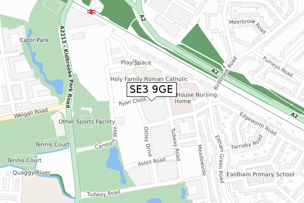
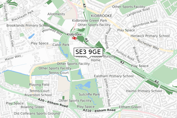
SE3 9GE is located in the Kidbrooke Village & Sutcliffe electoral ward, within the London borough of Greenwich and the English Parliamentary constituency of Eltham. The Sub Integrated Care Board (ICB) Location is NHS South East London ICB - 72Q and the police force is Metropolitan Police. This postcode has been in use since April 2018.


GetTheData
Source: OS Open Zoomstack (Ordnance Survey)
Licence: Open Government Licence (requires attribution)
Attribution: Contains OS data © Crown copyright and database right 2025
Source: Open Postcode Geo
Licence: Open Government Licence (requires attribution)
Attribution: Contains OS data © Crown copyright and database right 2025; Contains Royal Mail data © Royal Mail copyright and database right 2025; Source: Office for National Statistics licensed under the Open Government Licence v.3.0
| Easting | 541147 |
| Northing | 175342 |
| Latitude | 51.459464 |
| Longitude | 0.030314 |
GetTheData
Source: Open Postcode Geo
Licence: Open Government Licence
| Country | England |
| Postcode District | SE3 |
➜ See where SE3 is on a map ➜ Where is London? | |
GetTheData
Source: Land Registry Price Paid Data
Licence: Open Government Licence
| Ward | Kidbrooke Village & Sutcliffe |
| Constituency | Eltham |
GetTheData
Source: ONS Postcode Database
Licence: Open Government Licence
| Ryan Close | Kidbrooke | 64m |
| Kidbrooke Station Tudway Road | Kidbrooke | 104m |
| Ryan Close | Kidbrooke | 113m |
| Kidbrooke Park Road | Kidbrooke | 290m |
| Kidbrooke Health Centre (Kidbrooke Park Road) | Kidbrooke | 298m |
| Kidbrooke Station | 0.4km |
| Lee Station | 1.6km |
| Eltham Station | 1.6km |
GetTheData
Source: NaPTAN
Licence: Open Government Licence
| Percentage of properties with Next Generation Access | 100.0% |
| Percentage of properties with Superfast Broadband | 100.0% |
| Percentage of properties with Ultrafast Broadband | 100.0% |
| Percentage of properties with Full Fibre Broadband | 100.0% |
Superfast Broadband is between 30Mbps and 300Mbps
Ultrafast Broadband is > 300Mbps
| Percentage of properties unable to receive 2Mbps | 0.0% |
| Percentage of properties unable to receive 5Mbps | 0.0% |
| Percentage of properties unable to receive 10Mbps | 0.0% |
| Percentage of properties unable to receive 30Mbps | 0.0% |
GetTheData
Source: Ofcom
Licence: Ofcom Terms of Use (requires attribution)
GetTheData
Source: ONS Postcode Database
Licence: Open Government Licence


➜ Get more ratings from the Food Standards Agency
GetTheData
Source: Food Standards Agency
Licence: FSA terms & conditions
| Last Collection | |||
|---|---|---|---|
| Location | Mon-Fri | Sat | Distance |
| Kidbrooke Park Road | 17:30 | 12:00 | 329m |
| Birdbrook Road | 17:30 | 12:00 | 429m |
| Purneys Road | 17:30 | 12:00 | 508m |
GetTheData
Source: Dracos
Licence: Creative Commons Attribution-ShareAlike
The below table lists the International Territorial Level (ITL) codes (formerly Nomenclature of Territorial Units for Statistics (NUTS) codes) and Local Administrative Units (LAU) codes for SE3 9GE:
| ITL 1 Code | Name |
|---|---|
| TLI | London |
| ITL 2 Code | Name |
| TLI5 | Outer London - East and North East |
| ITL 3 Code | Name |
| TLI51 | Bexley and Greenwich |
| LAU 1 Code | Name |
| E09000011 | Greenwich |
GetTheData
Source: ONS Postcode Directory
Licence: Open Government Licence
The below table lists the Census Output Area (OA), Lower Layer Super Output Area (LSOA), and Middle Layer Super Output Area (MSOA) for SE3 9GE:
| Code | Name | |
|---|---|---|
| OA | E00176484 | |
| LSOA | E01033726 | Greenwich 034E |
| MSOA | E02006927 | Greenwich 034 |
GetTheData
Source: ONS Postcode Directory
Licence: Open Government Licence
| SE3 9YG | Tudway Road | 128m |
| SE3 9FT | Ottley Drive | 136m |
| SE3 9SD | Boyd Way | 145m |
| SE3 9FR | Tudway Road | 148m |
| SE9 6BD | Meadowside | 174m |
| SE3 9FB | Astell Road | 219m |
| SE3 9FL | Tudway Road | 223m |
| SE9 6BE | Eltham Green Road | 237m |
| SE3 9FN | Astell Road | 246m |
| SE3 9FJ | Ottley Drive | 246m |
GetTheData
Source: Open Postcode Geo; Land Registry Price Paid Data
Licence: Open Government Licence