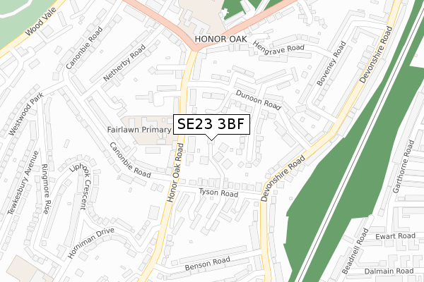
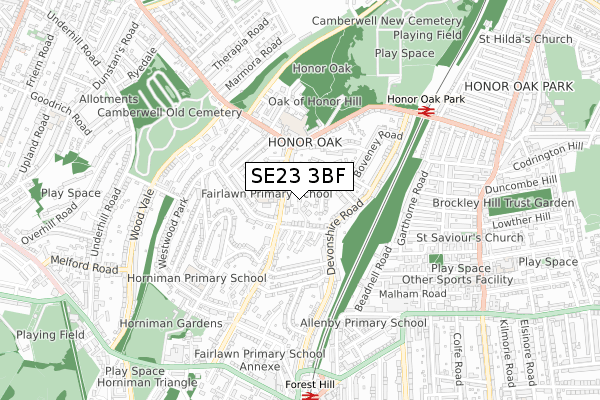
SE23 3BF is located in the Forest Hill electoral ward, within the London borough of Lewisham and the English Parliamentary constituency of Lewisham West and Penge. The Sub Integrated Care Board (ICB) Location is NHS South East London ICB - 72Q and the police force is Metropolitan Police. This postcode has been in use since October 2018.


GetTheData
Source: OS Open Zoomstack (Ordnance Survey)
Licence: Open Government Licence (requires attribution)
Attribution: Contains OS data © Crown copyright and database right 2024
Source: Open Postcode Geo
Licence: Open Government Licence (requires attribution)
Attribution: Contains OS data © Crown copyright and database right 2024; Contains Royal Mail data © Royal Mail copyright and database right 2024; Source: Office for National Statistics licensed under the Open Government Licence v.3.0
| Easting | 535373 |
| Northing | 173762 |
| Latitude | 51.446674 |
| Longitude | -0.053349 |
GetTheData
Source: Open Postcode Geo
Licence: Open Government Licence
| Country | England |
| Postcode District | SE23 |
| ➜ SE23 open data dashboard ➜ See where SE23 is on a map ➜ Where is London? | |
GetTheData
Source: Land Registry Price Paid Data
Licence: Open Government Licence
| Ward | Forest Hill |
| Constituency | Lewisham West And Penge |
GetTheData
Source: ONS Postcode Database
Licence: Open Government Licence
| December 2023 | Violence and sexual offences | On or near Honor Oak Road | 292m |
| October 2023 | Vehicle crime | On or near Honor Oak Road | 292m |
| July 2023 | Violence and sexual offences | On or near Honor Oak Road | 292m |
| ➜ Get more crime data in our Crime section | |||
GetTheData
Source: data.police.uk
Licence: Open Government Licence
| Fairlawn School (Honor Oak Road) | Forest Hill | 80m |
| Fairlawn School (Honor Oak Road) | Forest Hill | 85m |
| Horniman Drive (Honor Oak Road) | Forest Hill | 257m |
| Horniman Drive (Honor Oak Road) | Forest Hill | 263m |
| Hengrave Road (Honor Oak Park) | Honor Oak Park | 290m |
| Honor Oak Park Station | 0.7km |
| Forest Hill Station | 0.8km |
| Crofton Park Station | 1.5km |
GetTheData
Source: NaPTAN
Licence: Open Government Licence
| Percentage of properties with Next Generation Access | 100.0% |
| Percentage of properties with Superfast Broadband | 100.0% |
| Percentage of properties with Ultrafast Broadband | 100.0% |
| Percentage of properties with Full Fibre Broadband | 100.0% |
Superfast Broadband is between 30Mbps and 300Mbps
Ultrafast Broadband is > 300Mbps
| Percentage of properties unable to receive 2Mbps | 0.0% |
| Percentage of properties unable to receive 5Mbps | 0.0% |
| Percentage of properties unable to receive 10Mbps | 0.0% |
| Percentage of properties unable to receive 30Mbps | 0.0% |
GetTheData
Source: Ofcom
Licence: Ofcom Terms of Use (requires attribution)
GetTheData
Source: ONS Postcode Database
Licence: Open Government Licence


➜ Get more ratings from the Food Standards Agency
GetTheData
Source: Food Standards Agency
Licence: FSA terms & conditions
| Last Collection | |||
|---|---|---|---|
| Location | Mon-Fri | Sat | Distance |
| Tyson Road | 17:30 | 12:00 | 128m |
| Hengrave Road | 17:30 | 12:00 | 239m |
| 202 Devonshire Road | 17:30 | 12:00 | 279m |
GetTheData
Source: Dracos
Licence: Creative Commons Attribution-ShareAlike
| Facility | Distance |
|---|---|
| Honor Oak Sports Ground Honor Oak Park, London Grass Pitches, Outdoor Tennis Courts | 551m |
| Xcelerate Gym Forest Hill Sunderland Road, London Health and Fitness Gym | 669m |
| Aquarius Golf Club Marmora Road, London Golf | 681m |
GetTheData
Source: Active Places
Licence: Open Government Licence
| School | Phase of Education | Distance |
|---|---|---|
| Fairlawn Primary School Honor Oak Road, London, SE23 3SB | Primary | 96m |
| Horniman Primary School Horniman Drive, London, SE23 3BP | Primary | 516m |
| Allenby Tutorial Trust 62-72 Dalmain Road, London, SE23 1AT | Not applicable | 583m |
GetTheData
Source: Edubase
Licence: Open Government Licence
The below table lists the International Territorial Level (ITL) codes (formerly Nomenclature of Territorial Units for Statistics (NUTS) codes) and Local Administrative Units (LAU) codes for SE23 3BF:
| ITL 1 Code | Name |
|---|---|
| TLI | London |
| ITL 2 Code | Name |
| TLI4 | Inner London - East |
| ITL 3 Code | Name |
| TLI44 | Lewisham and Southwark |
| LAU 1 Code | Name |
| E09000023 | Lewisham |
GetTheData
Source: ONS Postcode Directory
Licence: Open Government Licence
The below table lists the Census Output Area (OA), Lower Layer Super Output Area (LSOA), and Middle Layer Super Output Area (MSOA) for SE23 3BF:
| Code | Name | |
|---|---|---|
| OA | E00016486 | |
| LSOA | E01003261 | Lewisham 021D |
| MSOA | E02000673 | Lewisham 021 |
GetTheData
Source: ONS Postcode Directory
Licence: Open Government Licence
| SE23 3SH | Honor Oak Road | 48m |
| SE23 3QP | Montgomerie Mews | 61m |
| SE23 3SJ | Honor Oak Road | 76m |
| SE23 3SB | Honor Oak Road | 96m |
| SE23 3TE | Fairlie Gardens | 110m |
| SE23 3AA | Tyson Road | 112m |
| SE23 3TD | Dunoon Road | 140m |
| SE23 3AT | Manor Way | 144m |
| SE23 3AD | Shirburn Close | 151m |
| SE23 3NB | Devonshire Road | 157m |
GetTheData
Source: Open Postcode Geo; Land Registry Price Paid Data
Licence: Open Government Licence