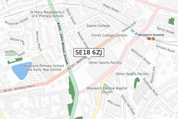
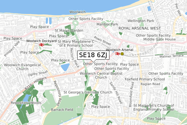
SE18 6ZJ is located in the Woolwich Arsenal electoral ward, within the London borough of Greenwich and the English Parliamentary constituency of Greenwich and Woolwich. The Sub Integrated Care Board (ICB) Location is NHS South East London ICB - 72Q and the police force is Metropolitan Police. This postcode has been in use since January 2020.


GetTheData
Source: OS Open Zoomstack (Ordnance Survey)
Licence: Open Government Licence (requires attribution)
Attribution: Contains OS data © Crown copyright and database right 2024
Source: Open Postcode Geo
Licence: Open Government Licence (requires attribution)
Attribution: Contains OS data © Crown copyright and database right 2024; Contains Royal Mail data © Royal Mail copyright and database right 2024; Source: Office for National Statistics licensed under the Open Government Licence v.3.0
| Easting | 543428 |
| Northing | 178680 |
| Latitude | 51.488885 |
| Longitude | 0.064479 |
GetTheData
Source: Open Postcode Geo
Licence: Open Government Licence
| Country | England |
| Postcode District | SE18 |
| ➜ SE18 open data dashboard ➜ See where SE18 is on a map ➜ Where is Woolwich? | |
GetTheData
Source: Land Registry Price Paid Data
Licence: Open Government Licence
| Ward | Woolwich Arsenal |
| Constituency | Greenwich And Woolwich |
GetTheData
Source: ONS Postcode Database
Licence: Open Government Licence
| January 2024 | Burglary | On or near Jim Bradley Close | 110m |
| January 2024 | Drugs | On or near Parking Area | 295m |
| January 2024 | Drugs | On or near Parking Area | 295m |
| ➜ Get more crime data in our Crime section | |||
GetTheData
Source: data.police.uk
Licence: Open Government Licence
| The Woolwich Centre | Woolwich | 33m |
| Woolwich Town Hall Centre | Woolwich | 127m |
| Woolwich Arsenal (Woolwich New Road) | Woolwich | 193m |
| Woolwich Arsenal | Woolwich | 221m |
| Monk Street Calderwood Street (Monk Street) | Woolwich | 222m |
| Woolwich Arsenal Dlr Station (Woolwich New Road) | Woolwich | 348m |
| King George V Dlr Station (Rymill Street) | Silvertown | 1,465m |
| Woolwich Arsenal Station | 0.3km |
| Woolwich Dockyard Station | 0.7km |
| Plumstead Station | 1.4km |
GetTheData
Source: NaPTAN
Licence: Open Government Licence
GetTheData
Source: ONS Postcode Database
Licence: Open Government Licence


➜ Get more ratings from the Food Standards Agency
GetTheData
Source: Food Standards Agency
Licence: FSA terms & conditions
| Last Collection | |||
|---|---|---|---|
| Location | Mon-Fri | Sat | Distance |
| Wellington Street | 17:30 | 12:00 | 64m |
| Calderwood Street | 17:30 | 12:00 | 244m |
| Brookhill Road | 17:30 | 12:00 | 280m |
GetTheData
Source: Dracos
Licence: Creative Commons Attribution-ShareAlike
| Facility | Distance |
|---|---|
| Anytime Fitness (London Woolwich) Love Lane, Love Lane, London Health and Fitness Gym | 105m |
| Mulgrave Primary School Rectory Place, Rectory Place, London Artificial Grass Pitch | 260m |
| Better Gym (Woolwich) (Closed) Macbean Street, London Health and Fitness Gym | 443m |
GetTheData
Source: Active Places
Licence: Open Government Licence
| School | Phase of Education | Distance |
|---|---|---|
| Greenwich Engineering and Medical School 31 Thomas Street, Woolwich, SE18 6HU | Not applicable | 231m |
| Mulgrave Primary School Rectory Place, Woolwich, London, SE18 5DL | Primary | 244m |
| Saint Mary Magdalene Church of England All Through School Kingsman Street, London, SE18 5PW | All-through | 347m |
GetTheData
Source: Edubase
Licence: Open Government Licence
The below table lists the International Territorial Level (ITL) codes (formerly Nomenclature of Territorial Units for Statistics (NUTS) codes) and Local Administrative Units (LAU) codes for SE18 6ZJ:
| ITL 1 Code | Name |
|---|---|
| TLI | London |
| ITL 2 Code | Name |
| TLI5 | Outer London - East and North East |
| ITL 3 Code | Name |
| TLI51 | Bexley and Greenwich |
| LAU 1 Code | Name |
| E09000011 | Greenwich |
GetTheData
Source: ONS Postcode Directory
Licence: Open Government Licence
The below table lists the Census Output Area (OA), Lower Layer Super Output Area (LSOA), and Middle Layer Super Output Area (MSOA) for SE18 6ZJ:
| Code | Name | |
|---|---|---|
| OA | E00008450 | |
| LSOA | E01001696 | Greenwich 011B |
| MSOA | E02000323 | Greenwich 011 |
GetTheData
Source: ONS Postcode Directory
Licence: Open Government Licence
| SE18 6GW | Love Lane | 67m |
| SE18 6HW | Love Lane | 71m |
| SE18 6QB | Wellington Street | 89m |
| SE18 6GY | Love Lane | 89m |
| SE18 6JN | Love Lane | 98m |
| SE18 6GS | Love Lane | 110m |
| SE18 6QR | Market Street | 120m |
| SE18 6QA | Jim Bradley Close | 126m |
| SE18 6GQ | Love Lane | 127m |
| SE18 6GU | Love Lane | 129m |
GetTheData
Source: Open Postcode Geo; Land Registry Price Paid Data
Licence: Open Government Licence