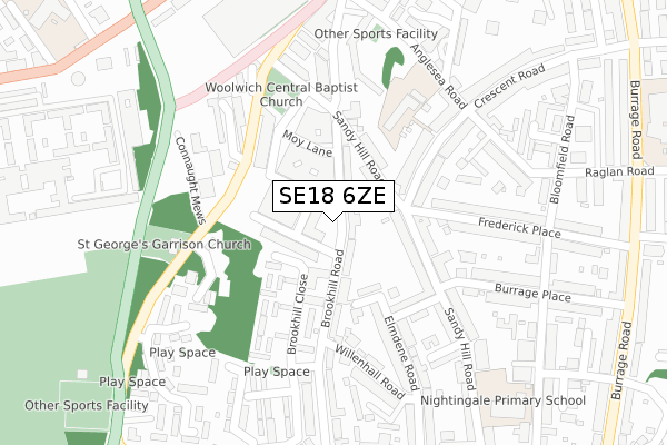
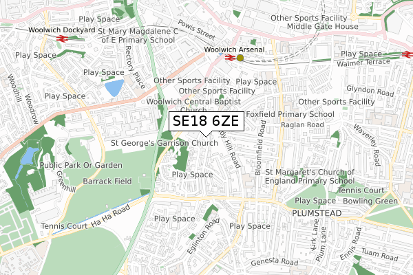
SE18 6ZE is located in the Woolwich Common electoral ward, within the London borough of Greenwich and the English Parliamentary constituency of Greenwich and Woolwich. The Sub Integrated Care Board (ICB) Location is NHS South East London ICB - 72Q and the police force is Metropolitan Police. This postcode has been in use since March 2019.


GetTheData
Source: OS Open Zoomstack (Ordnance Survey)
Licence: Open Government Licence (requires attribution)
Attribution: Contains OS data © Crown copyright and database right 2024
Source: Open Postcode Geo
Licence: Open Government Licence (requires attribution)
Attribution: Contains OS data © Crown copyright and database right 2024; Contains Royal Mail data © Royal Mail copyright and database right 2024; Source: Office for National Statistics licensed under the Open Government Licence v.3.0
| Easting | 543607 |
| Northing | 178314 |
| Latitude | 51.485551 |
| Longitude | 0.066906 |
GetTheData
Source: Open Postcode Geo
Licence: Open Government Licence
| Country | England |
| Postcode District | SE18 |
| ➜ SE18 open data dashboard ➜ See where SE18 is on a map ➜ Where is Woolwich? | |
GetTheData
Source: Land Registry Price Paid Data
Licence: Open Government Licence
| Ward | Woolwich Common |
| Constituency | Greenwich And Woolwich |
GetTheData
Source: ONS Postcode Database
Licence: Open Government Licence
| January 2024 | Burglary | On or near Peace Street | 456m |
| December 2023 | Anti-social behaviour | On or near Peace Street | 456m |
| December 2023 | Public order | On or near Peace Street | 456m |
| ➜ Get more crime data in our Crime section | |||
GetTheData
Source: data.police.uk
Licence: Open Government Licence
| Frederick Place (Sandy Hill Road) | Woolwich | 119m |
| Claydown Mews (Woolwich New Road) | Woolwich | 156m |
| Brookhill Road Connaught Estate (Sandy Hill Road) | Woolwich | 189m |
| Naafi Messing Store (Grand Depot Road) | Woolwich | 288m |
| Gunner Lane (Woolwich New Road) | Woolwich | 320m |
| Woolwich Arsenal Dlr Station (Woolwich New Road) | Woolwich | 520m |
| Woolwich Arsenal Station | 0.5km |
| Woolwich Dockyard Station | 1.1km |
| Plumstead Station | 1.3km |
GetTheData
Source: NaPTAN
Licence: Open Government Licence
GetTheData
Source: ONS Postcode Database
Licence: Open Government Licence


➜ Get more ratings from the Food Standards Agency
GetTheData
Source: Food Standards Agency
Licence: FSA terms & conditions
| Last Collection | |||
|---|---|---|---|
| Location | Mon-Fri | Sat | Distance |
| Brookhill Road | 17:30 | 12:00 | 151m |
| Conduit Road | 17:30 | 12:00 | 260m |
| Burrage Road | 17:30 | 12:00 | 336m |
GetTheData
Source: Dracos
Licence: Creative Commons Attribution-ShareAlike
| Facility | Distance |
|---|---|
| Anytime Fitness (London Woolwich) Love Lane, Love Lane, London Health and Fitness Gym | 408m |
| Royal Artillery Barracks Woolwich, London Health and Fitness Gym, Grass Pitches, Squash Courts, Outdoor Tennis Courts | 499m |
| Mulgrave Primary School Rectory Place, Rectory Place, London Artificial Grass Pitch | 541m |
GetTheData
Source: Active Places
Licence: Open Government Licence
| School | Phase of Education | Distance |
|---|---|---|
| St Peter's Catholic Primary School Crescent Road, London, SE18 7BN | Primary | 214m |
| Nightingale Primary School Bloomfield Road, Woolwich, London, SE18 7JJ | Primary | 381m |
| Notre Dame Catholic Primary School 169 Eglinton Road, London, SE18 3SJ | Primary | 494m |
GetTheData
Source: Edubase
Licence: Open Government Licence
The below table lists the International Territorial Level (ITL) codes (formerly Nomenclature of Territorial Units for Statistics (NUTS) codes) and Local Administrative Units (LAU) codes for SE18 6ZE:
| ITL 1 Code | Name |
|---|---|
| TLI | London |
| ITL 2 Code | Name |
| TLI5 | Outer London - East and North East |
| ITL 3 Code | Name |
| TLI51 | Bexley and Greenwich |
| LAU 1 Code | Name |
| E09000011 | Greenwich |
GetTheData
Source: ONS Postcode Directory
Licence: Open Government Licence
The below table lists the Census Output Area (OA), Lower Layer Super Output Area (LSOA), and Middle Layer Super Output Area (MSOA) for SE18 6ZE:
| Code | Name | |
|---|---|---|
| OA | E00008463 | |
| LSOA | E01001696 | Greenwich 011B |
| MSOA | E02000323 | Greenwich 011 |
GetTheData
Source: ONS Postcode Directory
Licence: Open Government Licence
| SE18 6TU | Brookhill Road | 86m |
| SE18 6TT | Brookhill Road | 87m |
| SE18 6UA | Elmdene Road | 111m |
| SE18 6UZ | Brookhill Road | 117m |
| SE18 6SA | Sandy Hill Road | 121m |
| SE18 7BQ | Sandy Hill Road | 144m |
| SE18 7AZ | Sandy Hill Road | 152m |
| SE18 6SB | Bignell Road | 162m |
| SE18 6XL | Fountain Close | 166m |
| SE18 6UD | Brookhill Close | 180m |
GetTheData
Source: Open Postcode Geo; Land Registry Price Paid Data
Licence: Open Government Licence