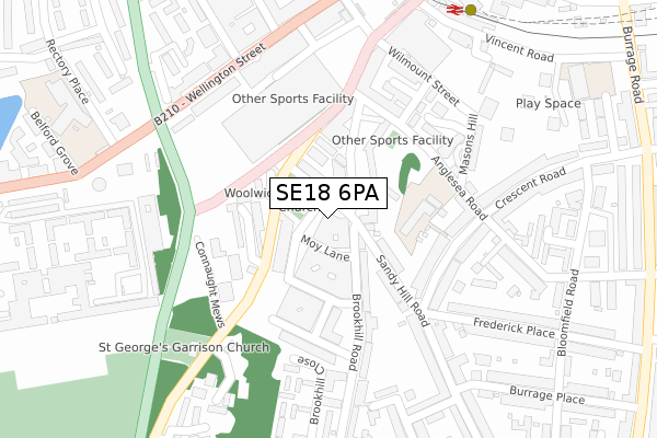
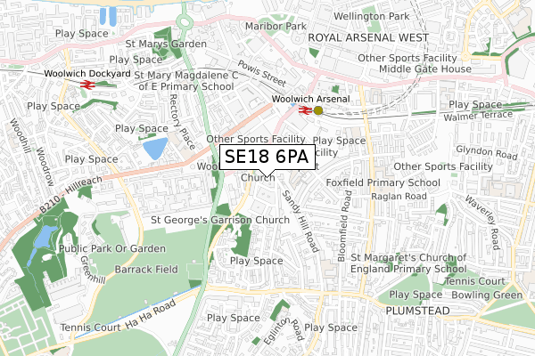
SE18 6PA is located in the Woolwich Common electoral ward, within the London borough of Greenwich and the English Parliamentary constituency of Greenwich and Woolwich. The Sub Integrated Care Board (ICB) Location is NHS South East London ICB - 72Q and the police force is Metropolitan Police. This postcode has been in use since August 2017.


GetTheData
Source: OS Open Zoomstack (Ordnance Survey)
Licence: Open Government Licence (requires attribution)
Attribution: Contains OS data © Crown copyright and database right 2024
Source: Open Postcode Geo
Licence: Open Government Licence (requires attribution)
Attribution: Contains OS data © Crown copyright and database right 2024; Contains Royal Mail data © Royal Mail copyright and database right 2024; Source: Office for National Statistics licensed under the Open Government Licence v.3.0
| Easting | 543574 |
| Northing | 178479 |
| Latitude | 51.487042 |
| Longitude | 0.066498 |
GetTheData
Source: Open Postcode Geo
Licence: Open Government Licence
| Country | England |
| Postcode District | SE18 |
| ➜ SE18 open data dashboard ➜ See where SE18 is on a map ➜ Where is Woolwich? | |
GetTheData
Source: Land Registry Price Paid Data
Licence: Open Government Licence
| Ward | Woolwich Common |
| Constituency | Greenwich And Woolwich |
GetTheData
Source: ONS Postcode Database
Licence: Open Government Licence
| January 2024 | Burglary | On or near Jim Bradley Close | 355m |
| December 2023 | Violence and sexual offences | On or near Jim Bradley Close | 355m |
| December 2023 | Violence and sexual offences | On or near Jim Bradley Close | 355m |
| ➜ Get more crime data in our Crime section | |||
GetTheData
Source: data.police.uk
Licence: Open Government Licence
| Brookhill Road Connaught Estate (Sandy Hill Road) | Woolwich | 23m |
| Claydown Mews (Woolwich New Road) | Woolwich | 113m |
| Woolwich Arsenal (Woolwich New Road) | Woolwich | 239m |
| Frederick Place (Sandy Hill Road) | Woolwich | 246m |
| Naafi Messing Store (Grand Depot Road) | Woolwich | 271m |
| Woolwich Arsenal Dlr Station (Woolwich New Road) | Woolwich | 378m |
| Woolwich Arsenal Station | 0.4km |
| Woolwich Dockyard Station | 0.9km |
| Plumstead Station | 1.3km |
GetTheData
Source: NaPTAN
Licence: Open Government Licence
➜ Broadband speed and availability dashboard for SE18 6PA
| Percentage of properties with Next Generation Access | 100.0% |
| Percentage of properties with Superfast Broadband | 100.0% |
| Percentage of properties with Ultrafast Broadband | 100.0% |
| Percentage of properties with Full Fibre Broadband | 0.0% |
Superfast Broadband is between 30Mbps and 300Mbps
Ultrafast Broadband is > 300Mbps
| Median download speed | 67.1Mbps |
| Average download speed | 76.6Mbps |
| Maximum download speed | 350.00Mbps |
| Median upload speed | 15.1Mbps |
| Average upload speed | 12.6Mbps |
| Maximum upload speed | 20.00Mbps |
| Percentage of properties unable to receive 2Mbps | 0.0% |
| Percentage of properties unable to receive 5Mbps | 0.0% |
| Percentage of properties unable to receive 10Mbps | 0.0% |
| Percentage of properties unable to receive 30Mbps | 0.0% |
➜ Broadband speed and availability dashboard for SE18 6PA
GetTheData
Source: Ofcom
Licence: Ofcom Terms of Use (requires attribution)
GetTheData
Source: ONS Postcode Database
Licence: Open Government Licence


➜ Get more ratings from the Food Standards Agency
GetTheData
Source: Food Standards Agency
Licence: FSA terms & conditions
| Last Collection | |||
|---|---|---|---|
| Location | Mon-Fri | Sat | Distance |
| Brookhill Road | 17:30 | 12:00 | 37m |
| Conduit Road | 17:30 | 12:00 | 233m |
| Wellington Street | 17:30 | 12:00 | 285m |
GetTheData
Source: Dracos
Licence: Creative Commons Attribution-ShareAlike
| Facility | Distance |
|---|---|
| Anytime Fitness (London Woolwich) Love Lane, Love Lane, London Health and Fitness Gym | 240m |
| Mulgrave Primary School Rectory Place, Rectory Place, London Artificial Grass Pitch | 432m |
| Royal Artillery Barracks Woolwich, London Health and Fitness Gym, Grass Pitches, Squash Courts, Outdoor Tennis Courts | 545m |
GetTheData
Source: Active Places
Licence: Open Government Licence
| School | Phase of Education | Distance |
|---|---|---|
| St Peter's Catholic Primary School Crescent Road, London, SE18 7BN | Primary | 154m |
| Mulgrave Primary School Rectory Place, Woolwich, London, SE18 5DL | Primary | 422m |
| Greenwich Engineering and Medical School 31 Thomas Street, Woolwich, SE18 6HU | Not applicable | 440m |
GetTheData
Source: Edubase
Licence: Open Government Licence
The below table lists the International Territorial Level (ITL) codes (formerly Nomenclature of Territorial Units for Statistics (NUTS) codes) and Local Administrative Units (LAU) codes for SE18 6PA:
| ITL 1 Code | Name |
|---|---|
| TLI | London |
| ITL 2 Code | Name |
| TLI5 | Outer London - East and North East |
| ITL 3 Code | Name |
| TLI51 | Bexley and Greenwich |
| LAU 1 Code | Name |
| E09000011 | Greenwich |
GetTheData
Source: ONS Postcode Directory
Licence: Open Government Licence
The below table lists the Census Output Area (OA), Lower Layer Super Output Area (LSOA), and Middle Layer Super Output Area (MSOA) for SE18 6PA:
| Code | Name | |
|---|---|---|
| OA | E00008455 | |
| LSOA | E01001696 | Greenwich 011B |
| MSOA | E02000323 | Greenwich 011 |
GetTheData
Source: ONS Postcode Directory
Licence: Open Government Licence
| SE18 6XL | Fountain Close | 59m |
| SE18 6AD | Spray Street | 65m |
| SE18 6TT | Brookhill Road | 97m |
| SE18 6TP | Walpole Place | 117m |
| SE18 6SA | Sandy Hill Road | 119m |
| SE18 6TW | Walpole Place | 135m |
| SE18 6EF | Woolwich New Road | 159m |
| SE18 6SU | Connaught Mews | 161m |
| SE18 6TS | Brookhill Road | 169m |
| SE18 7BN | Crescent Road | 171m |
GetTheData
Source: Open Postcode Geo; Land Registry Price Paid Data
Licence: Open Government Licence