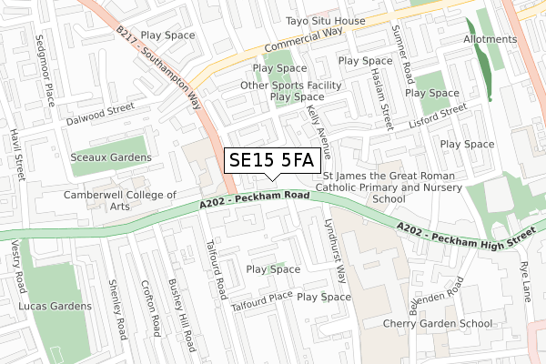
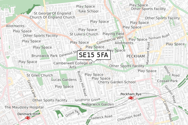
SE15 5FA is located in the Peckham electoral ward, within the London borough of Southwark and the English Parliamentary constituency of Camberwell and Peckham. The Sub Integrated Care Board (ICB) Location is NHS South East London ICB - 72Q and the police force is Metropolitan Police. This postcode has been in use since May 2019.


GetTheData
Source: OS Open Zoomstack (Ordnance Survey)
Licence: Open Government Licence (requires attribution)
Attribution: Contains OS data © Crown copyright and database right 2024
Source: Open Postcode Geo
Licence: Open Government Licence (requires attribution)
Attribution: Contains OS data © Crown copyright and database right 2024; Contains Royal Mail data © Royal Mail copyright and database right 2024; Source: Office for National Statistics licensed under the Open Government Licence v.3.0
| Easting | 533689 |
| Northing | 176814 |
| Latitude | 51.474501 |
| Longitude | -0.076414 |
GetTheData
Source: Open Postcode Geo
Licence: Open Government Licence
| Country | England |
| Postcode District | SE15 |
| ➜ SE15 open data dashboard ➜ See where SE15 is on a map ➜ Where is London? | |
GetTheData
Source: Land Registry Price Paid Data
Licence: Open Government Licence
| Ward | Peckham |
| Constituency | Camberwell And Peckham |
GetTheData
Source: ONS Postcode Database
Licence: Open Government Licence
| January 2024 | Violence and sexual offences | On or near Jocelyn Street | 408m |
| January 2024 | Violence and sexual offences | On or near Jocelyn Street | 408m |
| January 2024 | Anti-social behaviour | On or near Grenard Close | 418m |
| ➜ Get more crime data in our Crime section | |||
GetTheData
Source: data.police.uk
Licence: Open Government Licence
| Southampton Way (Peckham Road) | Peckham | 32m |
| Southampton Way (Peckham Road) | Peckham | 127m |
| Peckham Road (Southampton Way) | Peckham | 152m |
| The Academy At Peckham (Peckham Road) | Peckham | 202m |
| The Academy At Peckham (Peckham High Street) | Peckham | 228m |
| Peckham Rye Station | 0.7km |
| Denmark Hill Station | 1.1km |
| Queens Road Peckham Station | 1.3km |
GetTheData
Source: NaPTAN
Licence: Open Government Licence
| Percentage of properties with Next Generation Access | 100.0% |
| Percentage of properties with Superfast Broadband | 100.0% |
| Percentage of properties with Ultrafast Broadband | 100.0% |
| Percentage of properties with Full Fibre Broadband | 100.0% |
Superfast Broadband is between 30Mbps and 300Mbps
Ultrafast Broadband is > 300Mbps
| Percentage of properties unable to receive 2Mbps | 0.0% |
| Percentage of properties unable to receive 5Mbps | 0.0% |
| Percentage of properties unable to receive 10Mbps | 0.0% |
| Percentage of properties unable to receive 30Mbps | 0.0% |
GetTheData
Source: Ofcom
Licence: Ofcom Terms of Use (requires attribution)
GetTheData
Source: ONS Postcode Database
Licence: Open Government Licence


➜ Get more ratings from the Food Standards Agency
GetTheData
Source: Food Standards Agency
Licence: FSA terms & conditions
| Last Collection | |||
|---|---|---|---|
| Location | Mon-Fri | Sat | Distance |
| 74 Peckham Road | 17:30 | 12:00 | 165m |
| Peckham High Street | 17:30 | 12:00 | 211m |
| Post Office | 17:30 | 12:00 | 342m |
GetTheData
Source: Dracos
Licence: Creative Commons Attribution-ShareAlike
| Facility | Distance |
|---|---|
| Harris Academy Peckham Peckham Road, London Sports Hall, Studio, Artificial Grass Pitch | 252m |
| Highshore School (Closed) Bellenden Road, Peckham, London Sports Hall | 372m |
| Damilola Taylor Youth Centre East Surrey Grove, London Sports Hall, Health and Fitness Gym, Artificial Grass Pitch, Studio | 398m |
GetTheData
Source: Active Places
Licence: Open Government Licence
| School | Phase of Education | Distance |
|---|---|---|
| Oliver Goldsmith Primary School Peckham Road, Camberwell, London, SE5 8UH | Primary | 128m |
| Harris Primary Free School Peckham 112 Peckham Road, Peckham, SE15 5DZ | Primary | 156m |
| St James the Great Roman Catholic Primary School Peckham Road, St James the Great Catholic Pr, London, SE15 5LP | Primary | 232m |
GetTheData
Source: Edubase
Licence: Open Government Licence
The below table lists the International Territorial Level (ITL) codes (formerly Nomenclature of Territorial Units for Statistics (NUTS) codes) and Local Administrative Units (LAU) codes for SE15 5FA:
| ITL 1 Code | Name |
|---|---|
| TLI | London |
| ITL 2 Code | Name |
| TLI4 | Inner London - East |
| ITL 3 Code | Name |
| TLI44 | Lewisham and Southwark |
| LAU 1 Code | Name |
| E09000028 | Southwark |
GetTheData
Source: ONS Postcode Directory
Licence: Open Government Licence
The below table lists the Census Output Area (OA), Lower Layer Super Output Area (LSOA), and Middle Layer Super Output Area (MSOA) for SE15 5FA:
| Code | Name | |
|---|---|---|
| OA | E00020199 | |
| LSOA | E01004013 | Southwark 019D |
| MSOA | E02000825 | Southwark 019 |
GetTheData
Source: ONS Postcode Directory
Licence: Open Government Licence
| SE15 5JU | Crane Street | 47m |
| SE15 5LG | Pelican Estate | 55m |
| SE15 5BE | Peckham Road | 57m |
| SE15 5PY | Peckham Road | 65m |
| SE5 7FD | Wodehouse Avenue | 79m |
| SE15 5LH | Kelly Avenue | 87m |
| SE15 5JB | Moody Road | 92m |
| SE15 5NA | Kelly Avenue | 96m |
| SE15 5EU | Peckham Road | 100m |
| SE15 5JP | Charles Coveney Road | 102m |
GetTheData
Source: Open Postcode Geo; Land Registry Price Paid Data
Licence: Open Government Licence