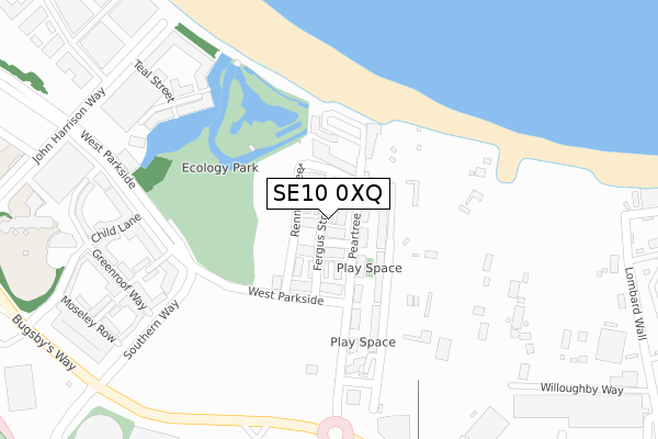
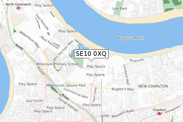
SE10 0XQ is located in the Greenwich Peninsula electoral ward, within the London borough of Greenwich and the English Parliamentary constituency of Greenwich and Woolwich. The Sub Integrated Care Board (ICB) Location is NHS South East London ICB - 72Q and the police force is Metropolitan Police. This postcode has been in use since August 2018.


GetTheData
Source: OS Open Zoomstack (Ordnance Survey)
Licence: Open Government Licence (requires attribution)
Attribution: Contains OS data © Crown copyright and database right 2024
Source: Open Postcode Geo
Licence: Open Government Licence (requires attribution)
Attribution: Contains OS data © Crown copyright and database right 2024; Contains Royal Mail data © Royal Mail copyright and database right 2024; Source: Office for National Statistics licensed under the Open Government Licence v.3.0
| Easting | 540182 |
| Northing | 179102 |
| Latitude | 51.493491 |
| Longitude | 0.017924 |
GetTheData
Source: Open Postcode Geo
Licence: Open Government Licence
| Country | England |
| Postcode District | SE10 |
| ➜ SE10 open data dashboard ➜ See where SE10 is on a map ➜ Where is London? | |
GetTheData
Source: Land Registry Price Paid Data
Licence: Open Government Licence
| Ward | Greenwich Peninsula |
| Constituency | Greenwich And Woolwich |
GetTheData
Source: ONS Postcode Database
Licence: Open Government Licence
7, FERGUS STREET, LONDON, SE10 0XQ 2020 22 DEC £799,995 |
8, FERGUS STREET, LONDON, SE10 0XQ 2018 21 SEP £750,000 |
GetTheData
Source: HM Land Registry Price Paid Data
Licence: Contains HM Land Registry data © Crown copyright and database right 2024. This data is licensed under the Open Government Licence v3.0.
| January 2024 | Criminal damage and arson | On or near John Harrison Way | 431m |
| January 2024 | Anti-social behaviour | On or near John Harrison Way | 431m |
| January 2024 | Anti-social behaviour | On or near John Harrison Way | 431m |
| ➜ Get more crime data in our Crime section | |||
GetTheData
Source: data.police.uk
Licence: Open Government Licence
| Millennium Village Oval Square (Millennium Transit Bus Way) | Charlton | 297m |
| Millennium Village Oval Square (Millennium Transit Bus Way) | Charlton | 317m |
| Millennium Village South (Millennium Transit Bus Way) | Charlton | 336m |
| Millennium Village South (Millennium Transit Bus Way) | Charlton | 351m |
| Peninsular Park Road | Charlton | 469m |
| Emirates Greenwich Peninsula (East Parkside) | North Greenwich | 948m |
| West Silvertown Dlr Station (Wesley Avenue) | Silvertown | 1,087m |
| North Greenwich Underground Station | North Greenwich | 1,223m |
| Pontoon Dock Dlr Station (North Woolwich Road) | Silvertown | 1,384m |
| Westcombe Park Station | 1km |
| Charlton Station | 1.2km |
| Maze Hill Station | 1.6km |
GetTheData
Source: NaPTAN
Licence: Open Government Licence
➜ Broadband speed and availability dashboard for SE10 0XQ
| Percentage of properties with Next Generation Access | 93.3% |
| Percentage of properties with Superfast Broadband | 93.3% |
| Percentage of properties with Ultrafast Broadband | 93.3% |
| Percentage of properties with Full Fibre Broadband | 93.3% |
Superfast Broadband is between 30Mbps and 300Mbps
Ultrafast Broadband is > 300Mbps
| Median download speed | 360.0Mbps |
| Average download speed | 360.0Mbps |
| Maximum download speed | 360.00Mbps |
| Median upload speed | 360.0Mbps |
| Average upload speed | 360.0Mbps |
| Maximum upload speed | 360.00Mbps |
| Percentage of properties unable to receive 2Mbps | 0.0% |
| Percentage of properties unable to receive 5Mbps | 0.0% |
| Percentage of properties unable to receive 10Mbps | 0.0% |
| Percentage of properties unable to receive 30Mbps | 6.7% |
➜ Broadband speed and availability dashboard for SE10 0XQ
GetTheData
Source: Ofcom
Licence: Ofcom Terms of Use (requires attribution)
GetTheData
Source: ONS Postcode Database
Licence: Open Government Licence


➜ Get more ratings from the Food Standards Agency
GetTheData
Source: Food Standards Agency
Licence: FSA terms & conditions
| Last Collection | |||
|---|---|---|---|
| Location | Mon-Fri | Sat | Distance |
| John Harrison Way | 17:30 | 12:00 | 423m |
| Horn Lane | 18:30 | 12:00 | 429m |
| Brocklebank Road | 17:30 | 12:00 | 503m |
GetTheData
Source: Dracos
Licence: Creative Commons Attribution-ShareAlike
| Facility | Distance |
|---|---|
| Millennium Primary School John Harrison Way, London Grass Pitches, Artificial Grass Pitch | 465m |
| Anytime Fitness (London Greenwich) Bugsby's Way, Bugsby's Way, London Health and Fitness Gym | 556m |
| St Mary Magdalene C Of E School (Peninsula Site) Hendon Street, London Sports Hall, Artificial Grass Pitch, Athletics, Outdoor Tennis Courts | 556m |
GetTheData
Source: Active Places
Licence: Open Government Licence
| School | Phase of Education | Distance |
|---|---|---|
| Millennium Primary School 50 John Harrison Way, Greenwich, London, SE10 0BG | Primary | 457m |
| Halstow Primary School Halstow Road, Greenwich, London, SE10 0LD | Primary | 953m |
| Christ Church Church of England Primary School 45 Commerell Street, Greenwich, London, SE10 0DZ | Primary | 998m |
GetTheData
Source: Edubase
Licence: Open Government Licence
The below table lists the International Territorial Level (ITL) codes (formerly Nomenclature of Territorial Units for Statistics (NUTS) codes) and Local Administrative Units (LAU) codes for SE10 0XQ:
| ITL 1 Code | Name |
|---|---|
| TLI | London |
| ITL 2 Code | Name |
| TLI5 | Outer London - East and North East |
| ITL 3 Code | Name |
| TLI51 | Bexley and Greenwich |
| LAU 1 Code | Name |
| E09000011 | Greenwich |
GetTheData
Source: ONS Postcode Directory
Licence: Open Government Licence
The below table lists the Census Output Area (OA), Lower Layer Super Output Area (LSOA), and Middle Layer Super Output Area (MSOA) for SE10 0XQ:
| Code | Name | |
|---|---|---|
| OA | E00176518 | |
| LSOA | E01033733 | Greenwich 036E |
| MSOA | E02006929 | Greenwich 036 |
GetTheData
Source: ONS Postcode Directory
Licence: Open Government Licence
| SE10 0GY | Peartree Way | 60m |
| SE10 0GZ | Peartree Way | 63m |
| SE10 0GU | Peartree Way | 81m |
| SE10 0GT | Peartree Way | 82m |
| SE10 0GW | Peartree Way | 117m |
| SE10 0RU | West Parkside | 248m |
| SE10 0QL | Renaissance Walk | 260m |
| SE10 0QG | West Parkside | 282m |
| SE10 0RG | Osier Lane | 282m |
| SE10 0QF | West Parkside | 291m |
GetTheData
Source: Open Postcode Geo; Land Registry Price Paid Data
Licence: Open Government Licence