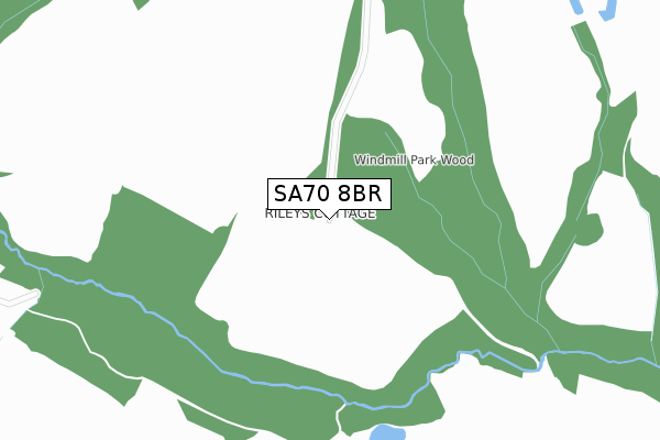
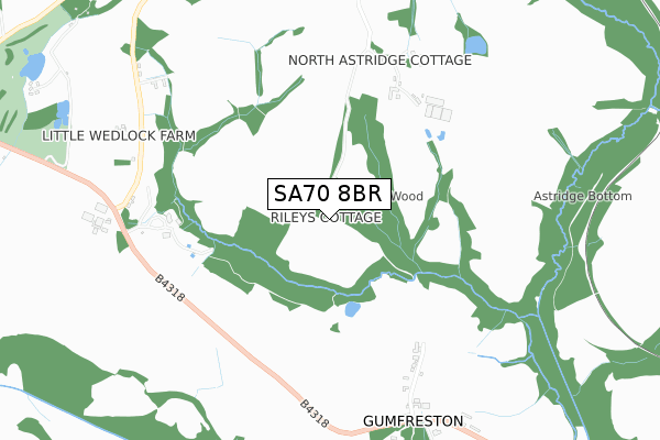
SA70 8BR is located in the St Florence and St Mary Out Liberty electoral ward, within the unitary authority of Pembrokeshire and the Welsh Parliamentary constituency of Carmarthen West and South Pembrokeshire. The Local Health Board is Hywel Dda University and the police force is Dyfed-Powys. This postcode has been in use since September 2018.


GetTheData
Source: OS Open Zoomstack (Ordnance Survey)
Licence: Open Government Licence (requires attribution)
Attribution: Contains OS data © Crown copyright and database right 2024
Source: Open Postcode Geo
Licence: Open Government Licence (requires attribution)
Attribution: Contains OS data © Crown copyright and database right 2024; Contains Royal Mail data © Royal Mail copyright and database right 2024; Source: Office for National Statistics licensed under the Open Government Licence v.3.0
| Easting | 210583 |
| Northing | 201984 |
| Latitude | 51.684592 |
| Longitude | -4.741524 |
GetTheData
Source: Open Postcode Geo
Licence: Open Government Licence
| Country | Wales |
| Postcode District | SA70 |
| ➜ SA70 open data dashboard ➜ See where SA70 is on a map | |
GetTheData
Source: Land Registry Price Paid Data
Licence: Open Government Licence
| Ward | St Florence And St Mary Out Liberty |
| Constituency | Carmarthen West And South Pembrokeshire |
GetTheData
Source: ONS Postcode Database
Licence: Open Government Licence
| Gumfreston Farm (B4318) | Gumfreston | 824m |
| Gumfreston Farm (B4318) | Gumfreston | 827m |
| Oakridge Acres | Knowling Mead | 1,736m |
| Tenby Station | 2.7km |
| Penally Station | 3.2km |
| Manorbier Station | 4.4km |
GetTheData
Source: NaPTAN
Licence: Open Government Licence
GetTheData
Source: ONS Postcode Database
Licence: Open Government Licence


➜ Get more ratings from the Food Standards Agency
GetTheData
Source: Food Standards Agency
Licence: FSA terms & conditions
| Last Collection | |||
|---|---|---|---|
| Location | Mon-Fri | Sat | Distance |
| Flemish Chimney | 17:00 | 09:45 | 2,842m |
| The Croft | 17:15 | 12:00 | 2,967m |
| Tenby Delivery Office | 18:00 | 12:30 | 2,974m |
GetTheData
Source: Dracos
Licence: Creative Commons Attribution-ShareAlike
| School | Phase of Education | Distance |
|---|---|---|
| The Greenhill School Heywood Lane, Tenby, Pembrokeshire, SA70 8BN | Not applicable | 2.3km |
| St Florence V.C. School St Florence, Tenby, Pembrokeshire, SA70 8LY | Not applicable | 2.6km |
| St Teilos V.R.C. School Greenhill Road, Tenby, Pembrokeshire, SA70 7LJ | Not applicable | 2.8km |
GetTheData
Source: Edubase
Licence: Open Government Licence
The below table lists the International Territorial Level (ITL) codes (formerly Nomenclature of Territorial Units for Statistics (NUTS) codes) and Local Administrative Units (LAU) codes for SA70 8BR:
| ITL 1 Code | Name |
|---|---|
| TLL | Wales |
| ITL 2 Code | Name |
| TLL1 | West Wales and The Valleys |
| ITL 3 Code | Name |
| TLL14 | South West Wales |
| LAU 1 Code | Name |
| W06000009 | Pembrokeshire |
GetTheData
Source: ONS Postcode Directory
Licence: Open Government Licence
The below table lists the Census Output Area (OA), Lower Layer Super Output Area (LSOA), and Middle Layer Super Output Area (MSOA) for SA70 8BR:
| Code | Name | |
|---|---|---|
| OA | W00003275 | |
| LSOA | W01000610 | Pembrokeshire 016A |
| MSOA | W02000141 | Pembrokeshire 016 |
GetTheData
Source: ONS Postcode Directory
Licence: Open Government Licence
| SA70 8RB | 784m | |
| SA70 8RA | 796m | |
| SA70 8DR | Clicketts Lane | 1726m |
| SA70 8DB | Oakridge Acres | 1823m |
| SA70 8DT | The Clicketts | 1891m |
| SA70 8TH | Narberth Road | 1921m |
| SA70 8DW | Scotsborough View | 1951m |
| SA70 8EA | Knowling Mead | 1964m |
| SA70 8EB | Knowling Mead | 1981m |
| SA70 8DN | Lamack Vale | 1984m |
GetTheData
Source: Open Postcode Geo; Land Registry Price Paid Data
Licence: Open Government Licence