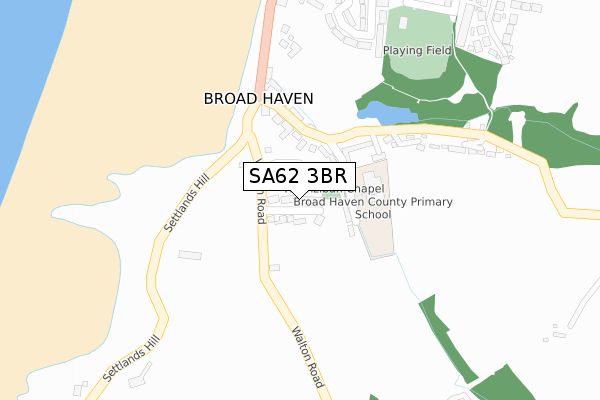
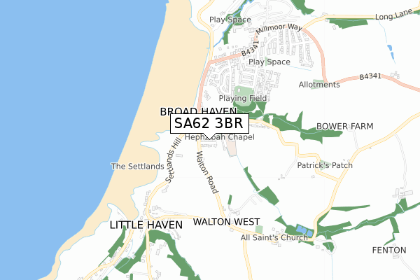
SA62 3BR is located in the The Havens electoral ward, within the unitary authority of Pembrokeshire and the Welsh Parliamentary constituency of Preseli Pembrokeshire. The Local Health Board is Hywel Dda University and the police force is Dyfed-Powys. This postcode has been in use since February 2020.


GetTheData
Source: OS Open Zoomstack (Ordnance Survey)
Licence: Open Government Licence (requires attribution)
Attribution: Contains OS data © Crown copyright and database right 2024
Source: Open Postcode Geo
Licence: Open Government Licence (requires attribution)
Attribution: Contains OS data © Crown copyright and database right 2024; Contains Royal Mail data © Royal Mail copyright and database right 2024; Source: Office for National Statistics licensed under the Open Government Licence v.3.0
| Easting | 186121 |
| Northing | 213384 |
| Latitude | 51.778160 |
| Longitude | -5.101873 |
GetTheData
Source: Open Postcode Geo
Licence: Open Government Licence
| Country | Wales |
| Postcode District | SA62 |
| ➜ SA62 open data dashboard ➜ See where SA62 is on a map ➜ Where is Broad Haven? | |
GetTheData
Source: Land Registry Price Paid Data
Licence: Open Government Licence
| Ward | The Havens |
| Constituency | Preseli Pembrokeshire |
GetTheData
Source: ONS Postcode Database
Licence: Open Government Licence
8, SAND BANKS, BROAD HAVEN, HAVERFORDWEST, SA62 3BR 2020 29 JUL £440,000 |
4, SAND BANKS, BROAD HAVEN, HAVERFORDWEST, SA62 3BR 2020 14 FEB £500,000 |
2, SAND BANKS, BROAD HAVEN, HAVERFORDWEST, SA62 3BR 2020 17 JAN £560,000 |
6, SAND BANKS, BROAD HAVEN, HAVERFORDWEST, SA62 3BR 2019 14 SEP £445,000 |
GetTheData
Source: HM Land Registry Price Paid Data
Licence: Contains HM Land Registry data © Crown copyright and database right 2024. This data is licensed under the Open Government Licence v3.0.
| June 2022 | Anti-social behaviour | On or near Marine Road | 167m |
| June 2022 | Violence and sexual offences | On or near Enfield Road | 355m |
| May 2022 | Violence and sexual offences | On or near Sandyke Road | 493m |
| ➜ Get more crime data in our Crime section | |||
GetTheData
Source: data.police.uk
Licence: Open Government Licence
| Post Office (Enfield Road) | Broad Haven | 250m |
| Post Office (Enfield Road) | Broad Haven | 253m |
| Sandyke Lane (Millmoor Way) | Broad Haven | 571m |
| Old Post Office (St Brides Road) | Little Haven | 653m |
| Car Park (Grounds) | Little Haven | 705m |
GetTheData
Source: NaPTAN
Licence: Open Government Licence
GetTheData
Source: ONS Postcode Database
Licence: Open Government Licence


➜ Get more ratings from the Food Standards Agency
GetTheData
Source: Food Standards Agency
Licence: FSA terms & conditions
| Last Collection | |||
|---|---|---|---|
| Location | Mon-Fri | Sat | Distance |
| Broad Haven P O | 16:00 | 11:30 | 235m |
| Little Haven P O | 16:00 | 12:00 | 662m |
| Hasguard Cross | 12:00 | 12:00 | 2,826m |
GetTheData
Source: Dracos
Licence: Creative Commons Attribution-ShareAlike
| School | Phase of Education | Distance |
|---|---|---|
| Broad Haven C.P. School Webbs Hill, Broad Haven, Haverfordwest, Pembrokeshire, SA62 3JT | Not applicable | 95m |
GetTheData
Source: Edubase
Licence: Open Government Licence
The below table lists the International Territorial Level (ITL) codes (formerly Nomenclature of Territorial Units for Statistics (NUTS) codes) and Local Administrative Units (LAU) codes for SA62 3BR:
| ITL 1 Code | Name |
|---|---|
| TLL | Wales |
| ITL 2 Code | Name |
| TLL1 | West Wales and The Valleys |
| ITL 3 Code | Name |
| TLL14 | South West Wales |
| LAU 1 Code | Name |
| W06000009 | Pembrokeshire |
GetTheData
Source: ONS Postcode Directory
Licence: Open Government Licence
The below table lists the Census Output Area (OA), Lower Layer Super Output Area (LSOA), and Middle Layer Super Output Area (MSOA) for SA62 3BR:
| Code | Name | |
|---|---|---|
| OA | W00003344 | |
| LSOA | W01000622 | Pembrokeshire 008E |
| MSOA | W02000133 | Pembrokeshire 008 |
GetTheData
Source: ONS Postcode Directory
Licence: Open Government Licence
| SA62 3JT | Webbs Hill | 93m |
| SA62 3JX | 120m | |
| SA62 3JS | Marine Road | 124m |
| SA62 3JR | Marine Road | 175m |
| SA62 3JU | Trafalgar Terrace | 210m |
| SA62 3JW | Enfield Road | 294m |
| SA62 3TY | 336m | |
| SA62 3HP | Puffin Way | 384m |
| SA62 3JG | Enfield Road | 385m |
| SA62 3HW | Wilson Meadow | 422m |
GetTheData
Source: Open Postcode Geo; Land Registry Price Paid Data
Licence: Open Government Licence