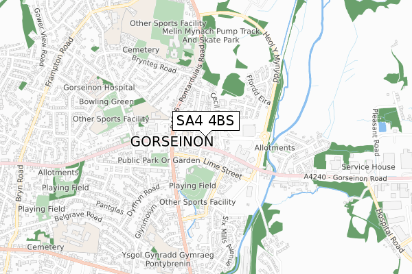
SA4 4BS is located in the Gorseinon and Penyrheol electoral ward, within the unitary authority of Swansea and the Welsh Parliamentary constituency of Gower. The Local Health Board is Swansea Bay University and the police force is South Wales. This postcode has been in use since January 2020.


GetTheData
Source: OS Open Zoomstack (Ordnance Survey)
Licence: Open Government Licence (requires attribution)
Attribution: Contains OS data © Crown copyright and database right 2024
Source: Open Postcode Geo
Licence: Open Government Licence (requires attribution)
Attribution: Contains OS data © Crown copyright and database right 2024; Contains Royal Mail data © Royal Mail copyright and database right 2024; Source: Office for National Statistics licensed under the Open Government Licence v.3.0
| Easting | 259119 |
| Northing | 198731 |
| Latitude | 51.669644 |
| Longitude | -4.038642 |
GetTheData
Source: Open Postcode Geo
Licence: Open Government Licence
| Country | Wales |
| Postcode District | SA4 |
| ➜ SA4 open data dashboard ➜ See where SA4 is on a map ➜ Where is Gorseinon? | |
GetTheData
Source: Land Registry Price Paid Data
Licence: Open Government Licence
| Ward | Gorseinon And Penyrheol |
| Constituency | Gower |
GetTheData
Source: ONS Postcode Database
Licence: Open Government Licence
| November 2023 | Other theft | On or near Parking Area | 347m |
| June 2022 | Public order | On or near Mill Street | 109m |
| June 2022 | Criminal damage and arson | On or near Cross Street | 118m |
| ➜ Get more crime data in our Crime section | |||
GetTheData
Source: data.police.uk
Licence: Open Government Licence
| Somerfield (High Street) | Gorseinon | 226m |
| Somerfield (High Street) | Gorseinon | 287m |
| Parc Melin Mynach (Heol Y Mynydd) | Gorseinon | 451m |
| Llanerch Crescent | Gorseinon | 476m |
| Libanus Road (West Street) | Gorseinon | 494m |
| Gowerton Station | 2.3km |
| Llangennech Station | 3.7km |
| Bynea Station | 4.2km |
GetTheData
Source: NaPTAN
Licence: Open Government Licence
GetTheData
Source: ONS Postcode Database
Licence: Open Government Licence


➜ Get more ratings from the Food Standards Agency
GetTheData
Source: Food Standards Agency
Licence: FSA terms & conditions
| Last Collection | |||
|---|---|---|---|
| Location | Mon-Fri | Sat | Distance |
| Trinity Street | 17:45 | 12:45 | 196m |
| Gorseinon P O | 17:45 | 12:30 | 247m |
| Pontardulais Road | 17:30 | 13:15 | 372m |
GetTheData
Source: Dracos
Licence: Creative Commons Attribution-ShareAlike
| School | Phase of Education | Distance |
|---|---|---|
| Penyrheol Comprehensive School Pontarddulais Road, Gorseinon, Swansea, SA4 4FG | Not applicable | 613m |
| Ysgol Gynradd Gymraeg Pontybrenin Loughor Road, Gorseinon, Swansea, SA4 6AU | Not applicable | 695m |
| Pontybrenin Primary School Glyn Rhosyn, Gorseinon, Swansea, SA4 6HX | Not applicable | 695m |
GetTheData
Source: Edubase
Licence: Open Government Licence
The below table lists the International Territorial Level (ITL) codes (formerly Nomenclature of Territorial Units for Statistics (NUTS) codes) and Local Administrative Units (LAU) codes for SA4 4BS:
| ITL 1 Code | Name |
|---|---|
| TLL | Wales |
| ITL 2 Code | Name |
| TLL1 | West Wales and The Valleys |
| ITL 3 Code | Name |
| TLL18 | Swansea |
| LAU 1 Code | Name |
| W06000011 | Swansea |
GetTheData
Source: ONS Postcode Directory
Licence: Open Government Licence
The below table lists the Census Output Area (OA), Lower Layer Super Output Area (LSOA), and Middle Layer Super Output Area (MSOA) for SA4 4BS:
| Code | Name | |
|---|---|---|
| OA | W00010076 | |
| LSOA | W01000773 | Swansea 005A |
| MSOA | W02000172 | Swansea 005 |
GetTheData
Source: ONS Postcode Directory
Licence: Open Government Licence
| SA4 4BR | High Street | 77m |
| SA4 4BP | High Street | 92m |
| SA4 4BW | Brighton Road | 103m |
| SA4 4BU | Cross Street | 105m |
| SA4 4BZ | Mill Street | 114m |
| SA4 4BT | High Street | 116m |
| SA4 4DA | Rhydymardy | 147m |
| SA4 4BY | Cecil Road | 155m |
| SA4 4EE | Lime Street | 163m |
| SA4 4AD | Lime Street | 169m |
GetTheData
Source: Open Postcode Geo; Land Registry Price Paid Data
Licence: Open Government Licence