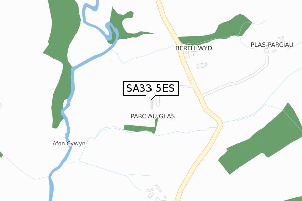
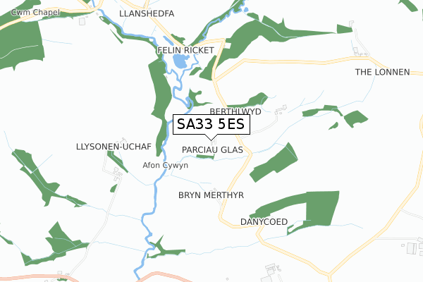
SA33 5ES is located in the Carmarthen Town North and South electoral ward, within the unitary authority of Carmarthenshire and the Welsh Parliamentary constituency of Carmarthen West and South Pembrokeshire. The Local Health Board is Hywel Dda University and the police force is Dyfed-Powys. This postcode has been in use since December 2018.


GetTheData
Source: OS Open Zoomstack (Ordnance Survey)
Licence: Open Government Licence (requires attribution)
Attribution: Contains OS data © Crown copyright and database right 2024
Source: Open Postcode Geo
Licence: Open Government Licence (requires attribution)
Attribution: Contains OS data © Crown copyright and database right 2024; Contains Royal Mail data © Royal Mail copyright and database right 2024; Source: Office for National Statistics licensed under the Open Government Licence v.3.0
| Easting | 237499 |
| Northing | 219047 |
| Latitude | 51.846315 |
| Longitude | -4.360522 |
GetTheData
Source: Open Postcode Geo
Licence: Open Government Licence
| Country | Wales |
| Postcode District | SA33 |
| ➜ SA33 open data dashboard ➜ See where SA33 is on a map | |
GetTheData
Source: Land Registry Price Paid Data
Licence: Open Government Licence
| Ward | Carmarthen Town North And South |
| Constituency | Carmarthen West And South Pembrokeshire |
GetTheData
Source: ONS Postcode Database
Licence: Open Government Licence
| Showground Park & Ride (Llysonen Road) | Travellers' Rest | 145m |
| Tenby Filling Station (Llysonnen Road) | Travellers' Rest | 646m |
| Nantyci Show Ground (A40) | Carmarthen | 724m |
| Travellers Rest (Llysonen Road) | Travellers' Rest | 800m |
| Travellers Rest (Llysonen Road) | Travellers' Rest | 1,007m |
| Carmarthen Station | 3.8km |
GetTheData
Source: NaPTAN
Licence: Open Government Licence
GetTheData
Source: ONS Postcode Database
Licence: Open Government Licence


➜ Get more ratings from the Food Standards Agency
GetTheData
Source: Food Standards Agency
Licence: FSA terms & conditions
| Last Collection | |||
|---|---|---|---|
| Location | Mon-Fri | Sat | Distance |
| Johnstown Post Office | 17:15 | 11:30 | 2,430m |
| Pass-by | 17:00 | 10:00 | 2,516m |
| Maes Y Wenol | 17:00 | 11:15 | 3,012m |
GetTheData
Source: Dracos
Licence: Creative Commons Attribution-ShareAlike
| School | Phase of Education | Distance |
|---|---|---|
| Johnstown C.P. School Salem Road, Johnstown, Carmarthen, Carmarthenshire, SA31 3HS | Not applicable | 2.2km |
| Carmarthenshire Secondary Teaching and Learning Centre Carmarthen Llansteffan Road, Johnstown, Carmarthen, SA31 3NQ | Not applicable | 2.7km |
| Queen Elizabeth High Llansteffan Road, Johnstown Road, Carmarthenshire, SA31 3NL | Not applicable | 2.7km |
GetTheData
Source: Edubase
Licence: Open Government Licence
The below table lists the International Territorial Level (ITL) codes (formerly Nomenclature of Territorial Units for Statistics (NUTS) codes) and Local Administrative Units (LAU) codes for SA33 5ES:
| ITL 1 Code | Name |
|---|---|
| TLL | Wales |
| ITL 2 Code | Name |
| TLL1 | West Wales and The Valleys |
| ITL 3 Code | Name |
| TLL14 | South West Wales |
| LAU 1 Code | Name |
| W06000010 | Carmarthenshire |
GetTheData
Source: ONS Postcode Directory
Licence: Open Government Licence
The below table lists the Census Output Area (OA), Lower Layer Super Output Area (LSOA), and Middle Layer Super Output Area (MSOA) for SA33 5ES:
| Code | Name | |
|---|---|---|
| OA | W00003453 | |
| LSOA | W01000642 | Carmarthenshire 008B |
| MSOA | W02000149 | Carmarthenshire 008 |
GetTheData
Source: ONS Postcode Directory
Licence: Open Government Licence
| SA33 5DS | 694m | |
| SA31 3RP | Llysonnen Road | 808m |
| SA31 3RS | Llysonnen Road | 836m |
| SA33 5DJ | 1009m | |
| SA31 3RL | Manor Way | 1081m |
| SA31 3RR | 1082m | |
| SA31 3RJ | Manor Crescent | 1112m |
| SA31 3BW | Maes Pedr | 1115m |
| SA31 3RN | 1117m | |
| SA31 3BR | Maes Pedr | 1159m |
GetTheData
Source: Open Postcode Geo; Land Registry Price Paid Data
Licence: Open Government Licence