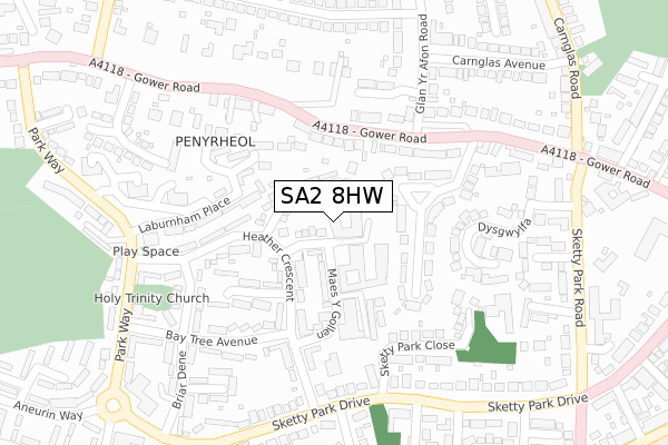
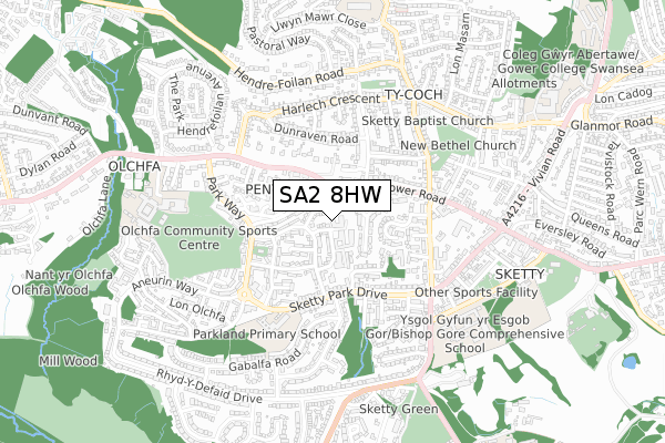
SA2 8HW is located in the Sketty electoral ward, within the unitary authority of Swansea and the Welsh Parliamentary constituency of Swansea West. The Local Health Board is Swansea Bay University and the police force is South Wales. This postcode has been in use since June 2018.


GetTheData
Source: OS Open Zoomstack (Ordnance Survey)
Licence: Open Government Licence (requires attribution)
Attribution: Contains OS data © Crown copyright and database right 2024
Source: Open Postcode Geo
Licence: Open Government Licence (requires attribution)
Attribution: Contains OS data © Crown copyright and database right 2024; Contains Royal Mail data © Royal Mail copyright and database right 2024; Source: Office for National Statistics licensed under the Open Government Licence v.3.0
| Easting | 261939 |
| Northing | 192943 |
| Latitude | 51.618335 |
| Longitude | -3.995603 |
GetTheData
Source: Open Postcode Geo
Licence: Open Government Licence
| Country | Wales |
| Postcode District | SA2 |
| ➜ SA2 open data dashboard ➜ See where SA2 is on a map ➜ Where is Swansea? | |
GetTheData
Source: Land Registry Price Paid Data
Licence: Open Government Licence
| Ward | Sketty |
| Constituency | Swansea West |
GetTheData
Source: ONS Postcode Database
Licence: Open Government Licence
| January 2024 | Other theft | On or near Devon View | 179m |
| January 2024 | Public order | On or near Parking Area | 380m |
| January 2024 | Violence and sexual offences | On or near Parking Area | 463m |
| ➜ Get more crime data in our Crime section | |||
GetTheData
Source: data.police.uk
Licence: Open Government Licence
| Glan-yr-afon Gardens (Gower Road) | Sketty | 206m |
| Glan-yr-afon Gardens (Gower Road) | Sketty | 221m |
| Sylvan Way (Glan-yr-afon Road) | Sketty | 249m |
| Sylvan Way (Glan-yr-afon Road) | Sketty | 251m |
| Sketty Park Drive | Sketty | 264m |
| Swansea Station | 3.8km |
| Gowerton Station | 4.4km |
GetTheData
Source: NaPTAN
Licence: Open Government Licence
➜ Broadband speed and availability dashboard for SA2 8HW
| Percentage of properties with Next Generation Access | 100.0% |
| Percentage of properties with Superfast Broadband | 100.0% |
| Percentage of properties with Ultrafast Broadband | 100.0% |
| Percentage of properties with Full Fibre Broadband | 0.0% |
Superfast Broadband is between 30Mbps and 300Mbps
Ultrafast Broadband is > 300Mbps
| Median download speed | 38.1Mbps |
| Average download speed | 41.3Mbps |
| Maximum download speed | 80.00Mbps |
| Median upload speed | 9.8Mbps |
| Average upload speed | 8.1Mbps |
| Maximum upload speed | 20.00Mbps |
| Percentage of properties unable to receive 2Mbps | 0.0% |
| Percentage of properties unable to receive 5Mbps | 0.0% |
| Percentage of properties unable to receive 10Mbps | 0.0% |
| Percentage of properties unable to receive 30Mbps | 0.0% |
➜ Broadband speed and availability dashboard for SA2 8HW
GetTheData
Source: Ofcom
Licence: Ofcom Terms of Use (requires attribution)
GetTheData
Source: ONS Postcode Database
Licence: Open Government Licence


➜ Get more ratings from the Food Standards Agency
GetTheData
Source: Food Standards Agency
Licence: FSA terms & conditions
| Last Collection | |||
|---|---|---|---|
| Location | Mon-Fri | Sat | Distance |
| Dunraven Road | 18:00 | 12:45 | 341m |
| Beaconsfield Way | 18:15 | 12:30 | 388m |
| Tycoch Road | 18:00 | 13:00 | 598m |
GetTheData
Source: Dracos
Licence: Creative Commons Attribution-ShareAlike
| School | Phase of Education | Distance |
|---|---|---|
| Parkland Primary School Sketty Park Drive, Sketty, Swansea, SA2 8NG | Not applicable | 455m |
| Sketty Primary School Llwynnawr Road, Ty Coch, Swansea, SA2 9HJ | Not applicable | 469m |
| Bishop Gore School De-La-Beche Road, Sketty, Swansea, SA2 9AP | Not applicable | 607m |
GetTheData
Source: Edubase
Licence: Open Government Licence
The below table lists the International Territorial Level (ITL) codes (formerly Nomenclature of Territorial Units for Statistics (NUTS) codes) and Local Administrative Units (LAU) codes for SA2 8HW:
| ITL 1 Code | Name |
|---|---|
| TLL | Wales |
| ITL 2 Code | Name |
| TLL1 | West Wales and The Valleys |
| ITL 3 Code | Name |
| TLL18 | Swansea |
| LAU 1 Code | Name |
| W06000011 | Swansea |
GetTheData
Source: ONS Postcode Directory
Licence: Open Government Licence
The below table lists the Census Output Area (OA), Lower Layer Super Output Area (LSOA), and Middle Layer Super Output Area (MSOA) for SA2 8HW:
| Code | Name | |
|---|---|---|
| OA | W00004563 | |
| LSOA | W01000857 | Swansea 022E |
| MSOA | W02000189 | Swansea 022 |
GetTheData
Source: ONS Postcode Directory
Licence: Open Government Licence
| SA2 8HR | Whitethorn Place | 46m |
| SA2 8HP | Furzeland Drive | 57m |
| SA2 9HX | Glan Yr Afon Gardens | 103m |
| SA2 9JH | Gower Road | 120m |
| SA2 8HQ | Maes Y Gollen | 123m |
| SA2 9HY | Glan Yr Afon Gardens | 148m |
| SA2 8HE | Heather Crescent | 149m |
| SA2 9FJ | Cwrt Pen Y Bryn | 151m |
| SA2 8JL | Laurel Place | 161m |
| SA2 8HT | Laburnum Place | 171m |
GetTheData
Source: Open Postcode Geo; Land Registry Price Paid Data
Licence: Open Government Licence