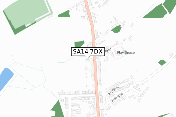
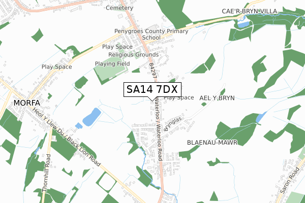
SA14 7DX is located in the Penygroes electoral ward, within the unitary authority of Carmarthenshire and the Welsh Parliamentary constituency of Carmarthen East and Dinefwr. The Local Health Board is Hywel Dda University and the police force is Dyfed-Powys. This postcode has been in use since July 2018.


GetTheData
Source: OS Open Zoomstack (Ordnance Survey)
Licence: Open Government Licence (requires attribution)
Attribution: Contains OS data © Crown copyright and database right 2024
Source: Open Postcode Geo
Licence: Open Government Licence (requires attribution)
Attribution: Contains OS data © Crown copyright and database right 2024; Contains Royal Mail data © Royal Mail copyright and database right 2024; Source: Office for National Statistics licensed under the Open Government Licence v.3.0
| Easting | 258763 |
| Northing | 212811 |
| Latitude | 51.796071 |
| Longitude | -4.049504 |
GetTheData
Source: Open Postcode Geo
Licence: Open Government Licence
| Country | Wales |
| Postcode District | SA14 |
| ➜ SA14 open data dashboard ➜ See where SA14 is on a map ➜ Where is Pen-y-groes? | |
GetTheData
Source: Land Registry Price Paid Data
Licence: Open Government Licence
| Ward | Penygroes |
| Constituency | Carmarthen East And Dinefwr |
GetTheData
Source: ONS Postcode Database
Licence: Open Government Licence
| July 2023 | Public order | On or near Clos Ael-Y-Bryn | 463m |
| December 2022 | Violence and sexual offences | On or near Bryndedwyddfa | 338m |
| November 2022 | Violence and sexual offences | On or near Bryndedwyddfa | 338m |
| ➜ Get more crime data in our Crime section | |||
GetTheData
Source: data.police.uk
Licence: Open Government Licence
| Spien Road (Waterloo Road) | Pen-y-groes | 49m |
| Spien Road (Waterloo Road) | Pen-y-groes | 67m |
| Maesglas (Waterloo Road) | Pen-y-groes | 240m |
| David's Way (Heol Waterloo) | Pen-y-groes | 273m |
| Bryndedwyddfa (Waterloo Road) | Pen-y-groes | 276m |
| Ammanford Station | 3.6km |
| Pantyffynnon Station | 4.1km |
| Llandybie Station | 4.2km |
GetTheData
Source: NaPTAN
Licence: Open Government Licence
| Percentage of properties with Next Generation Access | 100.0% |
| Percentage of properties with Superfast Broadband | 100.0% |
| Percentage of properties with Ultrafast Broadband | 0.0% |
| Percentage of properties with Full Fibre Broadband | 0.0% |
Superfast Broadband is between 30Mbps and 300Mbps
Ultrafast Broadband is > 300Mbps
| Percentage of properties unable to receive 2Mbps | 0.0% |
| Percentage of properties unable to receive 5Mbps | 0.0% |
| Percentage of properties unable to receive 10Mbps | 0.0% |
| Percentage of properties unable to receive 30Mbps | 0.0% |
GetTheData
Source: Ofcom
Licence: Ofcom Terms of Use (requires attribution)
GetTheData
Source: ONS Postcode Database
Licence: Open Government Licence


➜ Get more ratings from the Food Standards Agency
GetTheData
Source: Food Standards Agency
Licence: FSA terms & conditions
| Last Collection | |||
|---|---|---|---|
| Location | Mon-Fri | Sat | Distance |
| Spien Road | 16:00 | 08:00 | 38m |
| Gorsddu Road | 16:00 | 08:45 | 918m |
| Penygroes Post Office | 16:00 | 10:15 | 922m |
GetTheData
Source: Dracos
Licence: Creative Commons Attribution-ShareAlike
| School | Phase of Education | Distance |
|---|---|---|
| Penygroes C.P. School Waterloo Road, Penygroes, Llanelli, Carmarthenshire, SA14 7NT | Not applicable | 535m |
| Ysgol Gynradd Saron Saron, Rhydaman, Sir Gaerfyrddin, SA18 3LH | Not applicable | 1.3km |
| Ysgol Gynradd Gorslas Heol Y Llew Du, Gorslas, Llanelli, Sir Gaerfyrddin, SA14 7LA | Not applicable | 1.8km |
GetTheData
Source: Edubase
Licence: Open Government Licence
The below table lists the International Territorial Level (ITL) codes (formerly Nomenclature of Territorial Units for Statistics (NUTS) codes) and Local Administrative Units (LAU) codes for SA14 7DX:
| ITL 1 Code | Name |
|---|---|
| TLL | Wales |
| ITL 2 Code | Name |
| TLL1 | West Wales and The Valleys |
| ITL 3 Code | Name |
| TLL14 | South West Wales |
| LAU 1 Code | Name |
| W06000010 | Carmarthenshire |
GetTheData
Source: ONS Postcode Directory
Licence: Open Government Licence
The below table lists the Census Output Area (OA), Lower Layer Super Output Area (LSOA), and Middle Layer Super Output Area (MSOA) for SA14 7DX:
| Code | Name | |
|---|---|---|
| OA | W00003831 | |
| LSOA | W01000713 | Carmarthenshire 015E |
| MSOA | W02000156 | Carmarthenshire 015 |
GetTheData
Source: ONS Postcode Directory
Licence: Open Government Licence
| SA14 7PU | Waterloo Road | 58m |
| SA14 7PS | Garnfoel | 137m |
| SA14 7PT | Spien Road | 137m |
| SA14 7RF | Ffordd Dafydd | 194m |
| SA14 7PY | Brynglas | 248m |
| SA14 7RJ | Gilfach Y Gog | 285m |
| SA14 7RH | Maesglas Road | 298m |
| SA14 7PR | Bryndedwyddfa | 331m |
| SA14 7RE | Cwrt Y Ffynnon | 341m |
| SA14 7PN | Waterloo Road | 343m |
GetTheData
Source: Open Postcode Geo; Land Registry Price Paid Data
Licence: Open Government Licence