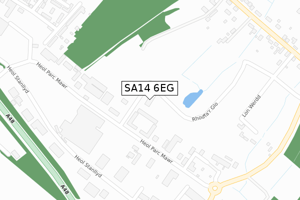
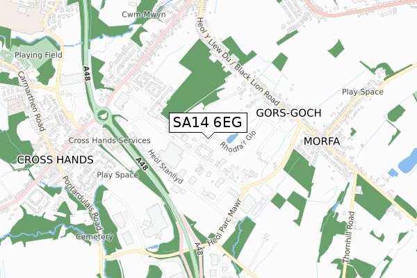
SA14 6EG is located in the Gorslas electoral ward, within the unitary authority of Carmarthenshire and the Welsh Parliamentary constituency of Carmarthen East and Dinefwr. The Local Health Board is Hywel Dda University and the police force is Dyfed-Powys. This postcode has been in use since February 2020.


GetTheData
Source: OS Open Zoomstack (Ordnance Survey)
Licence: Open Government Licence (requires attribution)
Attribution: Contains OS data © Crown copyright and database right 2024
Source: Open Postcode Geo
Licence: Open Government Licence (requires attribution)
Attribution: Contains OS data © Crown copyright and database right 2024; Contains Royal Mail data © Royal Mail copyright and database right 2024; Source: Office for National Statistics licensed under the Open Government Licence v.3.0
| Easting | 257052 |
| Northing | 212813 |
| Latitude | 51.795654 |
| Longitude | -4.074299 |
GetTheData
Source: Open Postcode Geo
Licence: Open Government Licence
| Country | Wales |
| Postcode District | SA14 |
| ➜ SA14 open data dashboard ➜ See where SA14 is on a map | |
GetTheData
Source: Land Registry Price Paid Data
Licence: Open Government Licence
| Ward | Gorslas |
| Constituency | Carmarthen East And Dinefwr |
GetTheData
Source: ONS Postcode Database
Licence: Open Government Licence
| June 2022 | Other crime | On or near Ty Newydd Terrace | 469m |
| May 2022 | Anti-social behaviour | On or near Heol Stanllyd | 314m |
| May 2022 | Drugs | On or near Ty Newydd Terrace | 469m |
| ➜ Get more crime data in our Crime section | |||
GetTheData
Source: data.police.uk
Licence: Open Government Licence
| Cross Hands All-spares (Heol Parc Mawr) | Morfa | 195m |
| Heol Parc Mawr | Cross Hands | 299m |
| Business Park (Heol Stanllyd) | Cross Hands | 337m |
| Cross Hands Jj Motors (Heol Stanllyd) | Gorslas | 369m |
| Black Lion (Black Lion Road) | Gorslas | 433m |
| Llandybie Station | 5.6km |
GetTheData
Source: NaPTAN
Licence: Open Government Licence
GetTheData
Source: ONS Postcode Database
Licence: Open Government Licence


➜ Get more ratings from the Food Standards Agency
GetTheData
Source: Food Standards Agency
Licence: FSA terms & conditions
| Last Collection | |||
|---|---|---|---|
| Location | Mon-Fri | Sat | Distance |
| Business Park | 16:15 | 09:00 | 366m |
| Gorsddu Road | 16:00 | 08:45 | 813m |
| Cross Hands Post Office | 16:00 | 10:45 | 889m |
GetTheData
Source: Dracos
Licence: Creative Commons Attribution-ShareAlike
| School | Phase of Education | Distance |
|---|---|---|
| Ysgol Gynradd Gorslas Heol Y Llew Du, Gorslas, Llanelli, Sir Gaerfyrddin, SA14 7LA | Not applicable | 970m |
| Cross Hands C.P. School Carmarthen Road, Cross Hands, Llanelli, Carmarthenshire, SA14 6SU | Not applicable | 1.2km |
| Penygroes C.P. School Waterloo Road, Penygroes, Llanelli, Carmarthenshire, SA14 7NT | Not applicable | 1.8km |
GetTheData
Source: Edubase
Licence: Open Government Licence
The below table lists the International Territorial Level (ITL) codes (formerly Nomenclature of Territorial Units for Statistics (NUTS) codes) and Local Administrative Units (LAU) codes for SA14 6EG:
| ITL 1 Code | Name |
|---|---|
| TLL | Wales |
| ITL 2 Code | Name |
| TLL1 | West Wales and The Valleys |
| ITL 3 Code | Name |
| TLL14 | South West Wales |
| LAU 1 Code | Name |
| W06000010 | Carmarthenshire |
GetTheData
Source: ONS Postcode Directory
Licence: Open Government Licence
The below table lists the Census Output Area (OA), Lower Layer Super Output Area (LSOA), and Middle Layer Super Output Area (MSOA) for SA14 6EG:
| Code | Name | |
|---|---|---|
| OA | W00003573 | |
| LSOA | W01000664 | Carmarthenshire 016C |
| MSOA | W02000157 | Carmarthenshire 016 |
GetTheData
Source: ONS Postcode Directory
Licence: Open Government Licence
| SA14 6RE | Heol Parc Mawr | 107m |
| SA14 6RB | Heol Stanllyd | 263m |
| SA14 6RY | Black Lion Road | 348m |
| SA14 6RL | Tynewydd Terrace | 372m |
| SA14 6RU | Black Lion Road | 418m |
| SA14 6SG | Clos Maes Rhedyn | 463m |
| SA14 6SA | Black Lion Road | 540m |
| SA14 6RT | Black Lion Road | 547m |
| SA14 6SQ | Clos Pen Y Waun | 574m |
| SA14 6SN | Heol Derwen | 594m |
GetTheData
Source: Open Postcode Geo; Land Registry Price Paid Data
Licence: Open Government Licence