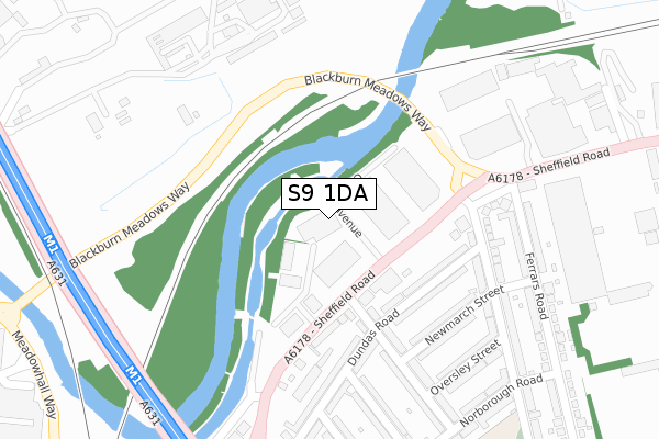
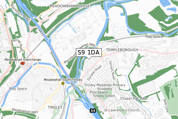
S9 1DA is located in the Darnall electoral ward, within the metropolitan district of Sheffield and the English Parliamentary constituency of Sheffield South East. The Sub Integrated Care Board (ICB) Location is NHS South Yorkshire ICB - 03N and the police force is South Yorkshire. This postcode has been in use since February 2018.


GetTheData
Source: OS Open Zoomstack (Ordnance Survey)
Licence: Open Government Licence (requires attribution)
Attribution: Contains OS data © Crown copyright and database right 2024
Source: Open Postcode Geo
Licence: Open Government Licence (requires attribution)
Attribution: Contains OS data © Crown copyright and database right 2024; Contains Royal Mail data © Royal Mail copyright and database right 2024; Source: Office for National Statistics licensed under the Open Government Licence v.3.0
| Easting | 440034 |
| Northing | 391281 |
| Latitude | 53.416839 |
| Longitude | -1.399124 |
GetTheData
Source: Open Postcode Geo
Licence: Open Government Licence
| Country | England |
| Postcode District | S9 |
| ➜ S9 open data dashboard ➜ See where S9 is on a map ➜ Where is Sheffield? | |
GetTheData
Source: Land Registry Price Paid Data
Licence: Open Government Licence
| Ward | Darnall |
| Constituency | Sheffield South East |
GetTheData
Source: ONS Postcode Database
Licence: Open Government Licence
| December 2023 | Criminal damage and arson | On or near Park/Open Space | 435m |
| September 2023 | Public order | On or near Park/Open Space | 435m |
| July 2023 | Violence and sexual offences | On or near Park/Open Space | 435m |
| ➜ Get more crime data in our Crime section | |||
GetTheData
Source: data.police.uk
Licence: Open Government Licence
| Raby Street (Sheffield Road) | Tinsley | 42m |
| St Lawrence Road (Sheffield Road) | Tinsley | 76m |
| Raby Street (Sheffield Road) | Tinsley | 97m |
| Sheffield Road (St Lawrence Road) | Tinsley | 200m |
| Sheffield Road (Blackburn Meadows Way) | Tinsley | 212m |
| Meadowhall South - Tinsley (Sheffield Supertram) (Off Meadowhall Way) | Meadowhall | 485m |
| Meadowhall Interchange (Sheffield Supertram) (Off Meadowhall Road) | Meadowhall | 906m |
| Carbrook (Sheffield Supertram) (Off Sheffield Road - Attercliffe Road) | Carbrook | 1,477m |
| Meadowhall Station | 0.9km |
| Rotherham Central Station | 3.1km |
| Darnall Station | 3.7km |
GetTheData
Source: NaPTAN
Licence: Open Government Licence
GetTheData
Source: ONS Postcode Database
Licence: Open Government Licence


➜ Get more ratings from the Food Standards Agency
GetTheData
Source: Food Standards Agency
Licence: FSA terms & conditions
| Last Collection | |||
|---|---|---|---|
| Location | Mon-Fri | Sat | Distance |
| 42 St Lawrence Road | 15:00 | 09:00 | 234m |
| Tinsley Post Office | 17:10 | 12:10 | 296m |
| Bawtry Road | 17:30 | 09:30 | 664m |
GetTheData
Source: Dracos
Licence: Creative Commons Attribution-ShareAlike
| Facility | Distance |
|---|---|
| Kickabout Football Centre Vantage Close, Sheffield Artificial Grass Pitch | 282m |
| Tinsley Green Norborough Road, Sheffield Grass Pitches | 455m |
| Itsa Goal Ltd (Closed) Ferrars Road, Sheffield Grass Pitches | 503m |
GetTheData
Source: Active Places
Licence: Open Government Licence
| School | Phase of Education | Distance |
|---|---|---|
| Tinsley Meadows Primary School Norborough Road, Tinsley, Sheffield, S9 1SG | Primary | 411m |
| Kelford School Oakdale Road, Kimberworth, Rotherham, S61 2NU | Not applicable | 1.3km |
| Meadow View Primary School Meadowhall Road, Kimberworth, Rotherham, S61 2JD | Primary | 1.5km |
GetTheData
Source: Edubase
Licence: Open Government Licence
The below table lists the International Territorial Level (ITL) codes (formerly Nomenclature of Territorial Units for Statistics (NUTS) codes) and Local Administrative Units (LAU) codes for S9 1DA:
| ITL 1 Code | Name |
|---|---|
| TLE | Yorkshire and The Humber |
| ITL 2 Code | Name |
| TLE3 | South Yorkshire |
| ITL 3 Code | Name |
| TLE32 | Sheffield |
| LAU 1 Code | Name |
| E08000019 | Sheffield |
GetTheData
Source: ONS Postcode Directory
Licence: Open Government Licence
The below table lists the Census Output Area (OA), Lower Layer Super Output Area (LSOA), and Middle Layer Super Output Area (MSOA) for S9 1DA:
| Code | Name | |
|---|---|---|
| OA | E00040084 | |
| LSOA | E01007913 | Sheffield 018C |
| MSOA | E02001628 | Sheffield 018 |
GetTheData
Source: ONS Postcode Directory
Licence: Open Government Licence
| S9 1RQ | Sheffield Road | 97m |
| S9 1SX | Dundas Road | 127m |
| S9 1SY | Dundas Road | 143m |
| S9 1ST | Newmarch Street | 176m |
| S9 1SU | Dundas Road | 198m |
| S9 1SQ | Raby Street | 200m |
| S9 1SW | Dundas Road | 201m |
| S9 1SD | St Lawrence Road | 214m |
| S9 1SR | Raby Street | 218m |
| S9 1RR | Sheffield Road | 242m |
GetTheData
Source: Open Postcode Geo; Land Registry Price Paid Data
Licence: Open Government Licence