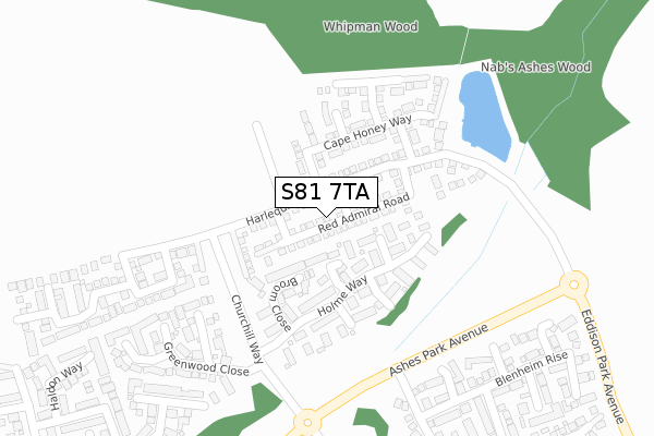
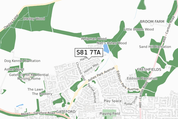
S81 7TA is located in the Worksop North electoral ward, within the local authority district of Bassetlaw and the English Parliamentary constituency of Bassetlaw. The Sub Integrated Care Board (ICB) Location is NHS Nottingham and Nottinghamshire ICB - 02Q and the police force is Nottinghamshire. This postcode has been in use since August 2018.


GetTheData
Source: OS Open Zoomstack (Ordnance Survey)
Licence: Open Government Licence (requires attribution)
Attribution: Contains OS data © Crown copyright and database right 2024
Source: Open Postcode Geo
Licence: Open Government Licence (requires attribution)
Attribution: Contains OS data © Crown copyright and database right 2024; Contains Royal Mail data © Royal Mail copyright and database right 2024; Source: Office for National Statistics licensed under the Open Government Licence v.3.0
| Easting | 457948 |
| Northing | 382249 |
| Latitude | 53.334006 |
| Longitude | -1.131276 |
GetTheData
Source: Open Postcode Geo
Licence: Open Government Licence
| Country | England |
| Postcode District | S81 |
| ➜ S81 open data dashboard ➜ See where S81 is on a map ➜ Where is Worksop? | |
GetTheData
Source: Land Registry Price Paid Data
Licence: Open Government Licence
| Ward | Worksop North |
| Constituency | Bassetlaw |
GetTheData
Source: ONS Postcode Database
Licence: Open Government Licence
2022 15 JUL £295,000 |
33, RED ADMIRAL ROAD, WORKSOP, S81 7TA 2020 21 AUG £217,995 |
17, RED ADMIRAL ROAD, WORKSOP, S81 7TA 2019 26 APR £209,995 |
19, RED ADMIRAL ROAD, WORKSOP, S81 7TA 2019 18 APR £209,995 |
15, RED ADMIRAL ROAD, WORKSOP, S81 7TA 2018 20 DEC £246,995 |
2018 13 DEC £245,995 |
3, RED ADMIRAL ROAD, WORKSOP, S81 7TA 2018 28 JUN £259,995 |
GetTheData
Source: HM Land Registry Price Paid Data
Licence: Contains HM Land Registry data © Crown copyright and database right 2024. This data is licensed under the Open Government Licence v3.0.
| June 2022 | Public order | On or near Cotterhill Close | 83m |
| June 2022 | Violence and sexual offences | On or near Cotterhill Close | 83m |
| June 2022 | Anti-social behaviour | On or near Lerwick Close | 325m |
| ➜ Get more crime data in our Crime section | |||
GetTheData
Source: data.police.uk
Licence: Open Government Licence
| Ashes Park Avenue | Gateford | 400m |
| Ashes Park Avenue | Gateford | 466m |
| Eddison Park Avenue | Worksop | 467m |
| Eddison Park Avenue | Worksop | 527m |
| Keswick Road | Worksop | 594m |
| Worksop Station | 2.6km |
| Shireoaks Station | 2.7km |
GetTheData
Source: NaPTAN
Licence: Open Government Licence
| Percentage of properties with Next Generation Access | 100.0% |
| Percentage of properties with Superfast Broadband | 100.0% |
| Percentage of properties with Ultrafast Broadband | 100.0% |
| Percentage of properties with Full Fibre Broadband | 92.3% |
Superfast Broadband is between 30Mbps and 300Mbps
Ultrafast Broadband is > 300Mbps
| Percentage of properties unable to receive 2Mbps | 0.0% |
| Percentage of properties unable to receive 5Mbps | 0.0% |
| Percentage of properties unable to receive 10Mbps | 0.0% |
| Percentage of properties unable to receive 30Mbps | 0.0% |
GetTheData
Source: Ofcom
Licence: Ofcom Terms of Use (requires attribution)
GetTheData
Source: ONS Postcode Database
Licence: Open Government Licence


➜ Get more ratings from the Food Standards Agency
GetTheData
Source: Food Standards Agency
Licence: FSA terms & conditions
| Last Collection | |||
|---|---|---|---|
| Location | Mon-Fri | Sat | Distance |
| Ashes Park Avenue | 16:00 | 10:00 | 311m |
| Keswick Road | 16:00 | 10:30 | 767m |
| Gateford Road | 16:45 | 10:30 | 898m |
GetTheData
Source: Dracos
Licence: Creative Commons Attribution-ShareAlike
| Facility | Distance |
|---|---|
| Raymoth Lane Playing Field Coniston Road, Worksop Grass Pitches | 795m |
| St John's Church Of England Academy Raymoth Lane, Worksop Artificial Grass Pitch | 947m |
| Prospect Hill Junior School Westway, Worksop Grass Pitches | 1.7km |
GetTheData
Source: Active Places
Licence: Open Government Licence
| School | Phase of Education | Distance |
|---|---|---|
| Gateford Park Primary School Amherst Rise, Gateford Park, Worksop, S81 7RG | Primary | 685m |
| St John's CofE Academy Raymoth Lane, Worksop, S81 7LU | Primary | 928m |
| Prospect Hill Junior School Maple Drive, Worksop, S81 0LR | Primary | 1.6km |
GetTheData
Source: Edubase
Licence: Open Government Licence
The below table lists the International Territorial Level (ITL) codes (formerly Nomenclature of Territorial Units for Statistics (NUTS) codes) and Local Administrative Units (LAU) codes for S81 7TA:
| ITL 1 Code | Name |
|---|---|
| TLF | East Midlands (England) |
| ITL 2 Code | Name |
| TLF1 | Derbyshire and Nottinghamshire |
| ITL 3 Code | Name |
| TLF15 | North Nottinghamshire |
| LAU 1 Code | Name |
| E07000171 | Bassetlaw |
GetTheData
Source: ONS Postcode Directory
Licence: Open Government Licence
The below table lists the Census Output Area (OA), Lower Layer Super Output Area (LSOA), and Middle Layer Super Output Area (MSOA) for S81 7TA:
| Code | Name | |
|---|---|---|
| OA | E00142907 | |
| LSOA | E01028047 | Bassetlaw 006B |
| MSOA | E02005840 | Bassetlaw 006 |
GetTheData
Source: ONS Postcode Directory
Licence: Open Government Licence
| S81 7QX | Cotterhill Close | 55m |
| S81 7QY | Peak Hill Close | 79m |
| S81 7NZ | Holme Way | 131m |
| S81 7QU | Nuthatch Crescent | 143m |
| S81 7QZ | Broom Close | 166m |
| S81 7QG | Woodpecker Close | 166m |
| S81 7RD | Rosewood Close | 279m |
| S81 7NH | Lerwick Close | 304m |
| S81 7RB | Greenwood Close | 338m |
| S81 7NL | Gibson Court | 365m |
GetTheData
Source: Open Postcode Geo; Land Registry Price Paid Data
Licence: Open Government Licence