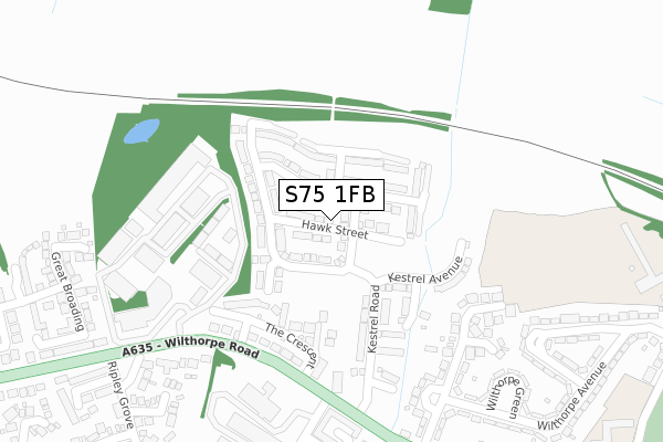
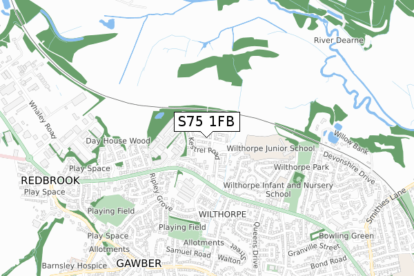
S75 1FB is located in the Darton West electoral ward, within the metropolitan district of Barnsley and the English Parliamentary constituency of Barnsley Central. The Sub Integrated Care Board (ICB) Location is NHS South Yorkshire ICB - 02P and the police force is South Yorkshire. This postcode has been in use since August 2017.


GetTheData
Source: OS Open Zoomstack (Ordnance Survey)
Licence: Open Government Licence (requires attribution)
Attribution: Contains OS data © Crown copyright and database right 2024
Source: Open Postcode Geo
Licence: Open Government Licence (requires attribution)
Attribution: Contains OS data © Crown copyright and database right 2024; Contains Royal Mail data © Royal Mail copyright and database right 2024; Source: Office for National Statistics licensed under the Open Government Licence v.3.0
| Easting | 433091 |
| Northing | 408020 |
| Latitude | 53.567770 |
| Longitude | -1.501824 |
GetTheData
Source: Open Postcode Geo
Licence: Open Government Licence
| Country | England |
| Postcode District | S75 |
| ➜ S75 open data dashboard ➜ See where S75 is on a map ➜ Where is Redbrook? | |
GetTheData
Source: Land Registry Price Paid Data
Licence: Open Government Licence
| Ward | Darton West |
| Constituency | Barnsley Central |
GetTheData
Source: ONS Postcode Database
Licence: Open Government Licence
59, HAWK STREET, BARNSLEY, S75 1FB 2018 30 NOV £199,950 |
9, HAWK STREET, BARNSLEY, S75 1FB 2018 16 APR £186,950 |
2, HAWK STREET, BARNSLEY, S75 1FB 2018 23 JAN £224,950 |
1, HAWK STREET, BARNSLEY, S75 1FB 2017 21 DEC £186,950 |
4, HAWK STREET, BARNSLEY, S75 1FB 2017 26 OCT £229,950 |
GetTheData
Source: HM Land Registry Price Paid Data
Licence: Contains HM Land Registry data © Crown copyright and database right 2024. This data is licensed under the Open Government Licence v3.0.
| October 2023 | Violence and sexual offences | On or near Ripley Grove | 436m |
| February 2023 | Burglary | On or near Ripley Grove | 436m |
| June 2022 | Other crime | On or near The Crescent | 186m |
| ➜ Get more crime data in our Crime section | |||
GetTheData
Source: data.police.uk
Licence: Open Government Licence
| The Crescent (Wilthorpe Road) | Wilthorpe | 235m |
| Innovation Way (Wilthorpe Road) | Wilthorpe | 252m |
| Ripley Grove (Wilthorpe Road) | Wilthorpe | 321m |
| Ripley Grove (Wilthorpe Road) | Wilthorpe | 354m |
| Rowland Road (Huddersfield Road) | Wilthorpe | 415m |
| Barnsley Station | 2.2km |
| Darton Station | 3km |
| Dodworth Station | 3.3km |
GetTheData
Source: NaPTAN
Licence: Open Government Licence
➜ Broadband speed and availability dashboard for S75 1FB
| Percentage of properties with Next Generation Access | 94.9% |
| Percentage of properties with Superfast Broadband | 94.9% |
| Percentage of properties with Ultrafast Broadband | 94.9% |
| Percentage of properties with Full Fibre Broadband | 74.4% |
Superfast Broadband is between 30Mbps and 300Mbps
Ultrafast Broadband is > 300Mbps
| Median download speed | 100.0Mbps |
| Average download speed | 103.6Mbps |
| Maximum download speed | 200.00Mbps |
| Median upload speed | 1.0Mbps |
| Average upload speed | 0.9Mbps |
| Maximum upload speed | 1.09Mbps |
| Percentage of properties unable to receive 2Mbps | 0.0% |
| Percentage of properties unable to receive 5Mbps | 0.0% |
| Percentage of properties unable to receive 10Mbps | 0.0% |
| Percentage of properties unable to receive 30Mbps | 5.1% |
➜ Broadband speed and availability dashboard for S75 1FB
GetTheData
Source: Ofcom
Licence: Ofcom Terms of Use (requires attribution)
GetTheData
Source: ONS Postcode Database
Licence: Open Government Licence


➜ Get more ratings from the Food Standards Agency
GetTheData
Source: Food Standards Agency
Licence: FSA terms & conditions
| Last Collection | |||
|---|---|---|---|
| Location | Mon-Fri | Sat | Distance |
| Huddersfield Road | 16:00 | 11:30 | 331m |
| Post Office | 17:10 | 11:30 | 626m |
| 23 Devonshire Drive | 17:00 | 11:45 | 814m |
GetTheData
Source: Dracos
Licence: Creative Commons Attribution-ShareAlike
| Facility | Distance |
|---|---|
| Barnsley Lawn Tennis Club The Crescent, Barnsley Outdoor Tennis Courts | 150m |
| Wilthorpe Primary School Greenfoot Lane, Barnsley Grass Pitches | 502m |
| Harry Road Recreation Ground Walton Street North, Old Town, Barnsley Grass Pitches | 589m |
GetTheData
Source: Active Places
Licence: Open Government Licence
| School | Phase of Education | Distance |
|---|---|---|
| Wilthorpe Primary School Greenfoot Lane, Barnsley, S75 1EG | Primary | 501m |
| Summer Lane Primary Summer Lane, Barnsley, S75 2BB | Primary | 1.1km |
| Gawber Primary School Church Street, Gawber, Barnsley, S75 2RJ | Primary | 1.3km |
GetTheData
Source: Edubase
Licence: Open Government Licence
The below table lists the International Territorial Level (ITL) codes (formerly Nomenclature of Territorial Units for Statistics (NUTS) codes) and Local Administrative Units (LAU) codes for S75 1FB:
| ITL 1 Code | Name |
|---|---|
| TLE | Yorkshire and The Humber |
| ITL 2 Code | Name |
| TLE3 | South Yorkshire |
| ITL 3 Code | Name |
| TLE31 | Barnsley, Doncaster and Rotherham |
| LAU 1 Code | Name |
| E08000016 | Barnsley |
GetTheData
Source: ONS Postcode Directory
Licence: Open Government Licence
The below table lists the Census Output Area (OA), Lower Layer Super Output Area (LSOA), and Middle Layer Super Output Area (MSOA) for S75 1FB:
| Code | Name | |
|---|---|---|
| OA | E00037415 | |
| LSOA | E01007381 | Barnsley 012C |
| MSOA | E02001520 | Barnsley 012 |
GetTheData
Source: ONS Postcode Directory
Licence: Open Government Licence
| S75 1JH | The Crescent | 159m |
| S75 1JQ | Wilthorpe Road | 208m |
| S75 1ES | Wilthorpe Farm Road | 271m |
| S75 1EW | Wilthorpe Avenue | 283m |
| S75 1ET | Moorbank Close | 302m |
| S75 1JF | Wilthorpe Road | 317m |
| S75 1EL | Wilthorpe Avenue | 347m |
| S75 1EN | Wilthorpe Green | 356m |
| S75 1HB | Huddersfield Road | 366m |
| S75 2RT | Wilthorpe Lane | 374m |
GetTheData
Source: Open Postcode Geo; Land Registry Price Paid Data
Licence: Open Government Licence