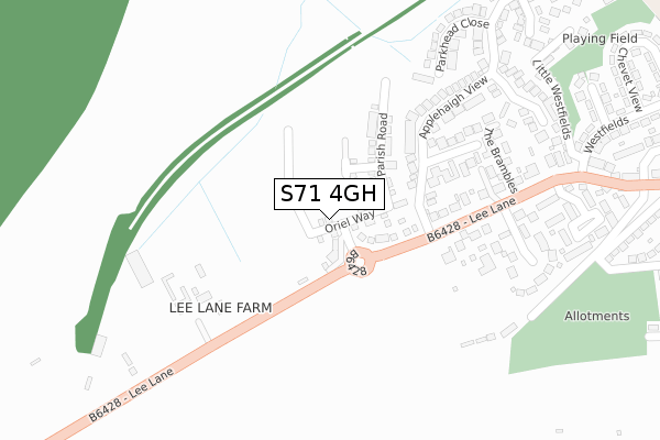
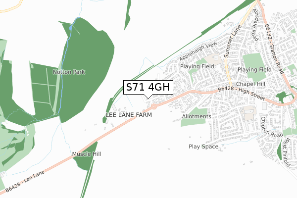
S71 4GH is located in the Royston electoral ward, within the metropolitan district of Barnsley and the English Parliamentary constituency of Barnsley Central. The Sub Integrated Care Board (ICB) Location is NHS South Yorkshire ICB - 02P and the police force is South Yorkshire. This postcode has been in use since March 2019.


GetTheData
Source: OS Open Zoomstack (Ordnance Survey)
Licence: Open Government Licence (requires attribution)
Attribution: Contains OS data © Crown copyright and database right 2024
Source: Open Postcode Geo
Licence: Open Government Licence (requires attribution)
Attribution: Contains OS data © Crown copyright and database right 2024; Contains Royal Mail data © Royal Mail copyright and database right 2024; Source: Office for National Statistics licensed under the Open Government Licence v.3.0
| Easting | 434938 |
| Northing | 411404 |
| Latitude | 53.598065 |
| Longitude | -1.473560 |
GetTheData
Source: Open Postcode Geo
Licence: Open Government Licence
| Country | England |
| Postcode District | S71 |
| ➜ S71 open data dashboard ➜ See where S71 is on a map ➜ Where is Royston? | |
GetTheData
Source: Land Registry Price Paid Data
Licence: Open Government Licence
| Ward | Royston |
| Constituency | Barnsley Central |
GetTheData
Source: ONS Postcode Database
Licence: Open Government Licence
2023 28 APR £310,000 |
2020 29 OCT £180,000 |
2020 14 AUG £185,000 |
4, ORIEL WAY, ROYSTON, BARNSLEY, S71 4GH 2019 19 JUL £279,995 |
2, ORIEL WAY, ROYSTON, BARNSLEY, S71 4GH 2019 28 JUN £249,995 |
3, ORIEL WAY, ROYSTON, BARNSLEY, S71 4GH 2019 28 JUN £254,995 |
1, ORIEL WAY, ROYSTON, BARNSLEY, S71 4GH 2019 28 JUN £214,995 |
2019 28 JUN £184,995 |
9, ORIEL WAY, ROYSTON, BARNSLEY, S71 4GH 2019 28 JUN £229,995 |
8, ORIEL WAY, ROYSTON, BARNSLEY, S71 4GH 2019 24 MAY £249,995 |
GetTheData
Source: HM Land Registry Price Paid Data
Licence: Contains HM Land Registry data © Crown copyright and database right 2024. This data is licensed under the Open Government Licence v3.0.
| December 2023 | Violence and sexual offences | On or near West End Crescent | 463m |
| December 2023 | Other crime | On or near West End Crescent | 463m |
| December 2023 | Other crime | On or near West End Crescent | 463m |
| ➜ Get more crime data in our Crime section | |||
GetTheData
Source: data.police.uk
Licence: Open Government Licence
| Applehaigh View (Lee Lane) | Royston | 133m |
| West End Avenue (High Street) | Royston | 570m |
| Manor Grove (Meadstead Drive) | Royston | 632m |
| Summer Lane (High Street) | Royston | 703m |
| Doles Avenue (Meadstead Drive) | Royston | 741m |
| Darton Station | 4km |
| Barnsley Station | 4.9km |
GetTheData
Source: NaPTAN
Licence: Open Government Licence
| Percentage of properties with Next Generation Access | 100.0% |
| Percentage of properties with Superfast Broadband | 100.0% |
| Percentage of properties with Ultrafast Broadband | 100.0% |
| Percentage of properties with Full Fibre Broadband | 100.0% |
Superfast Broadband is between 30Mbps and 300Mbps
Ultrafast Broadband is > 300Mbps
| Percentage of properties unable to receive 2Mbps | 0.0% |
| Percentage of properties unable to receive 5Mbps | 0.0% |
| Percentage of properties unable to receive 10Mbps | 0.0% |
| Percentage of properties unable to receive 30Mbps | 0.0% |
GetTheData
Source: Ofcom
Licence: Ofcom Terms of Use (requires attribution)
GetTheData
Source: ONS Postcode Database
Licence: Open Government Licence
➜ Get more ratings from the Food Standards Agency
GetTheData
Source: Food Standards Agency
Licence: FSA terms & conditions
| Last Collection | |||
|---|---|---|---|
| Location | Mon-Fri | Sat | Distance |
| 72 Applehaigh View | 16:45 | 10:45 | 532m |
| 235 Midland Road | 16:45 | 10:30 | 911m |
| 120 Station Road | 16:45 | 10:45 | 1,162m |
GetTheData
Source: Dracos
Licence: Creative Commons Attribution-ShareAlike
| Facility | Distance |
|---|---|
| Summerfields Primary Academy Haigh Croft, Royston, Barnsley Grass Pitches | 672m |
| Meadstead Primary Academy Meadstead Drive, Royston, Barnsley Grass Pitches | 864m |
| Oakwood Playing Fields Oakwood Road, Royston, Barnsley Grass Pitches | 939m |
GetTheData
Source: Active Places
Licence: Open Government Licence
| School | Phase of Education | Distance |
|---|---|---|
| Summerfields Primary Academy Haigh Croft Summer Lane, Royston, Barnsley, S71 4SF | Primary | 679m |
| Meadstead Primary Academy Meadstead Drive, Royston, Barnsley, S71 4JS | Primary | 883m |
| Parkside Primary Academy Midland Road, Royston, Barnsley, S71 4QP | Primary | 1.4km |
GetTheData
Source: Edubase
Licence: Open Government Licence
The below table lists the International Territorial Level (ITL) codes (formerly Nomenclature of Territorial Units for Statistics (NUTS) codes) and Local Administrative Units (LAU) codes for S71 4GH:
| ITL 1 Code | Name |
|---|---|
| TLE | Yorkshire and The Humber |
| ITL 2 Code | Name |
| TLE3 | South Yorkshire |
| ITL 3 Code | Name |
| TLE31 | Barnsley, Doncaster and Rotherham |
| LAU 1 Code | Name |
| E08000016 | Barnsley |
GetTheData
Source: ONS Postcode Directory
Licence: Open Government Licence
The below table lists the Census Output Area (OA), Lower Layer Super Output Area (LSOA), and Middle Layer Super Output Area (MSOA) for S71 4GH:
| Code | Name | |
|---|---|---|
| OA | E00037668 | |
| LSOA | E01007439 | Barnsley 001D |
| MSOA | E02001509 | Barnsley 001 |
GetTheData
Source: ONS Postcode Directory
Licence: Open Government Licence
| S71 4RT | Lee Lane | 188m |
| S71 4ER | Applehaigh Grove | 229m |
| S71 4TB | Orchard Drive | 259m |
| S71 4TA | The Brambles | 288m |
| S71 4JG | Applehaigh View | 320m |
| S71 4RG | Henderson Glen | 334m |
| S71 4JH | Tanfield Close | 340m |
| S71 4LT | Parkhead Close | 342m |
| S71 4RQ | The Pastures | 365m |
| S71 4RE | Railway Court | 420m |
GetTheData
Source: Open Postcode Geo; Land Registry Price Paid Data
Licence: Open Government Licence