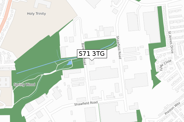
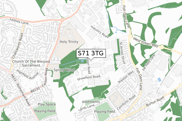
S71 3TG is located in the St Helens electoral ward, within the metropolitan district of Barnsley and the English Parliamentary constituency of Barnsley Central. The Sub Integrated Care Board (ICB) Location is NHS South Yorkshire ICB - 02P and the police force is South Yorkshire. This postcode has been in use since March 2018.


GetTheData
Source: OS Open Zoomstack (Ordnance Survey)
Licence: Open Government Licence (requires attribution)
Attribution: Contains OS data © Crown copyright and database right 2024
Source: Open Postcode Geo
Licence: Open Government Licence (requires attribution)
Attribution: Contains OS data © Crown copyright and database right 2024; Contains Royal Mail data © Royal Mail copyright and database right 2024; Source: Office for National Statistics licensed under the Open Government Licence v.3.0
| Easting | 436346 |
| Northing | 408884 |
| Latitude | 53.575321 |
| Longitude | -1.452579 |
GetTheData
Source: Open Postcode Geo
Licence: Open Government Licence
| Country | England |
| Postcode District | S71 |
| ➜ S71 open data dashboard ➜ See where S71 is on a map ➜ Where is Carlton? | |
GetTheData
Source: Land Registry Price Paid Data
Licence: Open Government Licence
| Ward | St Helens |
| Constituency | Barnsley Central |
GetTheData
Source: ONS Postcode Database
Licence: Open Government Licence
| June 2022 | Criminal damage and arson | On or near Humberside Way | 208m |
| June 2022 | Other theft | On or near Humberside Way | 208m |
| June 2022 | Burglary | On or near Humberside Way | 208m |
| ➜ Get more crime data in our Crime section | |||
GetTheData
Source: data.police.uk
Licence: Open Government Licence
| Albion Road (Industry Road) | Carlton | 447m |
| St Michaels School Bus Park | Athersley South | 527m |
| Derwent Road (Carlton Road) | Athersley South | 540m |
| Kirkham Place (Fish Dam Lane) | Monk Bretton | 543m |
| Baycliff Close (Fish Dam Lane) | Monk Bretton | 552m |
| Barnsley Station | 2.8km |
GetTheData
Source: NaPTAN
Licence: Open Government Licence
GetTheData
Source: ONS Postcode Database
Licence: Open Government Licence

➜ Get more ratings from the Food Standards Agency
GetTheData
Source: Food Standards Agency
Licence: FSA terms & conditions
| Last Collection | |||
|---|---|---|---|
| Location | Mon-Fri | Sat | Distance |
| Industry Road | 18:30 | 458m | |
| 13 King Edward Street | 17:00 | 10:30 | 658m |
| Derwent Road | 16:30 | 11:30 | 800m |
GetTheData
Source: Dracos
Licence: Creative Commons Attribution-ShareAlike
| Facility | Distance |
|---|---|
| St Dominic's Catholic Primary School (Closed) Carlton Road, Barnsley Grass Pitches | 392m |
| St Michael's Catholic & Church Of England High School (Closed) Carlton Road, Barnsley Grass Pitches, Sports Hall | 463m |
| Springwell Learning Community St. Helens Boulevard, Barnsley Health and Fitness Gym, Sports Hall, Artificial Grass Pitch, Grass Pitches, Outdoor Tennis Courts | 498m |
GetTheData
Source: Active Places
Licence: Open Government Licence
| School | Phase of Education | Distance |
|---|---|---|
| Holy Trinity Catholic and Church of England School Carlton Road, Barnsley, S71 2LF | All-through | 463m |
| Springwell Special Academy St Helen's Boulevard, Carlton Road, Barnsley, S71 2AY | Not applicable | 597m |
| St Helen's Primary Academy St Helen's Way, Monk Bretton, Barnsley, S71 2PS | Primary | 600m |
GetTheData
Source: Edubase
Licence: Open Government Licence
The below table lists the International Territorial Level (ITL) codes (formerly Nomenclature of Territorial Units for Statistics (NUTS) codes) and Local Administrative Units (LAU) codes for S71 3TG:
| ITL 1 Code | Name |
|---|---|
| TLE | Yorkshire and The Humber |
| ITL 2 Code | Name |
| TLE3 | South Yorkshire |
| ITL 3 Code | Name |
| TLE31 | Barnsley, Doncaster and Rotherham |
| LAU 1 Code | Name |
| E08000016 | Barnsley |
GetTheData
Source: ONS Postcode Directory
Licence: Open Government Licence
The below table lists the Census Output Area (OA), Lower Layer Super Output Area (LSOA), and Middle Layer Super Output Area (MSOA) for S71 3TG:
| Code | Name | |
|---|---|---|
| OA | E00037532 | |
| LSOA | E01007406 | Barnsley 009E |
| MSOA | E02001517 | Barnsley 009 |
GetTheData
Source: ONS Postcode Directory
Licence: Open Government Licence
| S71 3HS | Shawfield Road | 304m |
| S71 2SF | Rainford Drive | 376m |
| S71 2SN | Fylde Close | 400m |
| S71 2SA | St Annes Drive | 437m |
| S71 2SE | Poulton Street | 449m |
| S71 2SB | St Annes Drive | 456m |
| S71 2BX | Fulmer Close | 483m |
| S71 2SG | Edenfield Close | 483m |
| S71 2BW | Aldbury Close | 493m |
| S71 2SQ | Baycliff Close | 497m |
GetTheData
Source: Open Postcode Geo; Land Registry Price Paid Data
Licence: Open Government Licence