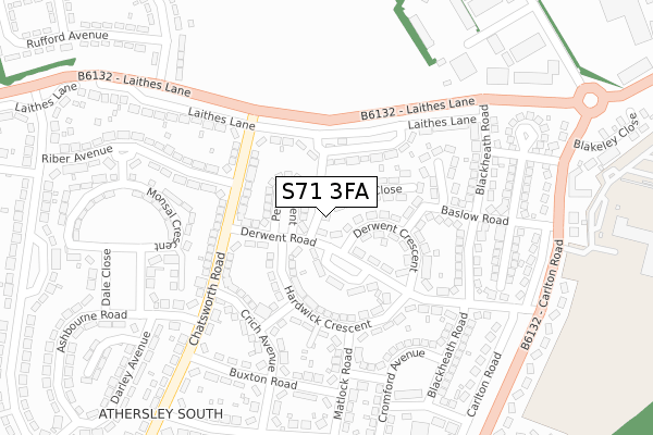
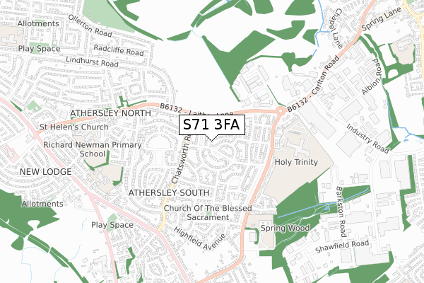
S71 3FA is located in the St Helens electoral ward, within the metropolitan district of Barnsley and the English Parliamentary constituency of Barnsley Central. The Sub Integrated Care Board (ICB) Location is NHS South Yorkshire ICB - 02P and the police force is South Yorkshire. This postcode has been in use since November 2018.


GetTheData
Source: OS Open Zoomstack (Ordnance Survey)
Licence: Open Government Licence (requires attribution)
Attribution: Contains OS data © Crown copyright and database right 2024
Source: Open Postcode Geo
Licence: Open Government Licence (requires attribution)
Attribution: Contains OS data © Crown copyright and database right 2024; Contains Royal Mail data © Royal Mail copyright and database right 2024; Source: Office for National Statistics licensed under the Open Government Licence v.3.0
| Easting | 435545 |
| Northing | 409262 |
| Latitude | 53.578773 |
| Longitude | -1.464632 |
GetTheData
Source: Open Postcode Geo
Licence: Open Government Licence
| Country | England |
| Postcode District | S71 |
| ➜ S71 open data dashboard ➜ See where S71 is on a map ➜ Where is Barnsley? | |
GetTheData
Source: Land Registry Price Paid Data
Licence: Open Government Licence
| Ward | St Helens |
| Constituency | Barnsley Central |
GetTheData
Source: ONS Postcode Database
Licence: Open Government Licence
| January 2024 | Other crime | On or near Wingfield Road | 441m |
| January 2024 | Violence and sexual offences | On or near Wingfield Road | 441m |
| January 2024 | Violence and sexual offences | On or near Wingfield Road | 441m |
| ➜ Get more crime data in our Crime section | |||
GetTheData
Source: data.police.uk
Licence: Open Government Licence
| Peveril Crescent (Derwent Road) | Athersley South | 67m |
| Derwent Crescent (Derwent Road) | Athersley South | 121m |
| Riber Avenue (Chatsworth Road) | Athersley South | 139m |
| Riber Avenue (Chatsworth Road) | Athersley South | 162m |
| Chatsworth Road (Laithes Lane) | Athersley South | 174m |
| Barnsley Station | 2.8km |
| Darton Station | 4.6km |
| Dodworth Station | 5.9km |
GetTheData
Source: NaPTAN
Licence: Open Government Licence
| Percentage of properties with Next Generation Access | 100.0% |
| Percentage of properties with Superfast Broadband | 100.0% |
| Percentage of properties with Ultrafast Broadband | 0.0% |
| Percentage of properties with Full Fibre Broadband | 0.0% |
Superfast Broadband is between 30Mbps and 300Mbps
Ultrafast Broadband is > 300Mbps
| Percentage of properties unable to receive 2Mbps | 0.0% |
| Percentage of properties unable to receive 5Mbps | 0.0% |
| Percentage of properties unable to receive 10Mbps | 0.0% |
| Percentage of properties unable to receive 30Mbps | 0.0% |
GetTheData
Source: Ofcom
Licence: Ofcom Terms of Use (requires attribution)
GetTheData
Source: ONS Postcode Database
Licence: Open Government Licence


➜ Get more ratings from the Food Standards Agency
GetTheData
Source: Food Standards Agency
Licence: FSA terms & conditions
| Last Collection | |||
|---|---|---|---|
| Location | Mon-Fri | Sat | Distance |
| Derwent Road | 16:30 | 11:30 | 101m |
| 107 Laithes Lane | 16:30 | 11:30 | 514m |
| 61 Lindhurst Road | 16:00 | 11:30 | 601m |
GetTheData
Source: Dracos
Licence: Creative Commons Attribution-ShareAlike
| Facility | Distance |
|---|---|
| Wharncliffe Woodmoor Memorial Field Laithes Lane, Barnsley Grass Pitches | 217m |
| St Michael's Catholic & Church Of England High School (Closed) Carlton Road, Barnsley Grass Pitches, Sports Hall | 435m |
| Carlton Community College (Closed) Carlton Road, Barnsley Sports Hall, Health and Fitness Gym, Grass Pitches | 441m |
GetTheData
Source: Active Places
Licence: Open Government Licence
| School | Phase of Education | Distance |
|---|---|---|
| Holy Trinity Catholic and Church of England School Carlton Road, Barnsley, S71 2LF | All-through | 435m |
| Athersley South Primary School Wakefield Road, Smithies, Barnsley, S71 3TP | Primary | 681m |
| Laithes Primary School Laithes Lane, Smithies, Barnsley, S71 3AF | Primary | 723m |
GetTheData
Source: Edubase
Licence: Open Government Licence
The below table lists the International Territorial Level (ITL) codes (formerly Nomenclature of Territorial Units for Statistics (NUTS) codes) and Local Administrative Units (LAU) codes for S71 3FA:
| ITL 1 Code | Name |
|---|---|
| TLE | Yorkshire and The Humber |
| ITL 2 Code | Name |
| TLE3 | South Yorkshire |
| ITL 3 Code | Name |
| TLE31 | Barnsley, Doncaster and Rotherham |
| LAU 1 Code | Name |
| E08000016 | Barnsley |
GetTheData
Source: ONS Postcode Directory
Licence: Open Government Licence
The below table lists the Census Output Area (OA), Lower Layer Super Output Area (LSOA), and Middle Layer Super Output Area (MSOA) for S71 3FA:
| Code | Name | |
|---|---|---|
| OA | E00037135 | |
| LSOA | E01007327 | Barnsley 007E |
| MSOA | E02001515 | Barnsley 007 |
GetTheData
Source: ONS Postcode Directory
Licence: Open Government Licence
| S71 3QS | Peveril Crescent | 92m |
| S71 3QT | Derwent Road | 102m |
| S71 3QU | Derwent Crescent | 109m |
| S71 3QX | Hardwick Crescent | 122m |
| S71 3QW | Chatsworth Road | 129m |
| S71 3AJ | Laithes Lane | 129m |
| S71 3QP | Chatsworth Road | 141m |
| S71 3QY | Hardwick Crescent | 144m |
| S71 3AN | Laithes Lane | 156m |
| S71 3RF | Baslow Road | 161m |
GetTheData
Source: Open Postcode Geo; Land Registry Price Paid Data
Licence: Open Government Licence