Property/Postcode Data Search:
S4 7ER maps, stats, and open data
S4 7ER is located in the Darnall electoral ward, within the metropolitan district of Sheffield and the English Parliamentary constituency of Sheffield South East. The Sub Integrated Care Board (ICB) Location is NHS South Yorkshire ICB - 03N and the police force is South Yorkshire. This postcode has been in use since September 2019.
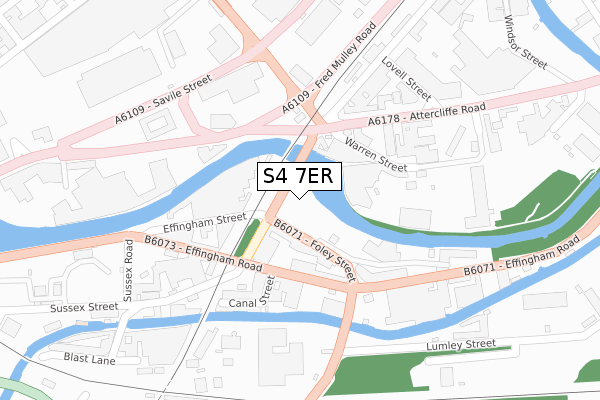
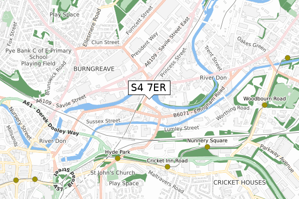
S4 7ER maps


Source: OS Open Zoomstack (Ordnance Survey)
Licence: Open Government Licence (requires attribution)
Attribution: Contains OS data © Crown copyright and database right 2025
Source: Open Postcode Geo
Licence: Open Government Licence (requires attribution)
Attribution: Contains OS data © Crown copyright and database right 2025; Contains Royal Mail data © Royal Mail copyright and database right 2025; Source: Office for National Statistics licensed under the Open Government Licence v.3.0
Licence: Open Government Licence (requires attribution)
Attribution: Contains OS data © Crown copyright and database right 2025
Source: Open Postcode Geo
Licence: Open Government Licence (requires attribution)
Attribution: Contains OS data © Crown copyright and database right 2025; Contains Royal Mail data © Royal Mail copyright and database right 2025; Source: Office for National Statistics licensed under the Open Government Licence v.3.0
S4 7ER geodata
| Easting | 436737 |
| Northing | 388175 |
| Latitude | 53.389161 |
| Longitude | -1.449087 |
Where is S4 7ER?
| Country | England |
| Postcode District | S4 |
Politics
| Ward | Darnall |
|---|---|
| Constituency | Sheffield South East |
Transport
Nearest bus stops to S4 7ER
| Norfolk Bridge (Attercliffe Road) | Attercliffe | 153m |
| Princess Street (Attercliffe Road) | Attercliffe | 160m |
| Warren Street (Attercliffe Road) | Attercliffe | 161m |
| 12 O Clock Court (Savile Street) | Atlas | 330m |
| Windsor Street (Corby Street) | Atlas | 359m |
Nearest underground/metro/tram to S4 7ER
| Hyde Park (Sheffield Supertram) (Cricket Inn Road) | Hyde Park | 550m |
| Cricket Inn Road (Sheffield Supertram) (Cricket Inn Road) | Park Hill | 594m |
| Nunnery Square (Sheffield Supertram) (Nunnery Square) | Attercliffe | 633m |
| Woodbourn Road (Sheffield Supertram) (Woodbourn Road) | Attercliffe | 967m |
| Fitzalan Sq - Ponds Forge (Sheffield Supertram) (Commercial Street) | Sheffield Centre | 1,187m |
Nearest railway stations to S4 7ER
| Sheffield Station | 1.5km |
| Darnall Station | 2.5km |
| Meadowhall Station | 4km |
Deprivation
95.5% of English postcodes are less deprived than S4 7ER:Food Standards Agency
Three nearest food hygiene ratings to S4 7ER (metres)
Effingham Road Sandwich Shop

The Effing Sandwich Shop
114m
Cath's Cafe

Unit 10 Clarence Works
169m
Paradise Studio
Effingham Street
213m
➜ Get more ratings from the Food Standards Agency
Nearest post box to S4 7ER
| Last Collection | |||
|---|---|---|---|
| Location | Mon-Fri | Sat | Distance |
| Washford Road | 17:30 | 10:30 | 613m |
| Cricket Inn Road | 17:45 | 09:30 | 660m |
| St Johns Road | 17:30 | 09:00 | 665m |
Environment
| Risk of S4 7ER flooding from rivers and sea | Medium |
S4 7ER ITL and S4 7ER LAU
The below table lists the International Territorial Level (ITL) codes (formerly Nomenclature of Territorial Units for Statistics (NUTS) codes) and Local Administrative Units (LAU) codes for S4 7ER:
| ITL 1 Code | Name |
|---|---|
| TLE | Yorkshire and The Humber |
| ITL 2 Code | Name |
| TLE3 | South Yorkshire |
| ITL 3 Code | Name |
| TLE32 | Sheffield |
| LAU 1 Code | Name |
| E08000019 | Sheffield |
S4 7ER census areas
The below table lists the Census Output Area (OA), Lower Layer Super Output Area (LSOA), and Middle Layer Super Output Area (MSOA) for S4 7ER:
| Code | Name | |
|---|---|---|
| OA | E00172428 | |
| LSOA | E01033269 | Sheffield 022G |
| MSOA | E02001632 | Sheffield 022 |
Nearest postcodes to S4 7ER
| S4 7YS | Effingham Road | 119m |
| S4 7WW | Attercliffe Road | 251m |
| S4 7WZ | Attercliffe Road | 263m |
| S4 7YY | Sussex Street | 306m |
| S4 7UW | Princess Street | 341m |
| S4 7YT | Effingham Road | 358m |
| S4 7UL | Savile Street | 379m |
| S4 7WB | Windsor Street | 406m |
| S4 7UD | Savile Street | 485m |
| S4 7LB | Sorby Street | 557m |