Property/Postcode Data Search:
S35 2PS maps, stats, and open data
S35 2PS is located in the West Ecclesfield electoral ward, within the metropolitan district of Sheffield and the English Parliamentary constituency of Penistone and Stocksbridge. The Sub Integrated Care Board (ICB) Location is NHS South Yorkshire ICB - 03N and the police force is South Yorkshire. This postcode has been in use since November 2018.
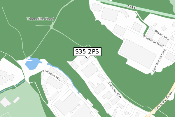
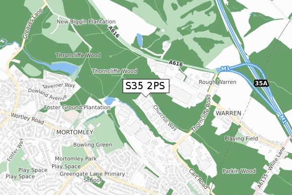
S35 2PS maps


Source: OS Open Zoomstack (Ordnance Survey)
Licence: Open Government Licence (requires attribution)
Attribution: Contains OS data © Crown copyright and database right 2025
Source: Open Postcode Geo
Licence: Open Government Licence (requires attribution)
Attribution: Contains OS data © Crown copyright and database right 2025; Contains Royal Mail data © Royal Mail copyright and database right 2025; Source: Office for National Statistics licensed under the Open Government Licence v.3.0
Licence: Open Government Licence (requires attribution)
Attribution: Contains OS data © Crown copyright and database right 2025
Source: Open Postcode Geo
Licence: Open Government Licence (requires attribution)
Attribution: Contains OS data © Crown copyright and database right 2025; Contains Royal Mail data © Royal Mail copyright and database right 2025; Source: Office for National Statistics licensed under the Open Government Licence v.3.0
S35 2PS geodata
| Easting | 434876 |
| Northing | 397864 |
| Latitude | 53.476373 |
| Longitude | -1.475998 |
Where is S35 2PS?
| Country | England |
| Postcode District | S35 |
Politics
| Ward | West Ecclesfield |
|---|---|
| Constituency | Penistone And Stocksbridge |
Transport
Nearest bus stops to S35 2PS
| Brookdale Road Terminus (Brookdale Road) | Warren | 311m |
| Thorncliffe Works (Thorncliffe Road) | Chapeltown | 470m |
| Thorncliffe Road (Brookdale Road) | Warren | 471m |
| Thorncliffe Works (Thorncliffe Road) | Chapeltown | 480m |
| Thorncliffe Road (Warren Lane) | Warren | 604m |
Nearest railway stations to S35 2PS
| Chapeltown Station | 1.7km |
| Elsecar Station | 4.1km |
| Wombwell Station | 6km |
Deprivation
20.1% of English postcodes are less deprived than S35 2PS:Food Standards Agency
Three nearest food hygiene ratings to S35 2PS (metres)
Interserve Catering Services

XPO Logistics
390m
Thorncliffe Park Day Nursery

Thorncliffe Park Day Nursery Churchills
390m
Churchills Cafe

Cafe Churchills
390m
➜ Get more ratings from the Food Standards Agency
Nearest post box to S35 2PS
| Last Collection | |||
|---|---|---|---|
| Location | Mon-Fri | Sat | Distance |
| Thorncliffe Park Estate | 18:30 | 631m | |
| Thorncliffe Park Estate | 18:30 | 11:45 | 632m |
| 110 Mortomley Lane | 17:30 | 11:30 | 720m |
Environment
| Risk of S35 2PS flooding from rivers and sea | Low |
S35 2PS ITL and S35 2PS LAU
The below table lists the International Territorial Level (ITL) codes (formerly Nomenclature of Territorial Units for Statistics (NUTS) codes) and Local Administrative Units (LAU) codes for S35 2PS:
| ITL 1 Code | Name |
|---|---|
| TLE | Yorkshire and The Humber |
| ITL 2 Code | Name |
| TLE3 | South Yorkshire |
| ITL 3 Code | Name |
| TLE32 | Sheffield |
| LAU 1 Code | Name |
| E08000019 | Sheffield |
S35 2PS census areas
The below table lists the Census Output Area (OA), Lower Layer Super Output Area (LSOA), and Middle Layer Super Output Area (MSOA) for S35 2PS:
| Code | Name | |
|---|---|---|
| OA | E00172527 | |
| LSOA | E01007889 | Sheffield 004B |
| MSOA | E02001614 | Sheffield 004 |
Nearest postcodes to S35 2PS
| S35 2PY | Churchill Way | 292m |
| S35 3XZ | Ironstone Drive | 523m |
| S35 3HZ | Mortomley Close | 617m |
| S35 4LG | Park Lane | 619m |
| S35 3XW | Ironstone Crescent | 624m |
| S35 3XX | Thorncliffe Lane | 635m |
| S35 4DX | Dowland Close | 637m |
| S35 3XT | Ironstone Crescent | 653m |
| S35 3HS | Mortomley Lane | 660m |
| S35 3XU | Thorncliffe View | 684m |