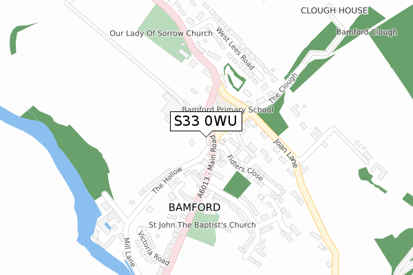
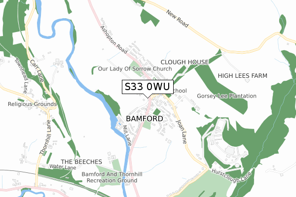
S33 0WU is located in the Hope Valley electoral ward, within the local authority district of High Peak and the English Parliamentary constituency of High Peak. The Sub Integrated Care Board (ICB) Location is NHS Derby and Derbyshire ICB - 15M and the police force is Derbyshire. This postcode has been in use since November 2017.


GetTheData
Source: OS Open Zoomstack (Ordnance Survey)
Licence: Open Government Licence (requires attribution)
Attribution: Contains OS data © Crown copyright and database right 2024
Source: Open Postcode Geo
Licence: Open Government Licence (requires attribution)
Attribution: Contains OS data © Crown copyright and database right 2024; Contains Royal Mail data © Royal Mail copyright and database right 2024; Source: Office for National Statistics licensed under the Open Government Licence v.3.0
| Easting | 420756 |
| Northing | 383559 |
| Latitude | 53.348536 |
| Longitude | -1.689672 |
GetTheData
Source: Open Postcode Geo
Licence: Open Government Licence
| Country | England |
| Postcode District | S33 |
| ➜ S33 open data dashboard ➜ See where S33 is on a map ➜ Where is Bamford? | |
GetTheData
Source: Land Registry Price Paid Data
Licence: Open Government Licence
| Ward | Hope Valley |
| Constituency | High Peak |
GetTheData
Source: ONS Postcode Database
Licence: Open Government Licence
| October 2023 | Anti-social behaviour | On or near Victoria Road | 307m |
| January 2023 | Burglary | On or near Victoria Road | 307m |
| May 2022 | Criminal damage and arson | On or near Fidlers Close | 123m |
| ➜ Get more crime data in our Crime section | |||
GetTheData
Source: data.police.uk
Licence: Open Government Licence
| Derwent Hotel (Main Road) | Bamford | 82m |
| Derwent Hotel (Main Road) | Bamford | 85m |
| Institute (Main Road) | Bamford | 101m |
| Greenhead Park (Ashopton Road) | Bamford | 245m |
| Victoria Road (Main Road) | Bamford | 290m |
| Bamford Station | 1.1km |
| Hope (Derbyshire) Station | 2.7km |
| Hathersage Station | 3.6km |
GetTheData
Source: NaPTAN
Licence: Open Government Licence
GetTheData
Source: ONS Postcode Database
Licence: Open Government Licence


➜ Get more ratings from the Food Standards Agency
GetTheData
Source: Food Standards Agency
Licence: FSA terms & conditions
| Last Collection | |||
|---|---|---|---|
| Location | Mon-Fri | Sat | Distance |
| Bamford Post Office | 16:30 | 12:15 | 42m |
| West Lees Road | 16:00 | 08:30 | 266m |
| Thornhill | 16:00 | 09:00 | 918m |
GetTheData
Source: Dracos
Licence: Creative Commons Attribution-ShareAlike
| Facility | Distance |
|---|---|
| Bamford Tennis Club Station Road, Bamford Outdoor Tennis Courts | 609m |
| Bamford With Thornhill Recreation Ground Water Lane, Bamford, Hope Valley Grass Pitches | 712m |
| Sickleholme Golf Club Station Road, Bamford, Hope Valley Golf | 969m |
GetTheData
Source: Active Places
Licence: Open Government Licence
| School | Phase of Education | Distance |
|---|---|---|
| Bamford Primary School Fidlers Well, Bamford, Hope Valley, S33 0AR | Primary | 76m |
| Hathersage St Michael's CofE (Aided) Primary School School Lane, Hathersage, Hope Valley, S32 1BZ | Primary | 3.3km |
| Hope Primary School Edale Road, Hope, Hope Valley, S33 6ZF | Primary | 3.6km |
GetTheData
Source: Edubase
Licence: Open Government Licence
The below table lists the International Territorial Level (ITL) codes (formerly Nomenclature of Territorial Units for Statistics (NUTS) codes) and Local Administrative Units (LAU) codes for S33 0WU:
| ITL 1 Code | Name |
|---|---|
| TLF | East Midlands (England) |
| ITL 2 Code | Name |
| TLF1 | Derbyshire and Nottinghamshire |
| ITL 3 Code | Name |
| TLF13 | South and West Derbyshire |
| LAU 1 Code | Name |
| E07000037 | High Peak |
GetTheData
Source: ONS Postcode Directory
Licence: Open Government Licence
The below table lists the Census Output Area (OA), Lower Layer Super Output Area (LSOA), and Middle Layer Super Output Area (MSOA) for S33 0WU:
| Code | Name | |
|---|---|---|
| OA | E00099857 | |
| LSOA | E01019735 | High Peak 013A |
| MSOA | E02006872 | High Peak 013 |
GetTheData
Source: ONS Postcode Directory
Licence: Open Government Licence
| S33 0AA | Main Road | 36m |
| S33 0AT | The Green | 52m |
| S33 0DY | Old Post Office Row | 57m |
| S33 0BL | South View | 62m |
| S33 0AR | Fidlers Well | 87m |
| S33 0AP | The Croft | 90m |
| S33 0BZ | Fidlers Close | 110m |
| S33 0BD | St Johns Close | 143m |
| S33 0BQ | Anglers Rest Bungalows | 145m |
| S33 0DU | The Hollow | 167m |
GetTheData
Source: Open Postcode Geo; Land Registry Price Paid Data
Licence: Open Government Licence