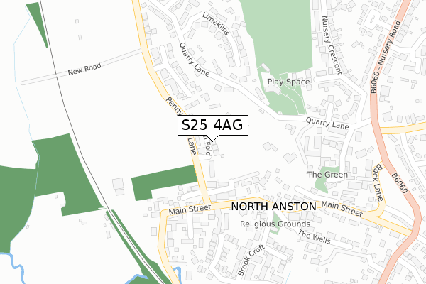
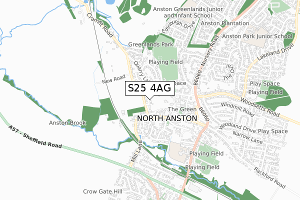
S25 4AG is located in the Anston & Woodsetts electoral ward, within the metropolitan district of Rotherham and the English Parliamentary constituency of Rother Valley. The Sub Integrated Care Board (ICB) Location is NHS South Yorkshire ICB - 03L and the police force is South Yorkshire. This postcode has been in use since September 2019.


GetTheData
Source: OS Open Zoomstack (Ordnance Survey)
Licence: Open Government Licence (requires attribution)
Attribution: Contains OS data © Crown copyright and database right 2024
Source: Open Postcode Geo
Licence: Open Government Licence (requires attribution)
Attribution: Contains OS data © Crown copyright and database right 2024; Contains Royal Mail data © Royal Mail copyright and database right 2024; Source: Office for National Statistics licensed under the Open Government Licence v.3.0
| Easting | 451620 |
| Northing | 384686 |
| Latitude | 53.356563 |
| Longitude | -1.225895 |
GetTheData
Source: Open Postcode Geo
Licence: Open Government Licence
| Country | England |
| Postcode District | S25 |
| ➜ S25 open data dashboard ➜ See where S25 is on a map ➜ Where is North Anston? | |
GetTheData
Source: Land Registry Price Paid Data
Licence: Open Government Licence
| Ward | Anston & Woodsetts |
| Constituency | Rother Valley |
GetTheData
Source: ONS Postcode Database
Licence: Open Government Licence
2023 1 MAR £615,000 |
5, RYTON FOLD, NORTH ANSTON, SHEFFIELD, S25 4AG 2020 27 NOV £434,999 |
2, RYTON FOLD, NORTH ANSTON, SHEFFIELD, S25 4AG 2020 4 SEP £475,500 |
4, RYTON FOLD, NORTH ANSTON, SHEFFIELD, S25 4AG 2020 1 JUL £454,999 |
7, RYTON FOLD, NORTH ANSTON, SHEFFIELD, S25 4AG 2020 12 MAY £439,999 |
3, RYTON FOLD, NORTH ANSTON, SHEFFIELD, S25 4AG 2020 7 FEB £443,999 |
2019 20 DEC £500,000 |
6, RYTON FOLD, NORTH ANSTON, SHEFFIELD, S25 4AG 2019 2 DEC £544,999 |
GetTheData
Source: HM Land Registry Price Paid Data
Licence: Contains HM Land Registry data © Crown copyright and database right 2024. This data is licensed under the Open Government Licence v3.0.
| June 2022 | Anti-social behaviour | On or near Quarry Lane | 134m |
| June 2022 | Anti-social behaviour | On or near Limekilns | 243m |
| June 2022 | Vehicle crime | On or near Hall Close | 319m |
| ➜ Get more crime data in our Crime section | |||
GetTheData
Source: data.police.uk
Licence: Open Government Licence
| Quarry Lane (Nursery Road) | North Anston | 418m |
| Woodsetts Road (Nursery Road) | North Anston | 452m |
| Nursery Road (Woodsetts Road) | North Anston | 471m |
| Back Lane (Nursery Road) | North Anston | 541m |
| Nursery Crescent (Nursery Road) | North Anston | 552m |
| Kiveton Park Station | 2.4km |
| Kiveton Bridge Station | 3.2km |
| Shireoaks Station | 5.2km |
GetTheData
Source: NaPTAN
Licence: Open Government Licence
GetTheData
Source: ONS Postcode Database
Licence: Open Government Licence


➜ Get more ratings from the Food Standards Agency
GetTheData
Source: Food Standards Agency
Licence: FSA terms & conditions
| Last Collection | |||
|---|---|---|---|
| Location | Mon-Fri | Sat | Distance |
| 42 Main Street | 17:45 | 12:45 | 267m |
| 77 Quarry Lane | 18:00 | 12:45 | 315m |
| Nursery Crescent | 17:30 | 12:00 | 533m |
GetTheData
Source: Dracos
Licence: Creative Commons Attribution-ShareAlike
| Facility | Distance |
|---|---|
| Greenlands Park Nursery Crescent, North Anston, Sheffield Grass Pitches | 302m |
| Anston Brook Primary School Ryton Road, North Anston, Sheffield Grass Pitches | 578m |
| Anston Recreation Ground Ryton Road, North Anston, Sheffield Grass Pitches | 709m |
GetTheData
Source: Active Places
Licence: Open Government Licence
| School | Phase of Education | Distance |
|---|---|---|
| Anston Brook Primary School Ryton Road, North Anston, Sheffield, S25 4DN | Primary | 595m |
| Anston Greenlands Primary School Edinburgh Drive, North Anston, Sheffield, S25 4HD | Primary | 812m |
| Anston Park Junior School Park Avenue, North Anston, Sheffield, S25 2QZ | Primary | 968m |
GetTheData
Source: Edubase
Licence: Open Government Licence
The below table lists the International Territorial Level (ITL) codes (formerly Nomenclature of Territorial Units for Statistics (NUTS) codes) and Local Administrative Units (LAU) codes for S25 4AG:
| ITL 1 Code | Name |
|---|---|
| TLE | Yorkshire and The Humber |
| ITL 2 Code | Name |
| TLE3 | South Yorkshire |
| ITL 3 Code | Name |
| TLE31 | Barnsley, Doncaster and Rotherham |
| LAU 1 Code | Name |
| E08000018 | Rotherham |
GetTheData
Source: ONS Postcode Directory
Licence: Open Government Licence
The below table lists the Census Output Area (OA), Lower Layer Super Output Area (LSOA), and Middle Layer Super Output Area (MSOA) for S25 4AG:
| Code | Name | |
|---|---|---|
| OA | E00038797 | |
| LSOA | E01007658 | Rotherham 032A |
| MSOA | E02001609 | Rotherham 032 |
GetTheData
Source: ONS Postcode Directory
Licence: Open Government Licence
| S25 4JZ | Penny Piece Place | 127m |
| S25 4BF | Poplar View | 152m |
| S25 4FT | Lodge Farm Close | 155m |
| S25 4DB | Quarry Lane | 169m |
| S25 4FW | Lodge Farm Mews | 184m |
| S25 4FB | Limekilns | 216m |
| S25 4JF | Penny Piece Lane | 234m |
| S25 4BE | Main Street | 239m |
| S25 4FU | Mill Haven | 254m |
| S25 4BB | Peacock Lane | 277m |
GetTheData
Source: Open Postcode Geo; Land Registry Price Paid Data
Licence: Open Government Licence