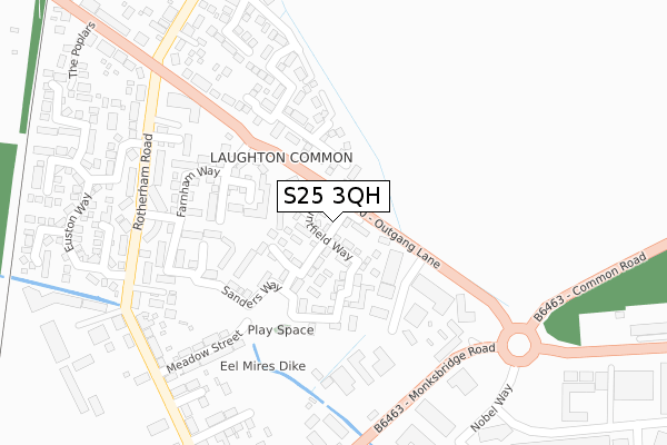
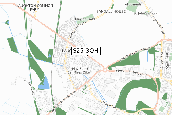
S25 3QH is located in the Dinnington electoral ward, within the metropolitan district of Rotherham and the English Parliamentary constituency of Rother Valley. The Sub Integrated Care Board (ICB) Location is NHS South Yorkshire ICB - 03L and the police force is South Yorkshire. This postcode has been in use since October 2017.


GetTheData
Source: OS Open Zoomstack (Ordnance Survey)
Licence: Open Government Licence (requires attribution)
Attribution: Contains OS data © Crown copyright and database right 2024
Source: Open Postcode Geo
Licence: Open Government Licence (requires attribution)
Attribution: Contains OS data © Crown copyright and database right 2024; Contains Royal Mail data © Royal Mail copyright and database right 2024; Source: Office for National Statistics licensed under the Open Government Licence v.3.0
| Easting | 451454 |
| Northing | 386932 |
| Latitude | 53.376765 |
| Longitude | -1.228024 |
GetTheData
Source: Open Postcode Geo
Licence: Open Government Licence
| Country | England |
| Postcode District | S25 |
| ➜ S25 open data dashboard ➜ See where S25 is on a map | |
GetTheData
Source: Land Registry Price Paid Data
Licence: Open Government Licence
| Ward | Dinnington |
| Constituency | Rother Valley |
GetTheData
Source: ONS Postcode Database
Licence: Open Government Licence
| November 2022 | Anti-social behaviour | On or near St Leger Close | 145m |
| October 2022 | Violence and sexual offences | On or near Euston Way | 380m |
| August 2022 | Other crime | On or near St Leger Close | 145m |
| ➜ Get more crime data in our Crime section | |||
GetTheData
Source: data.police.uk
Licence: Open Government Licence
| Outgang Lane (Monks Bridge Road) | Laughton Common | 286m |
| Outgang Lane (Monks Bridge Road) | Laughton Common | 297m |
| Station Road (Rotherham Road) | Laughton Common | 318m |
| Baker Street (Rotherham Road) | Laughton Common | 321m |
| Meadow Street (Rotherham Road) | Laughton Common | 354m |
| Kiveton Park Station | 4.5km |
| Kiveton Bridge Station | 4.8km |
GetTheData
Source: NaPTAN
Licence: Open Government Licence
GetTheData
Source: ONS Postcode Database
Licence: Open Government Licence


➜ Get more ratings from the Food Standards Agency
GetTheData
Source: Food Standards Agency
Licence: FSA terms & conditions
| Last Collection | |||
|---|---|---|---|
| Location | Mon-Fri | Sat | Distance |
| Laughton Common Post Office | 17:15 | 11:15 | 372m |
| Limelands Road | 17:00 | 11:15 | 1,006m |
| 88 Breck Lane | 17:15 | 11:30 | 1,138m |
GetTheData
Source: Dracos
Licence: Creative Commons Attribution-ShareAlike
| Facility | Distance |
|---|---|
| New Pace Fitness Centre (Closed) Outgang Lane, Dinnington, Sheffield Health and Fitness Gym | 229m |
| Hangsman Lane Recreation Ground All Saints Meadows, Laughton Common, Dinnington, Sheffield Grass Pitches | 565m |
| Laughton Junior & Infant School School Road, Laughton, Sheffield Grass Pitches | 974m |
GetTheData
Source: Active Places
Licence: Open Government Licence
| School | Phase of Education | Distance |
|---|---|---|
| Laughton Junior and Infant School School Road, Laughton-en-le-Morthen, Sheffield, S25 1YP | Primary | 983m |
| Laughton All Saints' CofE Primary School High Street, Laughton-en-le-Morthen, Sheffield, S25 1YF | Primary | 1.4km |
| Elements Academy Doe Quarry Lane, Dinnington, Sheffield, S25 2NF | Not applicable | 1.4km |
GetTheData
Source: Edubase
Licence: Open Government Licence
The below table lists the International Territorial Level (ITL) codes (formerly Nomenclature of Territorial Units for Statistics (NUTS) codes) and Local Administrative Units (LAU) codes for S25 3QH:
| ITL 1 Code | Name |
|---|---|
| TLE | Yorkshire and The Humber |
| ITL 2 Code | Name |
| TLE3 | South Yorkshire |
| ITL 3 Code | Name |
| TLE31 | Barnsley, Doncaster and Rotherham |
| LAU 1 Code | Name |
| E08000018 | Rotherham |
GetTheData
Source: ONS Postcode Directory
Licence: Open Government Licence
The below table lists the Census Output Area (OA), Lower Layer Super Output Area (LSOA), and Middle Layer Super Output Area (MSOA) for S25 3QH:
| Code | Name | |
|---|---|---|
| OA | E00168774 | |
| LSOA | E01007787 | Rotherham 028A |
| MSOA | E02001605 | Rotherham 028 |
GetTheData
Source: ONS Postcode Directory
Licence: Open Government Licence
| S25 3QJ | Fallon Close | 22m |
| S25 3QQ | Mountfield Way | 23m |
| S25 3QG | Frankham Close | 85m |
| S25 3QR | Blakeney Mews | 93m |
| S25 3QP | Carson Avenue | 97m |
| S25 3RQ | St Leger Close | 106m |
| S25 3QF | Sanders Way | 110m |
| S25 3AB | Barrow Way | 121m |
| S25 3SJ | Dettori Mews | 133m |
| S25 3AE | Hatfield Grove | 160m |
GetTheData
Source: Open Postcode Geo; Land Registry Price Paid Data
Licence: Open Government Licence