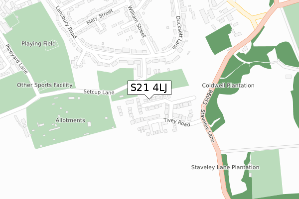
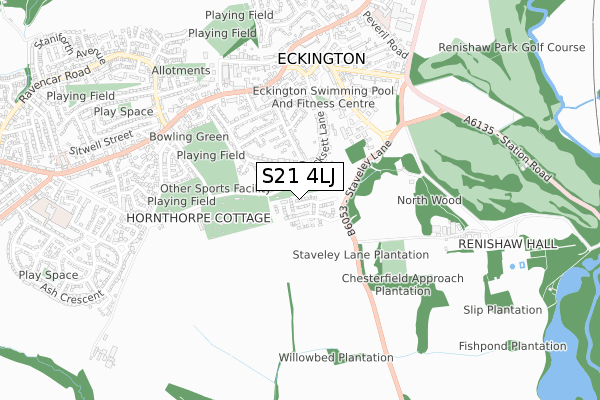
S21 4LJ is located in the Eckington South & Renishaw electoral ward, within the local authority district of North East Derbyshire and the English Parliamentary constituency of North East Derbyshire. The Sub Integrated Care Board (ICB) Location is NHS Derby and Derbyshire ICB - 15M and the police force is Derbyshire. This postcode has been in use since October 2018.


GetTheData
Source: OS Open Zoomstack (Ordnance Survey)
Licence: Open Government Licence (requires attribution)
Attribution: Contains OS data © Crown copyright and database right 2024
Source: Open Postcode Geo
Licence: Open Government Licence (requires attribution)
Attribution: Contains OS data © Crown copyright and database right 2024; Contains Royal Mail data © Royal Mail copyright and database right 2024; Source: Office for National Statistics licensed under the Open Government Licence v.3.0
| Easting | 442903 |
| Northing | 378775 |
| Latitude | 53.304211 |
| Longitude | -1.357651 |
GetTheData
Source: Open Postcode Geo
Licence: Open Government Licence
| Country | England |
| Postcode District | S21 |
| ➜ S21 open data dashboard ➜ See where S21 is on a map ➜ Where is Eckington? | |
GetTheData
Source: Land Registry Price Paid Data
Licence: Open Government Licence
| Ward | Eckington South & Renishaw |
| Constituency | North East Derbyshire |
GetTheData
Source: ONS Postcode Database
Licence: Open Government Licence
2021 30 APR £320,000 |
14, BERRISFORD AVENUE, ECKINGTON, SHEFFIELD, S21 4LJ 2019 1 NOV £305,000 |
18, BERRISFORD AVENUE, ECKINGTON, SHEFFIELD, S21 4LJ 2019 20 SEP £295,000 |
8, BERRISFORD AVENUE, ECKINGTON, SHEFFIELD, S21 4LJ 2019 30 AUG £320,000 |
2019 28 JUN £320,000 |
16, BERRISFORD AVENUE, ECKINGTON, SHEFFIELD, S21 4LJ 2019 28 JUN £295,000 |
12, BERRISFORD AVENUE, ECKINGTON, SHEFFIELD, S21 4LJ 2019 28 JUN £305,000 |
6, BERRISFORD AVENUE, ECKINGTON, SHEFFIELD, S21 4LJ 2019 23 MAY £330,000 |
5, BERRISFORD AVENUE, ECKINGTON, SHEFFIELD, S21 4LJ 2019 10 MAY £305,000 |
4, BERRISFORD AVENUE, ECKINGTON, SHEFFIELD, S21 4LJ 2019 3 MAY £305,000 |
GetTheData
Source: HM Land Registry Price Paid Data
Licence: Contains HM Land Registry data © Crown copyright and database right 2024. This data is licensed under the Open Government Licence v3.0.
| June 2022 | Violence and sexual offences | On or near Ducksett Lane | 289m |
| June 2022 | Violence and sexual offences | On or near Ducksett Lane | 289m |
| June 2022 | Violence and sexual offences | On or near Edward Street | 327m |
| ➜ Get more crime data in our Crime section | |||
GetTheData
Source: data.police.uk
Licence: Open Government Licence
| Southgate | Eckington | 428m |
| School Street (High Street) | Eckington | 513m |
| School Street (High Street) | Eckington | 526m |
| Station Road (Southgate) | Eckington | 534m |
| Station Road | Eckington | 590m |
GetTheData
Source: NaPTAN
Licence: Open Government Licence
| Percentage of properties with Next Generation Access | 100.0% |
| Percentage of properties with Superfast Broadband | 100.0% |
| Percentage of properties with Ultrafast Broadband | 100.0% |
| Percentage of properties with Full Fibre Broadband | 100.0% |
Superfast Broadband is between 30Mbps and 300Mbps
Ultrafast Broadband is > 300Mbps
| Percentage of properties unable to receive 2Mbps | 0.0% |
| Percentage of properties unable to receive 5Mbps | 0.0% |
| Percentage of properties unable to receive 10Mbps | 0.0% |
| Percentage of properties unable to receive 30Mbps | 0.0% |
GetTheData
Source: Ofcom
Licence: Ofcom Terms of Use (requires attribution)
GetTheData
Source: ONS Postcode Database
Licence: Open Government Licence

➜ Get more ratings from the Food Standards Agency
GetTheData
Source: Food Standards Agency
Licence: FSA terms & conditions
| Last Collection | |||
|---|---|---|---|
| Location | Mon-Fri | Sat | Distance |
| High Street | 16:00 | 09:30 | 557m |
| Eckington Post Office | 17:30 | 09:00 | 595m |
| Greenhall Road | 17:30 | 09:15 | 857m |
GetTheData
Source: Dracos
Licence: Creative Commons Attribution-ShareAlike
| Facility | Distance |
|---|---|
| Eckington Swimming Pool Gosber Street, Eckington, Sheffield Swimming Pool, Health and Fitness Gym, Studio | 458m |
| Eckington Cricket Club Renishaw Park, Renishaw, Sheffield Grass Pitches | 462m |
| Pitt Street Recreation Ground Eckington, Sheffield Grass Pitches | 492m |
GetTheData
Source: Active Places
Licence: Open Government Licence
| School | Phase of Education | Distance |
|---|---|---|
| Eckington Junior School School Street, Eckington, Sheffield, S21 4FL | Primary | 620m |
| Camms CofE (Aided) Primary School Camms Close, Castle Hill, Eckington, Chesterfield, S21 4AU | Primary | 919m |
| Landmarks Littlemoor House, Littlemoor, Eckington, Sheffield, S21 4EF | Not applicable | 958m |
GetTheData
Source: Edubase
Licence: Open Government Licence
The below table lists the International Territorial Level (ITL) codes (formerly Nomenclature of Territorial Units for Statistics (NUTS) codes) and Local Administrative Units (LAU) codes for S21 4LJ:
| ITL 1 Code | Name |
|---|---|
| TLF | East Midlands (England) |
| ITL 2 Code | Name |
| TLF1 | Derbyshire and Nottinghamshire |
| ITL 3 Code | Name |
| TLF12 | East Derbyshire |
| LAU 1 Code | Name |
| E07000038 | North East Derbyshire |
GetTheData
Source: ONS Postcode Directory
Licence: Open Government Licence
The below table lists the Census Output Area (OA), Lower Layer Super Output Area (LSOA), and Middle Layer Super Output Area (MSOA) for S21 4LJ:
| Code | Name | |
|---|---|---|
| OA | E00100157 | |
| LSOA | E01019791 | North East Derbyshire 014A |
| MSOA | E02006804 | North East Derbyshire 014 |
GetTheData
Source: ONS Postcode Directory
Licence: Open Government Licence
| S21 4AN | Barratt Road | 102m |
| S21 4DB | Hardie Street | 243m |
| S21 4BS | Ducksett Lane | 246m |
| S21 4DX | Joseph Street | 277m |
| S21 4GD | William Street | 278m |
| S21 4EA | Lansbury Road | 295m |
| S21 4EN | Mary Street | 314m |
| S21 4EB | Lansbury Road | 315m |
| S21 4BT | Edward Street | 341m |
| S21 4DU | John Street | 382m |
GetTheData
Source: Open Postcode Geo; Land Registry Price Paid Data
Licence: Open Government Licence