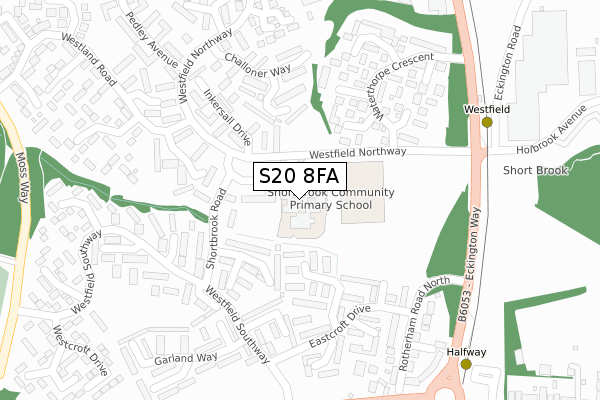
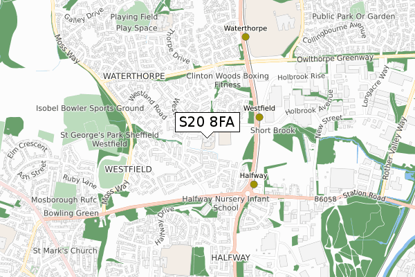
S20 8FA is located in the Mosborough electoral ward, within the metropolitan district of Sheffield and the English Parliamentary constituency of Sheffield South East. The Sub Integrated Care Board (ICB) Location is NHS South Yorkshire ICB - 03N and the police force is South Yorkshire. This postcode has been in use since October 2017.


GetTheData
Source: OS Open Zoomstack (Ordnance Survey)
Licence: Open Government Licence (requires attribution)
Attribution: Contains OS data © Crown copyright and database right 2024
Source: Open Postcode Geo
Licence: Open Government Licence (requires attribution)
Attribution: Contains OS data © Crown copyright and database right 2024; Contains Royal Mail data © Royal Mail copyright and database right 2024; Source: Office for National Statistics licensed under the Open Government Licence v.3.0
| Easting | 443483 |
| Northing | 381734 |
| Latitude | 53.330759 |
| Longitude | -1.348545 |
GetTheData
Source: Open Postcode Geo
Licence: Open Government Licence
| Country | England |
| Postcode District | S20 |
| ➜ S20 open data dashboard ➜ See where S20 is on a map | |
GetTheData
Source: Land Registry Price Paid Data
Licence: Open Government Licence
| Ward | Mosborough |
| Constituency | Sheffield South East |
GetTheData
Source: ONS Postcode Database
Licence: Open Government Licence
| January 2024 | Public order | On or near Eastcroft View | 260m |
| January 2024 | Other theft | On or near Westfield Northway | 327m |
| January 2024 | Anti-social behaviour | On or near Sandy Acres Drive | 492m |
| ➜ Get more crime data in our Crime section | |||
GetTheData
Source: data.police.uk
Licence: Open Government Licence
| Westfield Centre (Shortbrook Road) | Westfield | 121m |
| Westfield Centre (Shortbrook Road) | Westfield | 155m |
| Westland Road (Westfield Northway) | Westfield | 189m |
| Shortbrook Way (Westfield Southway) | Westfield | 213m |
| Challoner Way (Westfield Northway) | Westfield | 287m |
| Westfield (Sheffield Supertram) (Eckington Way) | Westfield | 337m |
| Halfway (Sheffield Supertram) (Eckington Way) | Halfway Tram Stop | 373m |
| Waterthorpe (Sheffield Supertram) (Eckington Way) | Waterthorpe | 680m |
| Beighton - Drake House La (Sheffield Supertram) (Off Eckington Way) | Beighton | 1,221m |
| Crystal Peaks (Sheffield Supertram) (Ochre Dike Lane) | Crystal Peaks Shopping Centre | 1,318m |
| Woodhouse Station | 3.7km |
GetTheData
Source: NaPTAN
Licence: Open Government Licence
GetTheData
Source: ONS Postcode Database
Licence: Open Government Licence


➜ Get more ratings from the Food Standards Agency
GetTheData
Source: Food Standards Agency
Licence: FSA terms & conditions
| Last Collection | |||
|---|---|---|---|
| Location | Mon-Fri | Sat | Distance |
| Westfield Southway | 16:00 | 11:30 | 234m |
| 20 Halfway Drive | 16:15 | 11:45 | 615m |
| Station Road | 17:15 | 11:00 | 665m |
GetTheData
Source: Dracos
Licence: Creative Commons Attribution-ShareAlike
| Facility | Distance |
|---|---|
| Shortbrook Primary School Westfield Northway, Westfield, Sheffield Sports Hall | 0m |
| Evolution Gym & Fitness Carley Drive, Westfield, Sheffield Health and Fitness Gym | 428m |
| Sheffield Westfield Hub Moss Way, Westfield, Sheffield Grass Pitches, Artificial Grass Pitch, Health and Fitness Gym, Studio | 586m |
GetTheData
Source: Active Places
Licence: Open Government Licence
| School | Phase of Education | Distance |
|---|---|---|
| Shortbrook Primary School Westfield Northway, Westfield, Sheffield, S20 8FB | Primary | 33m |
| Halfway Nursery Infant School Station Road, Halfway, Sheffield, S20 3GU | Primary | 384m |
| Waterthorpe Infant School Thorpe Drive, Waterthorpe, Waterthorpe Ni School, Sheffield, S20 7JU | Primary | 749m |
GetTheData
Source: Edubase
Licence: Open Government Licence
The below table lists the International Territorial Level (ITL) codes (formerly Nomenclature of Territorial Units for Statistics (NUTS) codes) and Local Administrative Units (LAU) codes for S20 8FA:
| ITL 1 Code | Name |
|---|---|
| TLE | Yorkshire and The Humber |
| ITL 2 Code | Name |
| TLE3 | South Yorkshire |
| ITL 3 Code | Name |
| TLE32 | Sheffield |
| LAU 1 Code | Name |
| E08000019 | Sheffield |
GetTheData
Source: ONS Postcode Directory
Licence: Open Government Licence
The below table lists the Census Output Area (OA), Lower Layer Super Output Area (LSOA), and Middle Layer Super Output Area (MSOA) for S20 8FA:
| Code | Name | |
|---|---|---|
| OA | E00040674 | |
| LSOA | E01008022 | Sheffield 065C |
| MSOA | E02001675 | Sheffield 065 |
GetTheData
Source: ONS Postcode Directory
Licence: Open Government Licence
| S20 8ND | Westfield Centre | 61m |
| S20 8LE | Shortbrook Close | 116m |
| S20 8LX | Waterthorpe Glade | 138m |
| S20 8LG | Shortbrook Drive | 145m |
| S20 8NJ | Challoner Green | 166m |
| S20 8LF | Shortbrook Bank | 168m |
| S20 8LD | Shortbrook Walk | 176m |
| S20 8JN | Eastcroft Way | 185m |
| S20 8NP | Cowley Gardens | 188m |
| S20 8NN | Inkersall Drive | 193m |
GetTheData
Source: Open Postcode Geo; Land Registry Price Paid Data
Licence: Open Government Licence