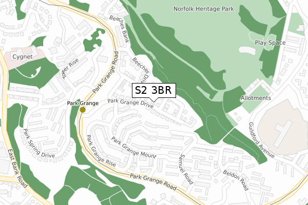
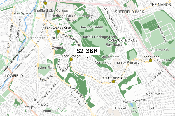
S2 3BR is located in the Park and Arbourthorne electoral ward, within the metropolitan district of Sheffield and the English Parliamentary constituency of Sheffield, Heeley. The Sub Integrated Care Board (ICB) Location is NHS South Yorkshire ICB - 03N and the police force is South Yorkshire. This postcode has been in use since December 2017.


GetTheData
Source: OS Open Zoomstack (Ordnance Survey)
Licence: Open Government Licence (requires attribution)
Attribution: Contains OS data © Crown copyright and database right 2024
Source: Open Postcode Geo
Licence: Open Government Licence (requires attribution)
Attribution: Contains OS data © Crown copyright and database right 2024; Contains Royal Mail data © Royal Mail copyright and database right 2024; Source: Office for National Statistics licensed under the Open Government Licence v.3.0
| Easting | 436542 |
| Northing | 385672 |
| Latitude | 53.366677 |
| Longitude | -1.452307 |
GetTheData
Source: Open Postcode Geo
Licence: Open Government Licence
| Country | England |
| Postcode District | S2 |
| ➜ S2 open data dashboard ➜ See where S2 is on a map ➜ Where is Sheffield? | |
GetTheData
Source: Land Registry Price Paid Data
Licence: Open Government Licence
| Ward | Park And Arbourthorne |
| Constituency | Sheffield, Heeley |
GetTheData
Source: ONS Postcode Database
Licence: Open Government Licence
43, PARK GRANGE DRIVE, SHEFFIELD, S2 3BR 2018 27 SEP £224,995 |
41, PARK GRANGE DRIVE, SHEFFIELD, S2 3BR 2018 27 SEP £224,995 |
GetTheData
Source: HM Land Registry Price Paid Data
Licence: Contains HM Land Registry data © Crown copyright and database right 2024. This data is licensed under the Open Government Licence v3.0.
| August 2023 | Other theft | On or near Park Grange Road | 190m |
| July 2023 | Criminal damage and arson | On or near Park Grange Road | 190m |
| June 2023 | Criminal damage and arson | On or near Park Grange Road | 190m |
| ➜ Get more crime data in our Crime section | |||
GetTheData
Source: data.police.uk
Licence: Open Government Licence
| Park Spring Drive (Park Grange Road) | Norfolk Park | 213m |
| Park Grange Drive (Park Grange Road) | Norfolk Park | 223m |
| Beeches Drive (Park Grange Road) | Norfolk Park | 226m |
| Park Grange View (Park Grange Road) | Norfolk Park | 252m |
| Park Grange View (Park Grange Road) | Norfolk Park | 254m |
| Park Grange (Sheffield Supertram) (Park Grange Road) | Norfolk Park | 187m |
| Arbourthorne Road (Sheffield Supertram) (Park Grange Road) | Norfolk Park | 460m |
| Park Grange Croft (Sheffield Supertram) (Off Park Grange Road) | Norfolk Park | 591m |
| Spring Lane (Sheffield Supertram) (Park Grange Road) | Fairleigh | 905m |
| Granville Rd - Sheffield College (Supertram) (Off Granville Road) | Park Hill | 1,048m |
| Sheffield Station | 1.4km |
| Darnall Station | 3.3km |
| Dore & Totley Station | 6km |
GetTheData
Source: NaPTAN
Licence: Open Government Licence
➜ Broadband speed and availability dashboard for S2 3BR
| Percentage of properties with Next Generation Access | 100.0% |
| Percentage of properties with Superfast Broadband | 100.0% |
| Percentage of properties with Ultrafast Broadband | 5.6% |
| Percentage of properties with Full Fibre Broadband | 0.0% |
Superfast Broadband is between 30Mbps and 300Mbps
Ultrafast Broadband is > 300Mbps
| Median download speed | 38.8Mbps |
| Average download speed | 34.7Mbps |
| Maximum download speed | 77.52Mbps |
| Median upload speed | 9.9Mbps |
| Average upload speed | 9.4Mbps |
| Maximum upload speed | 19.82Mbps |
| Percentage of properties unable to receive 2Mbps | 0.0% |
| Percentage of properties unable to receive 5Mbps | 0.0% |
| Percentage of properties unable to receive 10Mbps | 0.0% |
| Percentage of properties unable to receive 30Mbps | 0.0% |
➜ Broadband speed and availability dashboard for S2 3BR
GetTheData
Source: Ofcom
Licence: Ofcom Terms of Use (requires attribution)
GetTheData
Source: ONS Postcode Database
Licence: Open Government Licence


➜ Get more ratings from the Food Standards Agency
GetTheData
Source: Food Standards Agency
Licence: FSA terms & conditions
| Last Collection | |||
|---|---|---|---|
| Location | Mon-Fri | Sat | Distance |
| Park Grange Post Office | 15:00 | 12:00 | 157m |
| 1 Park Grange Road | 17:30 | 09:30 | 409m |
| Guildford Avenue | 17:00 | 10:00 | 499m |
GetTheData
Source: Dracos
Licence: Creative Commons Attribution-ShareAlike
| Facility | Distance |
|---|---|
| Norfolk Park Guildford Avenue, Sheffield Grass Pitches | 299m |
| Earl Marshall Jfc Sports Ground East Bank Road, Sheffield Grass Pitches | 444m |
| All Saints Roman Catholic High School (Grass Pitch) Norfolk Park Road, Sheffield Grass Pitches | 517m |
GetTheData
Source: Active Places
Licence: Open Government Licence
| School | Phase of Education | Distance |
|---|---|---|
| Norfolk Community Primary School Guildford Avenue, Sheffield, S2 2PJ | Primary | 432m |
| Discovery Academy Park Grange Road, Norfolk Park, Sheffield, S2 3QF | Not applicable | 433m |
| Heritage Park School Norfolk Park Road, Sheffield, S2 2RU | Not applicable | 661m |
GetTheData
Source: Edubase
Licence: Open Government Licence
The below table lists the International Territorial Level (ITL) codes (formerly Nomenclature of Territorial Units for Statistics (NUTS) codes) and Local Administrative Units (LAU) codes for S2 3BR:
| ITL 1 Code | Name |
|---|---|
| TLE | Yorkshire and The Humber |
| ITL 2 Code | Name |
| TLE3 | South Yorkshire |
| ITL 3 Code | Name |
| TLE32 | Sheffield |
| LAU 1 Code | Name |
| E08000019 | Sheffield |
GetTheData
Source: ONS Postcode Directory
Licence: Open Government Licence
The below table lists the Census Output Area (OA), Lower Layer Super Output Area (LSOA), and Middle Layer Super Output Area (MSOA) for S2 3BR:
| Code | Name | |
|---|---|---|
| OA | E00172472 | |
| LSOA | E01008095 | Sheffield 043A |
| MSOA | E02001653 | Sheffield 043 |
GetTheData
Source: ONS Postcode Directory
Licence: Open Government Licence
| S2 3UG | Samuel Road | 85m |
| S2 3SY | Park Grange Court | 109m |
| S2 3SU | Park Grange View | 147m |
| S2 3SP | Park Grange Mount | 153m |
| S2 3UB | Samuel Road | 164m |
| S2 3SQ | Park Grange Mount | 190m |
| S2 3SZ | Park Grange Rise | 210m |
| S2 3UF | Samuel Road | 216m |
| S2 3UJ | Samuel Place | 226m |
| S2 3RE | Frank Wright Close | 229m |
GetTheData
Source: Open Postcode Geo; Land Registry Price Paid Data
Licence: Open Government Licence