S10 5AF maps, stats, and open data
S10 5AF is located in the Fulwood electoral ward, within the metropolitan district of Sheffield and the English Parliamentary constituency of Sheffield, Hallam. The Sub Integrated Care Board (ICB) Location is NHS South Yorkshire ICB - 03N and the police force is South Yorkshire. This postcode has been in use since January 2018.
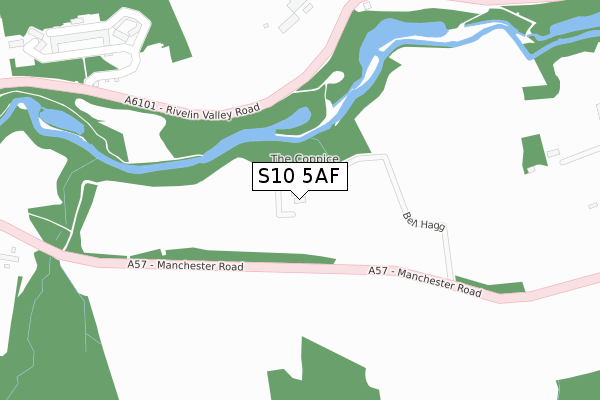
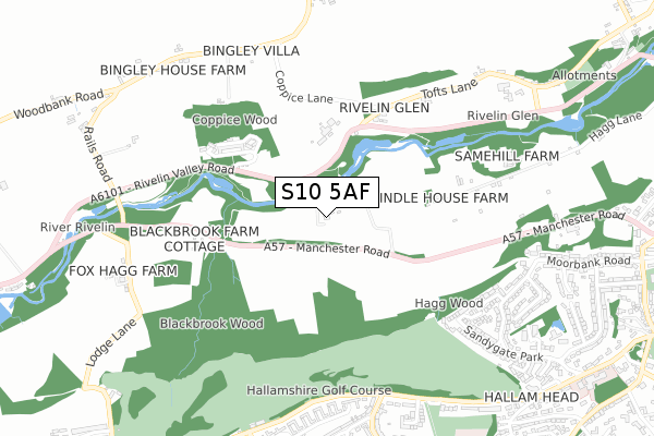
S10 5AF maps


Licence: Open Government Licence (requires attribution)
Attribution: Contains OS data © Crown copyright and database right 2025
Source: Open Postcode Geo
Licence: Open Government Licence (requires attribution)
Attribution: Contains OS data © Crown copyright and database right 2025; Contains Royal Mail data © Royal Mail copyright and database right 2025; Source: Office for National Statistics licensed under the Open Government Licence v.3.0
S10 5AF geodata
| Easting | 429950 |
| Northing | 387222 |
| Latitude | 53.381022 |
| Longitude | -1.551222 |
Where is S10 5AF?
| Country | England |
| Postcode District | S10 |
Politics
| Ward | Fulwood |
|---|---|
| Constituency | Sheffield, Hallam |
House Prices
Sales of detached houses in S10 5AF
LOW COPPICE HOUSE, MANCHESTER ROAD, SHEFFIELD, S10 5AF 2007 9 FEB £550,000 |
Licence: Contains HM Land Registry data © Crown copyright and database right 2025. This data is licensed under the Open Government Licence v3.0.
Transport
Nearest bus stops to S10 5AF
| Tofts Lane (Rivelin Valley Road) | Rivelin | 298m |
| Manchester Road | Rivelin | 302m |
| Manchester Road | Rivelin | 306m |
| Blackbrook Bridge (Manchester Road) | Rivelin | 365m |
| King Edward Hospital (Rivelin Valley Road) | Rivelin | 386m |
Broadband
Broadband access in S10 5AF (2020 data)
| Percentage of properties with Next Generation Access | 100.0% |
| Percentage of properties with Superfast Broadband | 0.0% |
| Percentage of properties with Ultrafast Broadband | 0.0% |
| Percentage of properties with Full Fibre Broadband | 0.0% |
Superfast Broadband is between 30Mbps and 300Mbps
Ultrafast Broadband is > 300Mbps
Broadband limitations in S10 5AF (2020 data)
| Percentage of properties unable to receive 2Mbps | 0.0% |
| Percentage of properties unable to receive 5Mbps | 100.0% |
| Percentage of properties unable to receive 10Mbps | 100.0% |
| Percentage of properties unable to receive 30Mbps | 100.0% |
Deprivation
59.8% of English postcodes are less deprived than S10 5AF:Food Standards Agency
Three nearest food hygiene ratings to S10 5AF (metres)


➜ Get more ratings from the Food Standards Agency
Nearest post box to S10 5AF
| Last Collection | |||
|---|---|---|---|
| Location | Mon-Fri | Sat | Distance |
| Westminster Crescent | 17:30 | 09:30 | 918m |
| Sandygate Park | 18:00 | 09:30 | 978m |
| 24 Moorbank Road | 18:00 | 09:30 | 1,013m |
S10 5AF ITL and S10 5AF LAU
The below table lists the International Territorial Level (ITL) codes (formerly Nomenclature of Territorial Units for Statistics (NUTS) codes) and Local Administrative Units (LAU) codes for S10 5AF:
| ITL 1 Code | Name |
|---|---|
| TLE | Yorkshire and The Humber |
| ITL 2 Code | Name |
| TLE3 | South Yorkshire |
| ITL 3 Code | Name |
| TLE32 | Sheffield |
| LAU 1 Code | Name |
| E08000019 | Sheffield |
S10 5AF census areas
The below table lists the Census Output Area (OA), Lower Layer Super Output Area (LSOA), and Middle Layer Super Output Area (MSOA) for S10 5AF:
| Code | Name | |
|---|---|---|
| OA | E00040274 | |
| LSOA | E01007953 | Sheffield 033B |
| MSOA | E02001643 | Sheffield 033 |
Nearest postcodes to S10 5AF
| S6 5SH | King Edwards Approach | 392m |
| S6 5SG | Rivelin Valley Road | 424m |
| S6 5SQ | King Edwards | 454m |
| S10 5TU | Burnt Stones Grove | 677m |
| S10 4ES | Westminster Avenue | 718m |
| S10 5PX | Bell Hagg | 742m |
| S6 5SL | Tofts Lane | 744m |
| S10 5TT | Burnt Stones Drive | 762m |
| S10 4ER | Westminster Avenue | 769m |
| S10 5TZ | Sandygate Park | 769m |