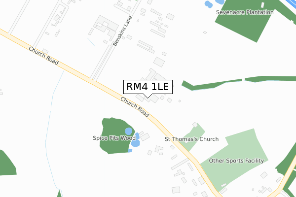
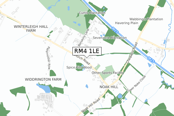
RM4 1LE is located in the Gooshays electoral ward, within the London borough of Havering and the English Parliamentary constituency of Hornchurch and Upminster. The Sub Integrated Care Board (ICB) Location is NHS North East London ICB - A3A8R and the police force is Metropolitan Police. This postcode has been in use since January 2018.


GetTheData
Source: OS Open Zoomstack (Ordnance Survey)
Licence: Open Government Licence (requires attribution)
Attribution: Contains OS data © Crown copyright and database right 2024
Source: Open Postcode Geo
Licence: Open Government Licence (requires attribution)
Attribution: Contains OS data © Crown copyright and database right 2024; Contains Royal Mail data © Royal Mail copyright and database right 2024; Source: Office for National Statistics licensed under the Open Government Licence v.3.0
| Easting | 553962 |
| Northing | 194136 |
| Latitude | 51.624987 |
| Longitude | 0.222847 |
GetTheData
Source: Open Postcode Geo
Licence: Open Government Licence
| Country | England |
| Postcode District | RM4 |
| ➜ RM4 open data dashboard ➜ See where RM4 is on a map | |
GetTheData
Source: Land Registry Price Paid Data
Licence: Open Government Licence
| Ward | Gooshays |
| Constituency | Hornchurch And Upminster |
GetTheData
Source: ONS Postcode Database
Licence: Open Government Licence
| May 2022 | Other crime | On or near Church Road | 57m |
| May 2022 | Violence and sexual offences | On or near Church Road | 57m |
| May 2022 | Violence and sexual offences | On or near Benskins Lane | 299m |
| ➜ Get more crime data in our Crime section | |||
GetTheData
Source: data.police.uk
Licence: Open Government Licence
| Wincanton Road Tees Drive (Tees Drive) | Noak Hill | 895m |
| Cummings Hall Lane (Noak Hill Road) | Noak Hill | 917m |
| Tees Drive Priory Road | Noak Hill | 1,013m |
| Priory Road (Rm3) (Tees Drive) | Noak Hill | 1,041m |
| Wincanton Road (North Hill Drive) | Noak Hill | 1,137m |
| Harold Wood Station | 3.7km |
| Gidea Park Station | 4.9km |
GetTheData
Source: NaPTAN
Licence: Open Government Licence
GetTheData
Source: ONS Postcode Database
Licence: Open Government Licence


➜ Get more ratings from the Food Standards Agency
GetTheData
Source: Food Standards Agency
Licence: FSA terms & conditions
| Last Collection | |||
|---|---|---|---|
| Location | Mon-Fri | Sat | Distance |
| Lambourne End | 17:15 | 11:30 | 644m |
| Tysea Hill | 16:30 | 11:00 | 932m |
| Liberty Cottage | 17:30 | 11:00 | 1,035m |
GetTheData
Source: Dracos
Licence: Creative Commons Attribution-ShareAlike
| Facility | Distance |
|---|---|
| Noak Hill Sports Ground Church Road, Noak Hill, Romford Grass Pitches | 368m |
| Havering College Of Further And Higher Education (Closed) Tring Gardens, Romford Grass Pitches, Sports Hall | 1.4km |
| Broxhill Centre (Closed) Broxhill Road, Havering-atte-bower, Romford Grass Pitches, Outdoor Tennis Courts, Sports Hall | 1.8km |
GetTheData
Source: Active Places
Licence: Open Government Licence
| School | Phase of Education | Distance |
|---|---|---|
| Koru Independent AP Academy 90 Taunton Road, Harold Hill, Romford, RM3 7SU | Not applicable | 1.5km |
| Drapers' Brookside Infant School Dagnam Park Drive, Harold Hill, Romford, RM3 9DJ | Primary | 1.8km |
| Drapers' Brookside Junior School Dagnam Park Drive, Harold Hill, Romford, RM3 9DJ | Primary | 1.8km |
GetTheData
Source: Edubase
Licence: Open Government Licence
The below table lists the International Territorial Level (ITL) codes (formerly Nomenclature of Territorial Units for Statistics (NUTS) codes) and Local Administrative Units (LAU) codes for RM4 1LE:
| ITL 1 Code | Name |
|---|---|
| TLI | London |
| ITL 2 Code | Name |
| TLI5 | Outer London - East and North East |
| ITL 3 Code | Name |
| TLI52 | Barking & Dagenham and Havering |
| LAU 1 Code | Name |
| E09000016 | Havering |
GetTheData
Source: ONS Postcode Directory
Licence: Open Government Licence
The below table lists the Census Output Area (OA), Lower Layer Super Output Area (LSOA), and Middle Layer Super Output Area (MSOA) for RM4 1LE:
| Code | Name | |
|---|---|---|
| OA | E00011366 | |
| LSOA | E01002276 | Havering 001A |
| MSOA | E02000464 | Havering 001 |
GetTheData
Source: ONS Postcode Directory
Licence: Open Government Licence
| RM4 1LD | Church Road | 0m |
| RM4 1LB | Benskins Lane | 327m |
| RM3 7NA | Chequers Road | 501m |
| RM3 7LT | Rose Cottages | 543m |
| RM4 1LA | Paternoster Row | 577m |
| RM3 7LS | Noak Hill Road | 578m |
| RM4 1JX | Church Road | 583m |
| RM3 7LX | Orchard Cottages | 601m |
| RM3 7LU | Meadow Cottages | 615m |
| RM3 9AJ | Tees Drive | 933m |
GetTheData
Source: Open Postcode Geo; Land Registry Price Paid Data
Licence: Open Government Licence