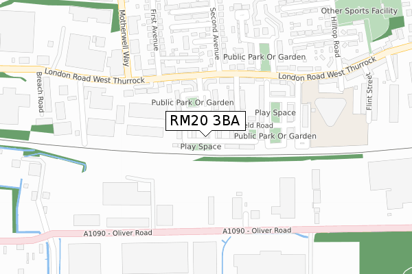
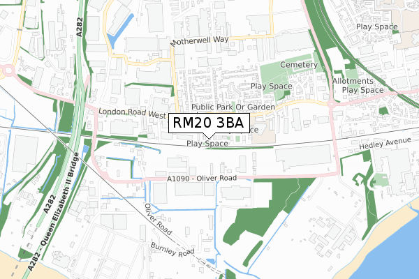
RM20 3BA is located in the West Thurrock and South Stifford electoral ward, within the unitary authority of Thurrock and the English Parliamentary constituency of Thurrock. The Sub Integrated Care Board (ICB) Location is NHS Mid and South Essex ICB - 07G and the police force is Essex. This postcode has been in use since August 2017.


GetTheData
Source: OS Open Zoomstack (Ordnance Survey)
Licence: Open Government Licence (requires attribution)
Attribution: Contains OS data © Crown copyright and database right 2025
Source: Open Postcode Geo
Licence: Open Government Licence (requires attribution)
Attribution: Contains OS data © Crown copyright and database right 2025; Contains Royal Mail data © Royal Mail copyright and database right 2025; Source: Office for National Statistics licensed under the Open Government Licence v.3.0
| Easting | 558265 |
| Northing | 177524 |
| Latitude | 51.474545 |
| Longitude | 0.277492 |
GetTheData
Source: Open Postcode Geo
Licence: Open Government Licence
| Country | England |
| Postcode District | RM20 |
➜ See where RM20 is on a map ➜ Where is West Thurrock? | |
GetTheData
Source: Land Registry Price Paid Data
Licence: Open Government Licence
| Ward | West Thurrock And South Stifford |
| Constituency | Thurrock |
GetTheData
Source: ONS Postcode Database
Licence: Open Government Licence
| The Rookery (London Road) | West Thurrock | 189m |
| The Rabbits (London Road) | West Thurrock | 197m |
| Motherwell Way | West Thurrock | 257m |
| The Rookery (London Road) | West Thurrock | 258m |
| Fox And Goose (West Thurrock Way) | West Thurrock | 429m |
| Chafford Hundred Station | 1.4km |
| Greenhithe for Bluewater Station | 2.7km |
| Stone Crossing Station | 2.8km |
GetTheData
Source: NaPTAN
Licence: Open Government Licence
| Percentage of properties with Next Generation Access | 100.0% |
| Percentage of properties with Superfast Broadband | 100.0% |
| Percentage of properties with Ultrafast Broadband | 97.8% |
| Percentage of properties with Full Fibre Broadband | 97.8% |
Superfast Broadband is between 30Mbps and 300Mbps
Ultrafast Broadband is > 300Mbps
| Median download speed | 52.6Mbps |
| Average download speed | 42.9Mbps |
| Maximum download speed | 77.95Mbps |
| Median upload speed | 12.7Mbps |
| Average upload speed | 12.4Mbps |
| Maximum upload speed | 20.00Mbps |
| Percentage of properties unable to receive 2Mbps | 0.0% |
| Percentage of properties unable to receive 5Mbps | 0.0% |
| Percentage of properties unable to receive 10Mbps | 0.0% |
| Percentage of properties unable to receive 30Mbps | 0.0% |
GetTheData
Source: Ofcom
Licence: Ofcom Terms of Use (requires attribution)
GetTheData
Source: ONS Postcode Database
Licence: Open Government Licence


➜ Get more ratings from the Food Standards Agency
GetTheData
Source: Food Standards Agency
Licence: FSA terms & conditions
| Last Collection | |||
|---|---|---|---|
| Location | Mon-Fri | Sat | Distance |
| Tesco Lakeside | 18:30 | 11:30 | 1,563m |
| Watts Wood | 17:45 | 12:00 | 1,769m |
| Wood Avenue | 17:45 | 12:00 | 2,243m |
GetTheData
Source: Dracos
Licence: Creative Commons Attribution-ShareAlike
| Risk of RM20 3BA flooding from rivers and sea | Very Low |
| ➜ RM20 3BA flood map | |
GetTheData
Source: Open Flood Risk by Postcode
Licence: Open Government Licence
The below table lists the International Territorial Level (ITL) codes (formerly Nomenclature of Territorial Units for Statistics (NUTS) codes) and Local Administrative Units (LAU) codes for RM20 3BA:
| ITL 1 Code | Name |
|---|---|
| TLH | East |
| ITL 2 Code | Name |
| TLH3 | Essex |
| ITL 3 Code | Name |
| TLH32 | Thurrock |
| LAU 1 Code | Name |
| E06000034 | Thurrock |
GetTheData
Source: ONS Postcode Directory
Licence: Open Government Licence
The below table lists the Census Output Area (OA), Lower Layer Super Output Area (LSOA), and Middle Layer Super Output Area (MSOA) for RM20 3BA:
| Code | Name | |
|---|---|---|
| OA | E00080946 | |
| LSOA | E01016012 | Thurrock 015C |
| MSOA | E02003310 | Thurrock 015 |
GetTheData
Source: ONS Postcode Directory
Licence: Open Government Licence
| RM20 3AP | Schoolfield Road | 61m |
| RM20 3AQ | Fox Field Close | 97m |
| RM20 3JA | Essex Road | 109m |
| RM20 3AN | Schoolfield Road | 133m |
| RM20 3HX | London Road | 140m |
| RM20 3AF | Schoolfield Way | 205m |
| RM20 3JT | London Road | 215m |
| RM20 3JH | Third Avenue | 229m |
| RM20 3HB | The Rookery | 251m |
| RM20 3LH | London Road | 252m |
GetTheData
Source: Open Postcode Geo; Land Registry Price Paid Data
Licence: Open Government Licence