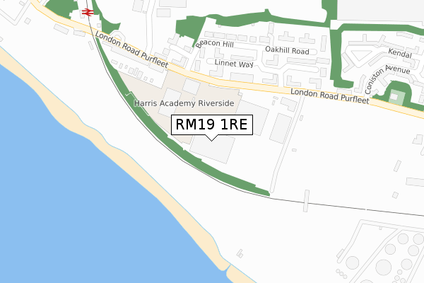
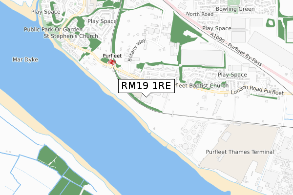
RM19 1RE is located in the West Thurrock and South Stifford electoral ward, within the unitary authority of Thurrock and the English Parliamentary constituency of Thurrock. The Sub Integrated Care Board (ICB) Location is NHS Mid and South Essex ICB - 07G and the police force is Essex. This postcode has been in use since November 2019.


GetTheData
Source: OS Open Zoomstack (Ordnance Survey)
Licence: Open Government Licence (requires attribution)
Attribution: Contains OS data © Crown copyright and database right 2025
Source: Open Postcode Geo
Licence: Open Government Licence (requires attribution)
Attribution: Contains OS data © Crown copyright and database right 2025; Contains Royal Mail data © Royal Mail copyright and database right 2025; Source: Office for National Statistics licensed under the Open Government Licence v.3.0
| Easting | 555725 |
| Northing | 177861 |
| Latitude | 51.478277 |
| Longitude | 0.241097 |
GetTheData
Source: Open Postcode Geo
Licence: Open Government Licence
| Country | England |
| Postcode District | RM19 |
➜ See where RM19 is on a map ➜ Where is Purfleet? | |
GetTheData
Source: Land Registry Price Paid Data
Licence: Open Government Licence
| Ward | West Thurrock And South Stifford |
| Constituency | Thurrock |
GetTheData
Source: ONS Postcode Database
Licence: Open Government Licence
| Linnet Way (London Road) | Purfleet | 181m |
| Linnet Way (London Road) | Purfleet | 277m |
| Railway Station (London Road) | Purfleet | 325m |
| Railway Station (London Road) | Purfleet | 330m |
| London Road Lindon Close (London Road) | Purfleet | 460m |
| Purfleet Station | 0.4km |
| Chafford Hundred Station | 3.3km |
| Stone Crossing Station | 3.4km |
GetTheData
Source: NaPTAN
Licence: Open Government Licence
GetTheData
Source: ONS Postcode Database
Licence: Open Government Licence


➜ Get more ratings from the Food Standards Agency
GetTheData
Source: Food Standards Agency
Licence: FSA terms & conditions
| Last Collection | |||
|---|---|---|---|
| Location | Mon-Fri | Sat | Distance |
| Wood Avenue | 17:45 | 12:00 | 971m |
| Watts Wood | 17:45 | 12:00 | 1,360m |
| Purfleet Road | 16:45 | 11:45 | 2,008m |
GetTheData
Source: Dracos
Licence: Creative Commons Attribution-ShareAlike
| Risk of RM19 1RE flooding from rivers and sea | Very Low |
| ➜ RM19 1RE flood map | |
GetTheData
Source: Open Flood Risk by Postcode
Licence: Open Government Licence
The below table lists the International Territorial Level (ITL) codes (formerly Nomenclature of Territorial Units for Statistics (NUTS) codes) and Local Administrative Units (LAU) codes for RM19 1RE:
| ITL 1 Code | Name |
|---|---|
| TLH | East |
| ITL 2 Code | Name |
| TLH3 | Essex |
| ITL 3 Code | Name |
| TLH32 | Thurrock |
| LAU 1 Code | Name |
| E06000034 | Thurrock |
GetTheData
Source: ONS Postcode Directory
Licence: Open Government Licence
The below table lists the Census Output Area (OA), Lower Layer Super Output Area (LSOA), and Middle Layer Super Output Area (MSOA) for RM19 1RE:
| Code | Name | |
|---|---|---|
| OA | E00175291 | |
| LSOA | E01016012 | Thurrock 015C |
| MSOA | E02003310 | Thurrock 015 |
GetTheData
Source: ONS Postcode Directory
Licence: Open Government Licence
| RM19 1NT | Linnet Way | 157m |
| RM19 1SL | Riverview Flats | 160m |
| RM19 1NH | Linnet Way | 185m |
| RM19 1NB | Wingrove Drive | 202m |
| RM19 1NP | Linnet Way | 204m |
| RM19 1NG | Linnet Way | 206m |
| RM19 1TX | Linnet Way | 214m |
| RM19 1RA | Southland Terrace | 217m |
| RM19 1NY | Wingrove Drive | 223m |
| RM19 1NF | Wingrove Drive | 231m |
GetTheData
Source: Open Postcode Geo; Land Registry Price Paid Data
Licence: Open Government Licence