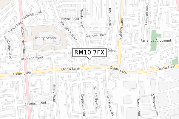
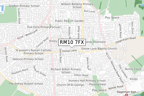
RM10 7FX is located in the Heath electoral ward, within the London borough of Barking and Dagenham and the English Parliamentary constituency of Dagenham and Rainham. The Sub Integrated Care Board (ICB) Location is NHS North East London ICB - A3A8R and the police force is Metropolitan Police. This postcode has been in use since May 2019.


GetTheData
Source: OS Open Zoomstack (Ordnance Survey)
Licence: Open Government Licence (requires attribution)
Attribution: Contains OS data © Crown copyright and database right 2024
Source: Open Postcode Geo
Licence: Open Government Licence (requires attribution)
Attribution: Contains OS data © Crown copyright and database right 2024; Contains Royal Mail data © Royal Mail copyright and database right 2024; Source: Office for National Statistics licensed under the Open Government Licence v.3.0
| Easting | 549482 |
| Northing | 186762 |
| Latitude | 51.559937 |
| Longitude | 0.155038 |
GetTheData
Source: Open Postcode Geo
Licence: Open Government Licence
| Country | England |
| Postcode District | RM10 |
| ➜ RM10 open data dashboard ➜ See where RM10 is on a map ➜ Where is London? | |
GetTheData
Source: Land Registry Price Paid Data
Licence: Open Government Licence
| Ward | Heath |
| Constituency | Dagenham And Rainham |
GetTheData
Source: ONS Postcode Database
Licence: Open Government Licence
| November 2023 | Burglary | On or near Parking Area | 335m |
| October 2023 | Public order | On or near Parking Area | 335m |
| September 2023 | Anti-social behaviour | On or near Parking Area | 335m |
| ➜ Get more crime data in our Crime section | |||
GetTheData
Source: data.police.uk
Licence: Open Government Licence
| Civic Centre Rainham Rd North (Rainham Road North) | Beacontree Heath | 20m |
| Civic Centre Rainham Rd North (Rainham Road North) | Beacontree Heath | 45m |
| Civic Centre Wood Lane (Wood Lane) | Beacontree Heath | 220m |
| Bull Lane Frizlands Lane | Beacontree Heath | 250m |
| Becontree Heath Bus Station | Beacontree Heath | 254m |
| Chadwell Heath Station | 2km |
| Romford Station | 2.6km |
| Goodmayes Station | 3.1km |
GetTheData
Source: NaPTAN
Licence: Open Government Licence
| Percentage of properties with Next Generation Access | 100.0% |
| Percentage of properties with Superfast Broadband | 100.0% |
| Percentage of properties with Ultrafast Broadband | 100.0% |
| Percentage of properties with Full Fibre Broadband | 100.0% |
Superfast Broadband is between 30Mbps and 300Mbps
Ultrafast Broadband is > 300Mbps
| Percentage of properties unable to receive 2Mbps | 0.0% |
| Percentage of properties unable to receive 5Mbps | 0.0% |
| Percentage of properties unable to receive 10Mbps | 0.0% |
| Percentage of properties unable to receive 30Mbps | 0.0% |
GetTheData
Source: Ofcom
Licence: Ofcom Terms of Use (requires attribution)
GetTheData
Source: ONS Postcode Database
Licence: Open Government Licence


➜ Get more ratings from the Food Standards Agency
GetTheData
Source: Food Standards Agency
Licence: FSA terms & conditions
| Last Collection | |||
|---|---|---|---|
| Location | Mon-Fri | Sat | Distance |
| Gray Avenue | 17:30 | 12:15 | 773m |
| Baron Road | 17:30 | 12:15 | 1,065m |
| Grove Gardens | 17:00 | 11:30 | 1,123m |
GetTheData
Source: Dracos
Licence: Creative Commons Attribution-ShareAlike
| Facility | Distance |
|---|---|
| William Bellamy Primary School Frizlands Lane, Dagenham Grass Pitches | 193m |
| Robert Clack School (Upper Site) Gosfield Road, Dagenham Sports Hall, Health and Fitness Gym, Artificial Grass Pitch, Grass Pitches, Studio | 281m |
| Crowlands Heath Golf Course Wood Lane, Dagenham Golf | 298m |
GetTheData
Source: Active Places
Licence: Open Government Licence
| School | Phase of Education | Distance |
|---|---|---|
| William Bellamy Primary School Frizlands Lane, East, Dagenham, RM10 7HX | Primary | 98m |
| Robert Clack School Gosfield Road, Dagenham, RM8 1JU | All-through | 314m |
| All Saints Catholic School and Technology College Terling Road, Wood Lane, Dagenham, RM8 1JT | Secondary | 403m |
GetTheData
Source: Edubase
Licence: Open Government Licence
The below table lists the International Territorial Level (ITL) codes (formerly Nomenclature of Territorial Units for Statistics (NUTS) codes) and Local Administrative Units (LAU) codes for RM10 7FX:
| ITL 1 Code | Name |
|---|---|
| TLI | London |
| ITL 2 Code | Name |
| TLI5 | Outer London - East and North East |
| ITL 3 Code | Name |
| TLI52 | Barking & Dagenham and Havering |
| LAU 1 Code | Name |
| E09000002 | Barking and Dagenham |
GetTheData
Source: ONS Postcode Directory
Licence: Open Government Licence
The below table lists the Census Output Area (OA), Lower Layer Super Output Area (LSOA), and Middle Layer Super Output Area (MSOA) for RM10 7FX:
| Code | Name | |
|---|---|---|
| OA | E00000329 | |
| LSOA | E01000061 | Barking and Dagenham 006C |
| MSOA | E02000007 | Barking and Dagenham 006 |
GetTheData
Source: ONS Postcode Directory
Licence: Open Government Licence
| RM10 7HY | Stour Road | 108m |
| RM10 7HZ | Stour Road | 108m |
| RM10 7JA | Stour Road | 153m |
| RM10 7QS | Trefgarne Road | 175m |
| RM10 7AQ | Bradwell Avenue | 192m |
| RM10 7AG | Bradwell Avenue | 195m |
| RM8 1JZ | Gosfield Road | 197m |
| RM10 7QT | Trefgarne Road | 229m |
| RM8 1JY | Gosfield Road | 232m |
| RM8 1DN | Gosfield Road | 245m |
GetTheData
Source: Open Postcode Geo; Land Registry Price Paid Data
Licence: Open Government Licence